Polk Township, Benton County, Iowa
| Polk Township | |
|---|---|
| Township | |
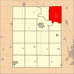 Location in Benton County | |
| Coordinates: 42°14′36″N 91°53′25″W / 42.24333°N 91.89028°WCoordinates: 42°14′36″N 91°53′25″W / 42.24333°N 91.89028°W | |
| Country |
|
| State |
|
| County | Benton |
| Area | |
| • Total | 45.56 sq mi (118 km2) |
| • Land | 45.47 sq mi (117.76 km2) |
| • Water | 0.09 sq mi (0.24 km2) 0.2% |
| Elevation | 869 ft (265 m) |
| Population (2000) | |
| • Total | 1,803 |
| • Density | 39.7/sq mi (15.3/km2) |
| Time zone | CST (UTC-6) |
| • Summer (DST) | CDT (UTC-5) |
| ZIP codes | 52213, 52345, 52349, 52352 |
| GNIS feature ID | 0468554 |
Polk Township is one of twenty townships in Benton County, Iowa, USA. As of the 2000 census, its population was 1,803.[1]
History
Polk Township was founded in 1848.[2]
Geography
According to the United States Census Bureau, Polk Township covers an area of 45.56 square miles (118 square kilometers); of this, 45.47 square miles (117.76 square kilometers, 99.8 percent) is land and 0.09 square miles (0.24 square kilometers, 0.2 percent) is water.
Cities, towns, villages
Unincorporated towns
- Cheney at 42°15′15″N 91°55′39″W / 42.254159°N 91.927400°W
- Spencers Grove at 42°17′04″N 91°52′09″W / 42.284436°N 91.869065°W
(This list is based on USGS data and may include former settlements.)
Extinct towns
- Manatheka at 42°13′40″N 91°52′14″W / 42.227771°N 91.870455°W
(These towns are listed as "historical" by the USGS.)
Adjacent townships
- Homer Township, Buchanan County (north)
- Cono Township, Buchanan County (northeast)
- Grant Township, Linn County (east)
- Fayette Township, Linn County (southeast)
- Washington Township, Linn County (southeast)
- Benton Township (south)
- Taylor Township (southwest)
- Harrison Township (west)
- Jefferson Township, Buchanan County (northwest)
Cemeteries
The township contains these five cemeteries: Cox, Kisling, Saint Marys, Spencers Grove and Urbana.
Major highways
-
 Interstate 380
 -
 Iowa Highway 150
 -
 Iowa Highway 363
 -
 Iowa Highway 920
School districts
- Center Point-Urbana Community School District
- North Linn Community School District
- Vinton-Shellsburg Community School District
Political districts
- Iowa's 3rd congressional district
- State House District 39
- State Senate District 20
References
- United States Census Bureau 2007 TIGER/Line Shapefiles
- United States Board on Geographic Names (GNIS)
- United States National Atlas
- ↑ United States Census Bureau American FactFinder
- ↑ The History of Benton County, Iowa, Containing a History of the County, Its Cities, Towns, &c. Western Historical. 1878. p. 312.
External links
| Wikimedia Commons has media related to Polk Township, Benton County, Iowa. |
Municipalities and communities of Benton County, Iowa, United States | ||
|---|---|---|
| Cities | ||
| Townships | ||
| CDP | ||
| Unincorporated communities | ||
| Footnotes | ‡This populated place also has portions in an adjacent county or counties | |
This article is issued from Wikipedia - version of the 10/31/2016. The text is available under the Creative Commons Attribution/Share Alike but additional terms may apply for the media files.