Pervomaysky District, Tambov Oblast
| Pervomaysky District Первомайский район (Russian) | |
|---|---|
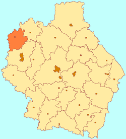 Location of Pervomaysky District in Tambov Oblast | |
| Coordinates: 53°14′33″N 40°17′12″E / 53.24250°N 40.28667°ECoordinates: 53°14′33″N 40°17′12″E / 53.24250°N 40.28667°E | |
.png) |
.png) |
|
| |
| Location | |
| Country | Russia |
| Federal subject | Tambov Oblast[1] |
| Administrative structure (as of April 2012) | |
| Administrative center | work settlement of Pervomaysky[1] |
| Administrative divisions:[1] | |
| Settlement councils | 1 |
| Selsoviets | 10 |
| Inhabited localities:[1] | |
| Urban-type settlements[2] | 1 |
| Rural localities | 44 |
| Municipal structure (as of April 2012) | |
| Municipally incorporated as | Pervomaysky Municipal District[3] |
| Municipal divisions:[3] | |
| Urban settlements | 1 |
| Rural settlements | 10 |
| Statistics | |
| Area | 941 km2 (363 sq mi)[4] |
| Population (2010 Census) | 29,277 inhabitants[5] |
| • Urban | 43.2% |
| • Rural | 56.8% |
| Density | 31.11/km2 (80.6/sq mi)[6] |
| Time zone | MSK (UTC+03:00)[7] |
| Pervomaysky District on WikiCommons | |
Pervomaysky District (Russian: Первома́йский райо́н) is an administrative[1] and municipal[3] district (raion), one of the twenty-three in Tambov Oblast, Russia. It is located in the northwest of the oblast. The area of the district is 941 square kilometers (363 sq mi).[4] Its administrative center is the urban locality (a work settlement) of Pervomaysky.[1] Population: 29,277 (2010 Census);[5] 31,925 (2002 Census);[8] 35,948 (1989 Census).[9] The population of the administrative center accounts for 43.2% of the district's total population.[5]
Geography
Pervomaysky District is on the northwestern border of Tambov Oblast, with Lipetsk Oblast to its west and Ryazan Oblast to the north. It is about 75 km northwest of the city of Tambov, and 60 km northeast of Lipetsk. The terrain is flat, with altitude above sea level between 130 and 160 meters. Aside from agricultural land, the predominant vegetation is pine forest, with some birch and alder.[10]
The district is about 40 km north-south and 30 km west-east. The administrative center of the district is the city of Pervomaysky. The M6 ("Caspian") highway that connects Moscow to the Caspian runs north-south across the middle of the district. Subdivisions of the district include 10 urban and rural settlements.[10]
As of January, 2016, the three largest towns are Pervomaysky (pop. 11,910), Khobotova (pop. 2,786), and Novospasskoye (pop. 2,733).[11] To the north, the area is bordered by Alexandro-Nevsky District of Ryazan Oblast, in the east by Staroyuryevsky District, in the south by Michurinsky District, and in the west by Chaplyginsky District of Lipetsk Oblast.
Climate
Average January temperature is −10.1 °C (13.8 °F), and average July temperature is 20 °C (68 °F). Annual annual precipitation is 553 millimeters (21.8 in).[12] The climate is Humid continental climate, cool summer, (Dfb). This climate is characterized by large swings in temperature, both diurnially and seasonally, with mild summers and cold, snowy winters.
History
Significant settlement in Pervomaysky began in 1635, with the building of the Belgorod Line, and the expansion of the fort as Kozlov (now the town of Michurinsky, 20 km to the south). The Belgorod Line of forts blocked the raids of the Tatars from the south. Because Kozlov was the northernmost anchor point, the Pervomaysky district benefited from not only the construction and garrison activity, but also the safety. Protected y the new fortifications, colonists moved into the area.[13]
In 1866, the "Ryazan-Kozlov" line of the South East Railway was laid through the district, on which the Bogoyavlansk station was built.
Agriculture
Petrovsky is an agricultural district, both crops and livestock. The primary crops are barley, sunflower and wheat.[14] Approximately 26,418 hectares (28%) of the total area of the district is in cultivation for crops. Vegetables account for only 206 ha (less than 1%). Livestock contributes about 20% of agricultural revenues, centered on dairy, poultry, and cattle.
In 2014, the top seven crops by area were:
| Crop | Cultivated Area (ha) | % of Culitvated Area |
|---|---|---|
| Summer Barley | 6,778 | 26 |
| Sunflower grain | 6,585 | 25 |
| Winter Wheat | 6,531 | 25 |
| Potatoes | 2,495 | 10 |
| Corn for grain | 1,911 | 7 |
| Sugar beet (factory) | 609 | 2 |
| Winter rye | 338 | 1 |
Transportation
The Michurinsk-Gryazi line of the South Easter Railway crosses Pervomaysky District through the town of Pervomaysky, with station 'Bogoyavlensk'. Detailed route map of South East Railway (in Russian) The European route E119 from Moscow to Tambov runs north-south across the middle of the district. The Urengoy–Pomary–Uzhgorod pipeline also runs through Pervomaysky.
References
- 1 2 3 4 5 6 Law #72-Z
- ↑ The count of urban-type settlements may include the work settlements, the resort settlements, the suburban (dacha) settlements, as well as urban-type settlements proper.
- 1 2 3 Law #232-Z
- 1 2 "About the Area - Pervomaysky District (Official Web Site)" (in Russian). Pervomaysky District. Retrieved July 2, 2016.
- 1 2 3 Russian Federal State Statistics Service (2011). "Всероссийская перепись населения 2010 года. Том 1" [2010 All-Russian Population Census, vol. 1]. Всероссийская перепись населения 2010 года (2010 All-Russia Population Census) (in Russian). Federal State Statistics Service. Retrieved June 29, 2012.
- ↑ The value of density was calculated automatically by dividing the 2010 Census population by the area specified in the infobox. Please note that this value is only approximate as the area specified in the infobox does not necessarily correspond to the area of the entity proper or is reported for the same year as the population.
- ↑ Правительство Российской Федерации. Федеральный закон №107-ФЗ от 3 июня 2011 г. «Об исчислении времени», в ред. Федерального закона №271-ФЗ от 03 июля 2016 г. «О внесении изменений в Федеральный закон "Об исчислении времени"». Вступил в силу по истечении шестидесяти дней после дня официального опубликования (6 августа 2011 г.). Опубликован: "Российская газета", №120, 6 июня 2011 г. (Government of the Russian Federation. Federal Law #107-FZ of June 31, 2011 On Calculating Time, as amended by the Federal Law #271-FZ of July 03, 2016 On Amending Federal Law "On Calculating Time". Effective as of after sixty days following the day of the official publication.).
- ↑ Russian Federal State Statistics Service (May 21, 2004). "Численность населения России, субъектов Российской Федерации в составе федеральных округов, районов, городских поселений, сельских населённых пунктов – районных центров и сельских населённых пунктов с населением 3 тысячи и более человек" [Population of Russia, Its Federal Districts, Federal Subjects, Districts, Urban Localities, Rural Localities—Administrative Centers, and Rural Localities with Population of Over 3,000] (XLS). Всероссийская перепись населения 2002 года [All-Russia Population Census of 2002] (in Russian). Retrieved August 9, 2014.
- ↑ Demoscope Weekly (1989). "Всесоюзная перепись населения 1989 г. Численность наличного населения союзных и автономных республик, автономных областей и округов, краёв, областей, районов, городских поселений и сёл-райцентров" [All Union Population Census of 1989: Present Population of Union and Autonomous Republics, Autonomous Oblasts and Okrugs, Krais, Oblasts, Districts, Urban Settlements, and Villages Serving as District Administrative Centers]. Всесоюзная перепись населения 1989 года [All-Union Population Census of 1989] (in Russian). Институт демографии Национального исследовательского университета: Высшая школа экономики [Institute of Demography at the National Research University: Higher School of Economics]. Retrieved August 9, 2014.
- 1 2 "About the region". Pervomaysky District (Official website). Pervomaysky District. Retrieved July 17, 2016.
- ↑ "Population of Municipalities in Tambov Region, January 1, 2016" (PDF) (in Russian). TERRITORIAL AUTHORITY OF THE FEDERAL SERVICE STATE STATISTICS for Tambov Region. Retrieved July 16, 2016.
- ↑ "Climate - Pervomaysky". Climate-Data.Org. Climate-Data.org. Retrieved 17 July 2016.
- ↑ Davies, Brian (2004). State power and community in early modern Russia : the case of Kozlov, 1635-1649. Palgrave Macmillan. p. 72. Retrieved 17 July 2016.
- ↑ "Descriptive Statistics - Pervomaysky" (in Russian). Federal State Statistics Service, Russian Federation. Retrieved July 16, 2016.
Sources
- Тамбовская областная Дума. Закон №72-З от 21 июня 1996 г. «Об административно-территориальном устройстве Тамбовской области», в ред. Закона №544-З от 11 июня 2015 г. «О внесении изменений в статью 7 Закона Тамбовской области "Об административно-территориальном устройстве Тамбовской области"». Опубликован: "Тамбовская жизнь", №131, 1996 г. (Tambov Oblast Duma. Law #72-Z of June 21, 1996 On the Administrative-Territorial Structure of Tambov Oblast, as amended by the Law #544-Z of June 11, 2015 On Amending Article 7 of the Law of Tambov Oblast "On the Administrative-Territorial Structure of Tambov Oblast". ).
- Тамбовская областная Дума. Закон №232-З от 17 сентября 2004 г. «Об установлении границ и определении места нахождения представительных органов муниципальных образований в Тамбовской области», в ред. Закона №606-З от 7 декабря 2015 г. «О внесении изменений в Закон Тамбовской области "Об установлении границ и определении места нахождения представительных органов муниципальных образований в Тамбовской области"». Вступил в силу со дня официального опубликования. Опубликован: "Тамбовская жизнь", №185 (23125). (Tambov Oblast Duma. Law #232-Z of September 17, 2004 On Establishing the Borders and Determining the Location of the Representative Organs of the Municipal Formations of Tambov Oblast, as amended by the Law #606-Z of December 7, 2015 On Amending the Law of Tambov Oblast "On Establishing the Borders and Determining the Location of the Representative Organs of the Municipal Formations of Tambov Oblast". Effective as of the official publication date.).
External links
- Official map of the district
- Pervomaysky District on OpenStreetMap.org
- Pervomaysky District on GoogleMaps
| Cities and towns | |||
|---|---|---|---|
| Districts | |||