Perry, Kansas
| Perry, Kansas | |
|---|---|
| City | |
|
Downtown Perry (2009) | |
 Location within Jefferson County and Kansas | |
 KDOT map of Jefferson County (legend) | |
| Coordinates: 39°4′32″N 95°23′31″W / 39.07556°N 95.39194°WCoordinates: 39°4′32″N 95°23′31″W / 39.07556°N 95.39194°W | |
| Country | United States |
| State | Kansas |
| County | Jefferson |
| Area[1] | |
| • Total | 0.77 sq mi (1.99 km2) |
| • Land | 0.77 sq mi (1.99 km2) |
| • Water | 0 sq mi (0 km2) |
| Elevation | 850 ft (259 m) |
| Population (2010)[2] | |
| • Total | 929 |
| • Estimate (2012[3]) | 913 |
| • Density | 1,200/sq mi (470/km2) |
| Time zone | Central (CST) (UTC-6) |
| • Summer (DST) | CDT (UTC-5) |
| ZIP code | 66073 |
| Area code(s) | 785 |
| FIPS code | 20-55450 [4] |
| GNIS feature ID | 0478809 [5] |
| Website | PerryKansas.us |

Perry is a city in Jefferson County, Kansas, United States. As of the 2010 census, the city population was 929.[6] It is part of the Topeka, Kansas Metropolitan Statistical Area.
History
Perry had its start in the year 1865 by the building of the railroad through that territory.[7] It was named for John D. Perry, the President of the Kansas Pacific Railroad.[8][9]
The first post office in Perry was established in October 1866.[10]
Geography
Perry is located at 39°4′32″N 95°23′31″W / 39.07556°N 95.39194°W (39.075458, -95.391902).[11] According to the United States Census Bureau, the city has a total area of 0.77 square miles (1.99 km2), all of it land.[1]
Climate
The climate in this area is characterized by hot, humid summers and generally mild to cool winters. According to the Köppen Climate Classification system, Perry has a humid subtropical climate, abbreviated "Cfa" on climate maps.[12]
Demographics
| Historical population | |||
|---|---|---|---|
| Census | Pop. | %± | |
| 1870 | 403 | — | |
| 1880 | 319 | −20.8% | |
| 1900 | 464 | — | |
| 1910 | 400 | −13.8% | |
| 1920 | 481 | 20.3% | |
| 1930 | 418 | −13.1% | |
| 1940 | 392 | −6.2% | |
| 1950 | 399 | 1.8% | |
| 1960 | 495 | 24.1% | |
| 1970 | 664 | 34.1% | |
| 1980 | 907 | 36.6% | |
| 1990 | 881 | −2.9% | |
| 2000 | 901 | 2.3% | |
| 2010 | 929 | 3.1% | |
| Est. 2015 | 909 | [13] | −2.2% |
| U.S. Decennial Census | |||
2010 census
As of the census[2] of 2010, there were 929 people, 375 households, and 254 families residing in the city. The population density was 1,206.5 inhabitants per square mile (465.8/km2). There were 392 housing units at an average density of 509.1 per square mile (196.6/km2). The racial makeup of the city was 95.7% White, 1.1% African American, 0.4% Native American, 0.3% Asian, 0.4% from other races, and 2.0% from two or more races. Hispanic or Latino of any race were 2.2% of the population.
There were 375 households of which 36.0% had children under the age of 18 living with them, 50.4% were married couples living together, 11.5% had a female householder with no husband present, 5.9% had a male householder with no wife present, and 32.3% were non-families. 26.7% of all households were made up of individuals and 13.6% had someone living alone who was 65 years of age or older. The average household size was 2.48 and the average family size was 2.92.
The median age in the city was 37.1 years. 27.1% of residents were under the age of 18; 6.4% were between the ages of 18 and 24; 25.6% were from 25 to 44; 25.3% were from 45 to 64; and 15.6% were 65 years of age or older. The gender makeup of the city was 47.6% male and 52.4% female.
2000 census
As of the census[4] of 2000, there were 901 people, 370 households, and 260 families residing in the city. The population density was 1,156.5 people per square mile (446.0/km²). There were 395 housing units at an average density of 507.0 per square mile (195.5/km²). The racial makeup of the city was 94.12% White, 0.67% African American, 0.67% Native American, 0.33% Asian, 0.22% Pacific Islander, 0.33% from other races, and 3.66% from two or more races. Hispanic or Latino of any race were 1.00% of the population.
There were 370 households out of which 33.5% had children under the age of 18 living with them, 55.4% were married couples living together, 11.9% had a female householder with no husband present, and 29.7% were non-families. 24.9% of all households were made up of individuals and 14.1% had someone living alone who was 65 years of age or older. The average household size was 2.44 and the average family size was 2.91.
In the city the population was spread out with 25.7% under the age of 18, 9.3% from 18 to 24, 27.3% from 25 to 44, 21.8% from 45 to 64, and 15.9% who were 65 years of age or older. The median age was 37 years. For every 100 females there were 94.6 males. For every 100 females age 18 and over, there were 89.0 males.
The median income for a household in the city was $39,013, and the median income for a family was $46,641. Males had a median income of $32,778 versus $26,500 for females. The per capita income for the city was $17,577. About 4.9% of families and 7.9% of the population were below the poverty line, including 6.0% of those under age 18 and 12.0% of those age 65 or over.
See also
References
- 1 2 "US Gazetteer files 2010". United States Census Bureau. Retrieved 2012-07-06.
- 1 2 "American FactFinder". United States Census Bureau. Retrieved 2012-07-06.
- ↑ "Population Estimates". United States Census Bureau. Retrieved 2013-05-29.
- 1 2 "American FactFinder". United States Census Bureau. Retrieved 2008-01-31.
- ↑ "US Board on Geographic Names". United States Geological Survey. 2007-10-25. Retrieved 2008-01-31.
- ↑ "2010 City Population and Housing Occupancy Status". U.S. Census Bureau. Retrieved April 6, 2012.
- ↑ Blackmar, Frank Wilson (1912). Kansas: A Cyclopedia of State History, Volume 2. Standard Publishing Company. p. 467.
- ↑ Bates, Elmer E. (July 8–10, 1954). "Homesteaders: The Story of Perry, Kansas" (pdf). One Hundred Years of Progress from 1854 to 1954. Perry Centennial. p. 12. Retrieved February 19, 2011.
- ↑ Carpenter, Tim (November 28, 1997). "What's in a name? Key elements of area history". Lawrence Journal-World. pp. 3B. Retrieved 28 April 2015.
- ↑ "Kansas Post Offices, 1828-1961 (archived)". Kansas Historical Society. Archived from the original on October 9, 2013. Retrieved 11 June 2014.
- ↑ "US Gazetteer files: 2010, 2000, and 1990". United States Census Bureau. 2011-02-12. Retrieved 2011-04-23.
- ↑ Climate Summary for Perry, Kansas
- ↑ "Annual Estimates of the Resident Population for Incorporated Places: April 1, 2010 to July 1, 2015". Retrieved July 2, 2016.
External links
| Wikimedia Commons has media related to Perry, Kansas. |
- City
- Schools
- USD 343, local school district
- Maps
- Perry City Map, KDOT
Municipalities and communities of Jefferson County, Kansas, United States | ||
|---|---|---|
| Cities | 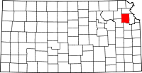 | |
| CDP | ||
| Unincorporated communities | ||
| Townships | ||