Odessa, New York
| Odessa, New York | |
|---|---|
| Village | |
 Odessa, New York Location within the state of New York | |
| Coordinates: 42°20′11″N 76°47′21″W / 42.33639°N 76.78917°WCoordinates: 42°20′11″N 76°47′21″W / 42.33639°N 76.78917°W | |
| Country | United States |
| State | New York |
| County | Schuyler |
| Area | |
| • Total | 1.2 sq mi (3.1 km2) |
| • Land | 1.2 sq mi (3.1 km2) |
| • Water | 0.0 sq mi (0.0 km2) |
| Elevation | 1,043 ft (318 m) |
| Population (2010) | |
| • Total | 591 |
| • Density | 509.1/sq mi (196.6/km2) |
| Time zone | Eastern (EST) (UTC-5) |
| • Summer (DST) | EDT (UTC-4) |
| ZIP code | 14869 |
| Area code(s) | 607 |
| FIPS code | 36-54452 |
| GNIS feature ID | 0959224 |
Odessa is a village in Schuyler County, New York, United States. The population was 617 at the 2000 census.
The Village of Odessa is in western side of the Town of Catharine near the town line and is shared with the Town of Montour. Odessa is north of Elmira, New York.
History
The village of Odessa was incorporated in 1905. Keith T. Peirce is the current mayor. Odessa voters rejected a proposal to dissolve the village into the surrounding towns of Catharine and Montour in a vote on December 7, 2010.
Geography
Odessa is located at 42°20′11″N 76°47′21″W / 42.33639°N 76.78917°W (42.336328, -76.789069).[1]
Odessa is at the junction of Routes County Roads 7 and 15 and New York State Route 224 and New York State Route 228. The village is south of the south end of Seneca Lake.
Demographics
| Historical population | |||
|---|---|---|---|
| Census | Pop. | %± | |
| 1880 | 230 | — | |
| 1910 | 330 | — | |
| 1920 | 366 | 10.9% | |
| 1930 | 379 | 3.6% | |
| 1940 | 424 | 11.9% | |
| 1950 | 526 | 24.1% | |
| 1960 | 573 | 8.9% | |
| 1970 | 606 | 5.8% | |
| 1980 | 613 | 1.2% | |
| 1990 | 986 | 60.8% | |
| 2000 | 617 | −37.4% | |
| 2010 | 591 | −4.2% | |
| Est. 2015 | 573 | [2] | −3.0% |
As of the census[4] of 2010, there were 591 people, 246 households, and 164 families residing in the village. The population density was 509.1 people per square mile (196.9/km²). There were 261 housing units at an average density of 215.4 per square mile (83.3/km²). The racial makeup of the village was 96.60% White, 0.81% African American, 0.16% Native American, 1.62% from other races, and 0.81% from two or more races. Hispanic or Latino of any race were 1.46% of the population.
There were 246 households out of which 34.1% had children under the age of 18 living with them, 52.4% were married couples living together, 12.6% had a female householder with no husband present, and 33.3% were non-families. 29.3% of all households were made up of individuals and 13.8% had someone living alone who was 65 years of age or older. The average household size was 2.46 and the average family size was 3.04.
In the village the population was spread out with 25.8% under the age of 18, 8.1% from 18 to 24, 27.4% from 25 to 44, 25.8% from 45 to 64, and 13.0% who were 65 years of age or older. The median age was 37 years. For every 100 females there were 87.0 males. For every 100 females age 18 and over, there were 84.7 males.
The median income for a household in the village was $41,250, and the median income for a family was $51,429. Males had a median income of $27,969 versus $27,143 for females. The per capita income for the village was $18,639. About 8.8% of families and 8.9% of the population were below the poverty line, including 12.0% of those under age 18 and 8.1% of those age 65 or over.
References
- ↑ "US Gazetteer files: 2010, 2000, and 1990". United States Census Bureau. 2011-02-12. Retrieved 2011-04-23.
- ↑ "Annual Estimates of the Resident Population for Incorporated Places: April 1, 2010 to July 1, 2015". Retrieved July 2, 2016.
- ↑ "Census of Population and Housing". Census.gov. Archived from the original on May 11, 2015. Retrieved June 4, 2015.
- ↑ "American FactFinder". United States Census Bureau. Archived from the original on September 11, 2013. Retrieved 2008-01-31.
Sources
- Parry, Albert (Spring 1944). "US towns named Odessa". Russian Review. 3 (2): 30–43. doi:10.2307/125407.
External links
Municipalities and communities of Schuyler County, New York, United States | ||
|---|---|---|
| Towns | 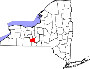 | |
| Villages | ||