Oak Grove, Jackson County, Missouri
| Oak Grove | |
|---|---|
| City | |
 Oak Grove Location within the state of Missouri | |
| Coordinates: 39°0′15″N 94°7′42″W / 39.00417°N 94.12833°WCoordinates: 39°0′15″N 94°7′42″W / 39.00417°N 94.12833°W | |
| Country | United States |
| State | Missouri |
| County | Jackson |
| Area[1] | |
| • Total | 6.19 sq mi (16.03 km2) |
| • Land | 6.17 sq mi (15.98 km2) |
| • Water | 0.02 sq mi (0.05 km2) |
| Population (2010)[2] | |
| • Total | 7,795 |
| • Estimate (2012[3]) | 7,852 |
| • Density | 1,263.4/sq mi (487.8/km2) |
| Time zone | Central (CST) (UTC-6) |
| • Summer (DST) | CDT (UTC-5) |
Oak Grove is a city in Jackson and Lafayette counties in the U.S. state of Missouri. The population was 7,795 at the 2010 census.
History
A post office called Oak Grove has been in operation since 1840.[4] The city was not platted until 1878.[5] The city was named for a grove of oak trees near the original town site.[6]
Geography
Oak Grove is located at 39°0′15″N 94°7′42″W / 39.00417°N 94.12833°W (39.004181, -94.128299).[7]
According to the United States Census Bureau, the city has a total area of 6.19 square miles (16.03 km2), of which, 6.17 square miles (15.98 km2) is land and 0.02 square miles (0.05 km2) is water.[1]
Demographics
| Historical population | |||
|---|---|---|---|
| Census | Pop. | %± | |
| 1880 | 208 | — | |
| 1900 | 408 | — | |
| 1910 | 641 | 57.1% | |
| 1920 | 634 | −1.1% | |
| 1930 | 702 | 10.7% | |
| 1940 | 680 | −3.1% | |
| 1950 | 761 | 11.9% | |
| 1960 | 1,100 | 44.5% | |
| 1970 | 2,025 | 84.1% | |
| 1980 | 4,067 | 100.8% | |
| 1990 | 4,565 | 12.2% | |
| 2000 | 5,535 | 21.2% | |
| 2010 | 7,795 | 40.8% | |
| Est. 2015 | 7,937 | [8] | 1.8% |
2010 census
As of the census[2] of 2010, there were 7,795 people, 2,791 households, and 2,068 families residing in the city. The population density was 1,263.4 inhabitants per square mile (487.8/km2). There were 2,990 housing units at an average density of 484.6 per square mile (187.1/km2). The racial makeup of the city was 94.7% White, 1.1% African American, 0.8% Native American, 0.7% Asian, 0.1% Pacific Islander, 0.8% from other races, and 1.8% from two or more races. Hispanic or Latino of any race were 3.7% of the population.
There were 2,791 households of which 44.3% had children under the age of 18 living with them, 51.1% were married couples living together, 15.8% had a female householder with no husband present, 7.2% had a male householder with no wife present, and 25.9% were non-families. 21.1% of all households were made up of individuals and 9.1% had someone living alone who was 65 years of age or older. The average household size was 2.76 and the average family size was 3.16.
The median age in the city was 32.4 years. 30.6% of residents were under the age of 18; 8.8% were between the ages of 18 and 24; 28.3% were from 25 to 44; 20.4% were from 45 to 64; and 11.8% were 65 years of age or older. The gender makeup of the city was 48.5% male and 51.5% female.
2000 census
As of the census[10] of 2000, there were 5,535 people, 1,944 households, and 1,479 families residing in the city. The population density was 1,140.3 people per square mile (440.6/km²). There were 2,016 housing units at an average density of 415.3 per square mile (160.5/km²). The racial makeup of the city was 97.07% White, 0.25% African American, 0.25% Native American, 0.42% Asian, 0.20% Pacific Islander, 0.76% from other races, and 1.05% from two or more races. Hispanic or Latino of any race were 1.66% of the population.
There were 1,944 households out of which 45.1% had children under the age of 18 living with them, 57.9% were married couples living together, 13.3% had a female householder with no husband present, and 23.9% were non-families. 20.2% of all households were made up of individuals and 8.7% had someone living alone who was 65 years of age or older. The average household size was 2.80 and the average family size was 3.21.
In the city the population was spread out with 31.8% under the age of 18, 8.7% from 18 to 24, 32.3% from 25 to 44, 17.3% from 45 to 64, and 9.8% who were 65 years of age or older. The median age was 31 years. For every 100 females there were 95.0 males. For every 100 females age 18 and over, there were 87.9 males.
The median income for a household in the city was $44,952, and the median income for a family was $49,136. Males had a median income of $35,644 versus $25,238 for females. The per capita income for the city was $17,738. About 8.3% of families and 10.1% of the population were below the poverty line, including 11.2% of those under age 18 and 7.2% of those age 65 or over.
References
- 1 2 "US Gazetteer files 2010". United States Census Bureau. Archived from the original on January 24, 2012. Retrieved 2012-07-08.
- 1 2 "American FactFinder". United States Census Bureau. Retrieved 2012-07-08.
- ↑ "Population Estimates". United States Census Bureau. Archived from the original on June 17, 2013. Retrieved 2013-05-30.
- ↑ "Post Offices". Jim Forte Postal History. Retrieved 16 October 2016.
- ↑ "Jackson County Place Names, 1928–1945 (archived)". The State Historical Society of Missouri. Retrieved 16 October 2016.
- ↑ Eaton, David Wolfe (1916). How Missouri Counties, Towns and Streams Were Named. The State Historical Society of Missouri. p. 178.
- ↑ "US Gazetteer files: 2010, 2000, and 1990". United States Census Bureau. 2011-02-12. Retrieved 2011-04-23.
- ↑ "Annual Estimates of the Resident Population for Incorporated Places: April 1, 2010 to July 1, 2015". Retrieved June 4, 2016.
- ↑ "Census of Population and Housing". Census.gov. Archived from the original on May 11, 2015. Retrieved June 4, 2015.
- ↑ "American FactFinder". United States Census Bureau. Archived from the original on September 11, 2013. Retrieved 2008-01-31.
External links
- Historic maps of Oak Grove in the Sanborn Maps of Missouri Collection at the University of Missouri
Municipalities and communities of Jackson County, Missouri, United States | ||
|---|---|---|
| Cities |  | |
| Villages | ||
| Townships | ||
| Unincorporated communities | ||
| Footnotes | ‡This populated place also has portions in an adjacent county or counties | |
Municipalities and communities of Lafayette County, Missouri, United States | ||
|---|---|---|
| Cities | 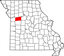 | |
| Villages | ||
| Townships | ||
| Unincorporated communities | ||
| Ghost towns | ||
| Footnotes | ‡This populated place also has portions in an adjacent county or counties | |
Kansas City metropolitan area's cities and counties | ||
|---|---|---|
| Central city | 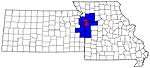 | |
| Largest cities (over 100,000 in 2000) | ||
| Medium-sized cities (10,000 to 100,000 in 2000) | ||
| Smaller Cities (between 5,000 and 9,900 in 2010) | ||
| Counties | ||