Norman, Arkansas
| Norman, Arkansas | |
|---|---|
| Town | |
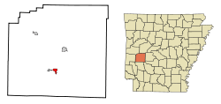 Location in Montgomery County and the state of Arkansas | |
| Coordinates: 34°27′24″N 93°40′54″W / 34.45667°N 93.68167°WCoordinates: 34°27′24″N 93°40′54″W / 34.45667°N 93.68167°W | |
| Country | United States |
| State | Arkansas |
| County | Montgomery |
| Area | |
| • Total | 1.2 sq mi (3 km2) |
| • Land | 1.2 sq mi (3 km2) |
| • Water | 0 sq mi (0 km2) |
| Elevation | 692 ft (211 m) |
| Population (2010) | |
| • Total | 378 |
| • Density | 315/sq mi (126/km2) |
| Time zone | Central (CST) (UTC-6) |
| • Summer (DST) | CDT (UTC-5) |
| ZIP code | 71960 |
| Area code(s) | 870 |
| FIPS code | 05-50030 |
| GNIS feature ID | 0077857 |
Norman is a town in Montgomery County, Arkansas, United States. It was known as Womble until 1925.[1] The population was 378 at the 2010 census.
Geography
Norman is located at 34°27′24″N 93°40′54″W / 34.45667°N 93.68167°W (34.456684, -93.681618).[2]
According to the United States Census Bureau, the town has a total area of 3.0 km² (1.2 mi²), all land.
Norman is situated on the northern banks of the Caddo River (which defines the town's southwestern city limits) and is surrounded by the Ouachita National Forest.
Norman is part of a local region that was formerly known as Womble. The west end of the town is unofficially known as Middlebuster and was in the past known as "Poor Horse".
There is a Caddo Native American burial ground on the southern end of town. It was discovered by city officials, led by then mayor Duane Cox, who protected it with a wooden fence. Recently, descendents of the Caddo added to the site a footpath and benches as well as plaques containing historical information regarding the living habits of Native Americans.
Demographics
| Historical population | |||
|---|---|---|---|
| Census | Pop. | %± | |
| 1910 | 552 | — | |
| 1920 | 420 | −23.9% | |
| 1930 | 478 | 13.8% | |
| 1940 | 512 | 7.1% | |
| 1950 | 401 | −21.7% | |
| 1960 | 482 | 20.2% | |
| 1970 | 505 | 4.8% | |
| 1980 | 539 | 6.7% | |
| 1990 | 382 | −29.1% | |
| 2000 | 423 | 10.7% | |
| 2010 | 378 | −10.6% | |
| Est. 2015 | 359 | [3] | −5.0% |
As of the census[5] of 2000, there were 423 people, 190 households, and 117 families residing in the town. The population density was 140.8/km² (364.8/mi²). There were 224 housing units at an average density of 74.6/km² (193.2/mi²). The racial makeup of the town was 94.56% White, 1.42% Native American, 0.95% Asian, 0.95% from other races, and 2.13% from two or more races. 2.84% of the population were Hispanic or Latino of any race.
There were 190 households out of which 25.3% had children under the age of 18 living with them, 41.1% were married couples living together, 16.8% had a female householder with no husband present, and 37.9% were non-families. 34.7% of all households were made up of individuals and 20.0% had someone living alone who was 65 years of age or older. The average household size was 2.23 and the average family size was 2.84.
In the town the population was spread out with 26.0% under the age of 18, 6.6% from 18 to 24, 23.4% from 25 to 44, 25.1% from 45 to 64, and 18.9% who were 65 years of age or older. The median age was 40 years. For every 100 females there were 79.2 males. For every 100 females age 18 and over, there were 72.0 males.
The median income for a household in the town was $20,481, and the median income for a family was $25,417. Males had a median income of $28,250 versus $16,875 for females. The per capita income for the town was $10,807. About 21.0% of families and 29.1% of the population were below the poverty line, including 44.8% of those under age 18 and 22.5% of those age 65 or over.
Education
Public education for elementary and secondary school students is provided by the following:
- Caddo Hills School District, which leads to graduation from Caddo Hills High School.
- Mount Ida School District, which leads to graduation from Mount Ida High School.
Attractions
References
- ↑ "Norman (Montgomery County)". Encyclopedia of Arkansas History and Culture. Central Arkansas Library System. Retrieved 9 June 2015.
- ↑ "US Gazetteer files: 2010, 2000, and 1990". United States Census Bureau. 2011-02-12. Retrieved 2011-04-23.
- ↑ "Annual Estimates of the Resident Population for Incorporated Places: April 1, 2010 to July 1, 2015". Retrieved July 2, 2016.
- ↑ "Census of Population and Housing". Census.gov. Retrieved June 4, 2015.
- ↑ "American FactFinder". United States Census Bureau. Retrieved 2008-01-31.
Municipalities and communities of Montgomery County, Arkansas, United States | ||
|---|---|---|
| City |  | |
| Towns | ||
| Unincorporated communities | ||
| Footnotes | ‡This populated place also has portions in an adjacent county or counties | |