Normain Heights Historic District
|
Normain Heights Historic District | |
|
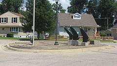
Normandy and Guam in Normain Heights, July 2013 | |
  | |
| Location | Roughly 2300-2900 N. Main, 2300-2800 Normandy, & 100-200 blks. E. Ardennes, Palau, Bastogne, Leyte, Saint Lo & Guam, Mishawaka, Indiana |
|---|---|
| Coordinates | 41°41′03″N 86°10′47″W / 41.68417°N 86.17972°WCoordinates: 41°41′03″N 86°10′47″W / 41.68417°N 86.17972°W |
| Area | 76 acres (31 ha) |
| Built | 1947 |
| Architect | Schwartz, Karl |
| Architectural style | Modern Movement |
| NRHP Reference # | 02000203[1] |
| Added to NRHP | March 20, 2002 |
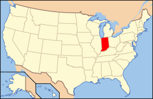
Normain Heights Historic District is a national historic district located at Mishawaka, St. Joseph County, Indiana. The district encompasses 224 contributing buildings and 1 contributing site in a planned post-World War II residential subdivision of Mishawaka. It developed between 1946 and 1951, and includes notable examples of Modern Movement architecture. They are in seven house types randomly scattered throughout the district and were designed for families with low-to-moderate incomes.[2]
It was listed on the National Register of Historic Places in 2002.[1]
References
- 1 2 National Park Service (2010-07-09). "National Register Information System". National Register of Historic Places. National Park Service.
- ↑ "Indiana State Historic Architectural and Archaeological Research Database (SHAARD)" (Searchable database). Department of Natural Resources, Division of Historic Preservation and Archaeology. Retrieved 2016-07-01. Note: This includes Glory-June Grieff (July 2001). "National Register of Historic Places Inventory Nomination Form: Normain Heights Historic District" (PDF). Retrieved 2016-07-01., site map, quad map, and Accompanying photographs

This article is issued from Wikipedia - version of the 12/2/2016. The text is available under the Creative Commons Attribution/Share Alike but additional terms may apply for the media files.