Nemesszentandrás
| Nemesszentandrás | |
|---|---|
 Nemesszentandrás Location of Nemesszentandrás | |
| Coordinates: HU 46°46′32″N 16°56′49″E / 46.77550°N 16.94688°ECoordinates: HU 46°46′32″N 16°56′49″E / 46.77550°N 16.94688°E | |
| Country |
|
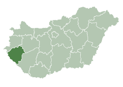
| County | Zala |
| Area | |
| • Total | 5.47 km2 (2.11 sq mi) |
| Population (2001) | |
| • Total | 281 |
| • Density | 51/km2 (130/sq mi) |
| Time zone | CET (UTC+1) |
| • Summer (DST) | CEST (UTC+2) |
| Postal code | 8925 |
Nemesszentandrás is a village in Zala County, Hungary.
References
External links
This article is issued from Wikipedia - version of the 2/6/2014. The text is available under the Creative Commons Attribution/Share Alike but additional terms may apply for the media files.