Nash, North Dakota
| Nash | |
|---|---|
| Census-designated place & Unincorporated community | |
|
Entering Nash, North Dakota from the East | |
 Nash  Nash Location within the state of North Dakota | |
| Coordinates: 48°28′14″N 97°30′47″W / 48.47056°N 97.51306°W | |
| Country | United States |
| State | North Dakota |
| County | Walsh |
| Area[1] | |
| • Total | 1.022 sq mi (2.65 km2) |
| • Land | 1.022 sq mi (2.65 km2) |
| • Water | 0 sq mi (0 km2) |
| Population (2010)[2] | |
| • Total | 32 |
| • Density | 31/sq mi (12/km2) |
| Time zone | Central (CST) (UTC-6) |
| • Summer (DST) | CDT (UTC-5) |
| ZIP code | 58237 |
| Area code(s) | 701 |

Nash is a census-designated place in Walsh County in the U.S. State of North Dakota. The unincorporated community is located in Farmington Township, northwest of Grafton, North Dakota. It was founded in 1890 as a station along the Great Northern Railroad and named for the Nash brothers, pioneer settlers in the area who operated a fruit store in Grafton and started what is now the Nash Finch Company, the third-largest food wholesaler in the United States.[3][4]
Nash was designated as part of the U.S. Census Bureau's Participant Statistical Areas Program on March 31, 2010.[5] It was not counted separately during the 2000 Census,[6] but was included in the 2010 Census,[7] where a population of 32 was reported.[2]
References
- ↑ "US Gazetteer files: 2010, 2000, and 1990". United States Census Bureau. 2011-02-12. Retrieved 2011-04-23.
- 1 2 "2010 Census Redistricting Data (Public Law 94-171) Summary File". American FactFinder. United States Census Bureau. Retrieved 2 May 2011.
- ↑ Wick, Douglas A. (1988). North Dakota Place Names. Bismarck, North Dakota: Hedemarken Collectibles. p. 135. ISBN 0-9620968-0-6. OCLC 191277027.
- ↑ Williams, Mary Ann (Barnes) (1966). Origins of North Dakota Place Names. Bismarck, North Dakota: Bismarck Tribune, 1966. p. 328. OCLC 431626.
- ↑ "Nash Census Designated Place". Geographic Names Information System. United States Geological Survey. Retrieved 2010-07-13.
- ↑ U.S. Census Bureau (2003). "Population and Housing Unit Counts, North Dakota" (PDF). 2000 Census of Population and Housing. Government Printing Office. Retrieved 2008-07-20.
- ↑ U.S. Census Bureau (February 13, 2008). "Census Designated Place (CDP) Program for the 2010 Census—Final Criteria" (PDF). Federal Register. Retrieved 2010-07-13.
Municipalities and communities of Walsh County, North Dakota, United States | ||
|---|---|---|
| Cities | 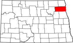 | |
| Townships |
| |
| CDPs | ||
| Unincorporated communities | ||
Coordinates: 48°28′14″N 97°30′47″W / 48.47056°N 97.51306°W