Mystic River Reservation
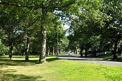
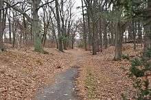
The Mystic River Reservation is a publicly owned nature preserve located along the Mystic River in eastern Massachusetts, United States. It forms part of the nearly 76-square-mile (200 km2) Mystic River watershed,[3] and runs through the towns of Winchester, Arlington, Medford, Somerville, Everett, and Chelsea. The reservation includes four waterfront parks—Draw Seven Park in Somerville, Torbert MacDonald Park in Medford, the Mystic Lakes in Winchester, Arlington, and Medford, and Mary O'Malley Waterfront Park in Chelsea—and is open to the public year-round from dawn to dusk.[4] The reservation is maintained by the Massachusetts Department of Conservation and Recreation.
History
The reservation was established in 1893 by the newly formed Metropolitan Parks Commission (later renamed the Metropolitan District Commission),[5] making it one of the first official nature preserves in Massachusetts, and one of five designed by the commission in that year.[6] Of these five, three were planned as woodland river reservations: the Mystic River Reservation, Charles River Reservation, and Neponset River Reservation.[5] The Mystic River Reservation originally comprised a little over 100 hectares (250 acres) of land.[6] By the early 20th century, most of the land along the Mystic River in Medford, Arlington, and Somerville had become public (i.e. state-owned) land.[3][5]
In 2010, the DCR unveiled a plan for restoring and preserving the reservation, called the Mystic River Master Plan. Proposed projects include a partnership between the DCR and the City of Medford to restore the Condon Shell (an outdoor amphitheater located just outside Medford Square); restoration of the Amelia Earhart Dam basin parklands; and a $3.6 million federally funded link between the reservation, the Minuteman Bikeway, and the Alewife "T" Station.[3] The lower parkland is being redeveloped as part of Assembly Square construction.
References
External links
|
|---|
|
|
|
|
|
|
|
| Wildlife Management Areas |
|---|
| Wildlife
Management Areas | |
|---|
| Wildlife
Sanctuaries |
- Billingsgate Island
- Carr Island
- E. Howe Forbush
- Egg Rock
- Grace A. Robson
- J.C. Phillips
- Knight
- Penikese Island
- Ram Island (Salisbury)
- Ram Island (Mattapoisett)
- Susan B. Minns
- Tarpaulin Cove
- Watatic Mountain
|
|---|
|
|
|
| |
|---|
|
- Black Pond Bog
- Boat Meadow
- Francis Newhall Woods
- Grassy Pond
- Greene Swamp
- Halfway Pond Island
- Hawley Bog
- Hockomock Swamp
- Hoft Farm
- Homer-Watcha Preserve
- Katama Plains
- McElwain-Olsen
- Miacomet Moors
- Reed Brook
- Drury
- Sandy Neck
- David H. Smith Preserve and Fire Trail
- Stacy Mountain
- Tatkon
|
|
|
|
|
|
|
|
|
|
|
|---|
|
| Coastal reservations | |
|---|
|
| River reservations | |
|---|
|
| Woodland reservations | |
|---|
|
| Heritage state parks | |
|---|
|
| Parkways and roads | |
|---|
|
|