Mount Carbon, West Virginia
| Mount Carbon, West Virginia | |
|---|---|
| Census-designated place (CDP) | |
| Nickname(s): Adena | |
 Mount Carbon  Mount Carbon | |
| Coordinates: 38°08′16″N 81°17′08″W / 38.13778°N 81.28556°WCoordinates: 38°08′16″N 81°17′08″W / 38.13778°N 81.28556°W | |
| Country | United States |
| State | West Virginia |
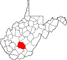
| County | Fayette |
| Area[1] | |
| • Total | 0.241 sq mi (0.62 km2) |
| • Land | 0.149 sq mi (0.39 km2) |
| • Water | 0.092 sq mi (0.24 km2) |
| Elevation | 643 ft (196 m) |
| Population (2010)[2] | |
| • Total | 428 |
| • Density | 1,800/sq mi (690/km2) |
| Time zone | Eastern (EST) (UTC-5) |
| • Summer (DST) | EDT (UTC-4) |
| ZIP code | 25139 |
| Area code(s) | 304 & 681 |
| GNIS feature ID | 1555166[3] |
Mount Carbon is a census-designated place (CDP) in Fayette County, West Virginia, United States. Mount Carbon is located along West Virginia Route 61, 3 miles (4.8 km) southeast of Montgomery, on the south bank of the Kanawha River at the mouth of Armstrong Creek.[4] Mount Carbon has a post office with ZIP code 25139.[5] As of the 2010 census, its population was 428.[2]
Namesake
Mount Carbon was named for nearby coal deposits, a carbon-based fuel.[6]
Archaeological History
Mount Carbon has a rich archaeological history. In the early 20th century, Indian skeletons were found under the railroad tracks. Ancient tools and weapons were found near there, as well. On the mountain above the town, there was a discovery of a man-made wall stretching for about 10 miles, 2 wells, and grave sites, possibly relating to the Adena culture that inhabited the region from 250-100 BCE.
References
- ↑ "US Gazetteer files: 2010, 2000, and 1990". United States Census Bureau. 2011-02-12. Retrieved 2011-04-23.
- 1 2 "American FactFinder". United States Census Bureau. Retrieved 2011-05-14.
- ↑ U.S. Geological Survey Geographic Names Information System: Mount Carbon, West Virginia
- ↑ The National Map, accessed 2013-11-26
- ↑ ZIP Code Lookup
- ↑ Kenny, Hamill (1945). West Virginia Place Names: Their Origin and Meaning, Including the Nomenclature of the Streams and Mountains. Piedmont, WV: The Place Name Press. p. 431.