Morenci, Michigan
| Morenci, Michigan | |
|---|---|
| City | |
 Location of Morenci, Michigan | |
| Coordinates: 41°43′15″N 84°12′59″W / 41.72083°N 84.21639°W | |
| Country | United States |
| State | Michigan |
| County | Lenawee |
| Area[1] | |
| • Total | 2.12 sq mi (5.49 km2) |
| • Land | 2.12 sq mi (5.49 km2) |
| • Water | 0 sq mi (0 km2) |
| Elevation | 764 ft (233 m) |
| Population (2010)[2] | |
| • Total | 2,220 |
| • Estimate (2012[3]) | 2,197 |
| • Density | 1,047.2/sq mi (404.3/km2) |
| Time zone | Eastern (EST) (UTC-5) |
| • Summer (DST) | EDT (UTC-4) |
| ZIP code | 49256 |
| Area code(s) | 517 |
| FIPS code | 26-55500[4] |
| GNIS feature ID | 0632677[5] |
Morenci is a city in Lenawee County in the U.S. state of Michigan. Its southern boundary is the Ohio state line. The population was 2,220 at the 2010 census.
Morenci is the birthplace of Tony Scheffler, former tight end for the Detroit Lions. An article about Scheffler's connection to Morenci was published in the State Line Observer.
History
The settlement of Morenci began in 1833.[6]
Geography
According to the United States Census Bureau, the city has a total area of 2.12 square miles (5.49 km2), all land.[1]
Demographics
| Historical population | |||
|---|---|---|---|
| Census | Pop. | %± | |
| 1860 | 459 | — | |
| 1880 | 1,209 | — | |
| 1890 | 1,248 | 3.2% | |
| 1900 | 1,334 | 6.9% | |
| 1910 | 1,515 | 13.6% | |
| 1920 | 1,697 | 12.0% | |
| 1930 | 1,773 | 4.5% | |
| 1940 | 1,845 | 4.1% | |
| 1950 | 1,983 | 7.5% | |
| 1960 | 2,053 | 3.5% | |
| 1970 | 2,132 | 3.8% | |
| 1980 | 2,110 | −1.0% | |
| 1990 | 2,342 | 11.0% | |
| 2000 | 2,398 | 2.4% | |
| 2010 | 2,220 | −7.4% | |
| Est. 2015 | 2,187 | [7] | −1.5% |
2010 census
As of the census[2] of 2010, there were 2,220 people, 821 households, and 582 families residing in the city. The population density was 1,047.2 inhabitants per square mile (404.3/km2). There were 951 housing units at an average density of 448.6 per square mile (173.2/km2). The racial makeup of the city was 96.2% White, 1.0% African American, 0.3% Native American, 0.3% Asian, 0.1% Pacific Islander, 0.7% from other races, and 1.4% from two or more races. Hispanic or Latino of any race were 4.5% of the population.
There were 821 households of which 39.0% had children under the age of 18 living with them, 51.0% were married couples living together, 13.9% had a female householder with no husband present, 6.0% had a male householder with no wife present, and 29.1% were non-families. 25.7% of all households were made up of individuals and 13% had someone living alone who was 65 years of age or older. The average household size was 2.68 and the average family size was 3.13.
The median age in the city was 34.1 years. 28.7% of residents were under the age of 18; 8.8% were between the ages of 18 and 24; 26.9% were from 25 to 44; 22.2% were from 45 to 64; and 13.4% were 65 years of age or older. The gender makeup of the city was 48.1% male and 51.9% female.
2000 census
As of the census[4] of 2000, there were 2,398 people, 877 households, and 644 families residing in the city. The population density was 1,134.1 per square mile (438.8/km²). There were 942 housing units at an average density of 445.5 per square mile (172.4/km²). The racial makeup of the city was 97.00% White, 0.13% African American, 0.33% Native American, 0.33% Asian, 0.63% from other races, and 1.58% from two or more races. Hispanic or Latino of any race were 3.50% of the population.
There were 877 households out of which 39.3% had children under the age of 18 living with them, 56.7% were married couples living together, 11.3% had a female householder with no husband present, and 26.5% were non-families. 22.5% of all households were made up of individuals and 12.8% had someone living alone who was 65 years of age or older. The average household size was 2.68 and the average family size was 3.11.
In the city the population was spread out with 28.9% under the age of 18, 9.2% from 18 to 24, 27.8% from 25 to 44, 19.7% from 45 to 64, and 14.4% who were 65 years of age or older. The median age was 34 years. For every 100 females there were 93.9 males. For every 100 females age 18 and over, there were 83.7 males.
The median income for a household in the city was $40,050, and the median income for a family was $46,324. Males had a median income of $33,459 versus $22,288 for females. The per capita income for the city was $16,557. About 7.4% of families and 9.7% of the population were below the poverty line, including 14.4% of those under age 18 and 6.8% of those age 65 or over.
Education
The community is served by Morenci Area Schools. The Morenci Area High School Bulldogs are members of the Tri-County Conference.
Transportation
Notable people
- Tony Scheffler, former Detroit Lion
Climate
This climatic region is typified by large seasonal temperature differences, with warm to hot (and often humid) summers and cold (sometimes severely cold) winters. According to the Köppen Climate Classification system, Morenci has a humid continental climate, abbreviated "Dfb" on climate maps.[9]
References
- 1 2 "US Gazetteer files 2010". United States Census Bureau. Retrieved 2012-11-25.
- 1 2 "American FactFinder". United States Census Bureau. Retrieved 2012-11-25.
- ↑ "Population Estimates". United States Census Bureau. Retrieved 2013-06-03.
- 1 2 "American FactFinder". United States Census Bureau. Retrieved 2008-01-31.
- ↑ "US Board on Geographic Names". United States Geological Survey. 2007-10-25. Retrieved 2008-01-31.
- ↑ Morenci Area Chamber of Commerce website
- ↑ "Annual Estimates of the Resident Population for Incorporated Places: April 1, 2010 to July 1, 2015". Retrieved July 2, 2016.
- ↑ "Census of Population and Housing". Census.gov. Retrieved June 4, 2015.
- ↑ Climate Summary for Morenci, Michigan
External links
- State Line Observer
- The Daily Telegram
- Lenawee County government site
- Complete text of History of Lenawee County published in 1909 by the Western Historical Society
- City of Morenci Info
- Morenci Area Schools
- M-156 Bridge "Murray D. Van Wagoner Memorial Bridge"
- Michigan's Internet Railroad History Museum
- Rex Theatre
- Former Morenci Area Hospital
Municipalities and communities of Lenawee County, Michigan, United States | ||
|---|---|---|
| Cities | 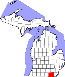 | |
| Villages | ||
| Charter townships | ||
| General law townships | ||
| CDPs | ||
| Other unincorporated communities | ||
| Footnotes | ‡This populated place also has portions in an adjacent county or counties | |
Coordinates: 41°43′10″N 84°13′05″W / 41.71944°N 84.21806°W