Monroe Township, Wyoming County, Pennsylvania
| Monroe Township | |
| Township | |
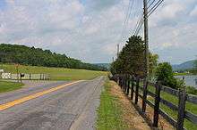
 Lake and mountains in Monroe Township | |
| Country | United States |
|---|---|
| State | Pennsylvania |
| County | Wyoming |
| Elevation | 1,155 ft (352.0 m) |
| Coordinates | 41°25′00″N 76°00′59″W / 41.41667°N 76.01639°WCoordinates: 41°25′00″N 76°00′59″W / 41.41667°N 76.01639°W |
| Area | 21.3 sq mi (55.2 km2) |
| - land | 21.2 sq mi (55 km2) |
| - water | 0.1 sq mi (0 km2), 0.47% |
| Population | 1,652 (2010) |
| Density | 77.9/sq mi (30.1/km2) |
| Timezone | EST (UTC-5) |
| - summer (DST) | EDT (UTC-4) |
| Area code | 570 |
 Location of Monroe Township in Pennsylvania | |
 Location of Pennsylvania in the United States | |
Monroe Township is a township in Wyoming County, Pennsylvania, United States. The population was 1,652 at the 2010 census.
Geography


According to the United States Census Bureau, the township has a total area of 21.3 square miles (55 km2), of which, 21.2 square miles (55 km2) of it is land and 0.1 square miles (0.26 km2) of it (0.47%) is water.
Demographics
As of the census[1] of 2010, there were 1,652 people, 674 households, and 466 families residing in the township. The population density was 77.9 people per square mile (30.1/km²). There were 732 housing units at an average density of 34.5/sq mi (13.5/km²). The racial makeup of the township was 98.4% White, 0.7% African American, 0.2% Asian, 0.05% from other races, and 0.65% from two or more races. Hispanic or Latino of any race were 1% of the population.
There were 674 households out of which 28.2% had children under the age of 18 living with them, 51.6% were married couples living together, 11.3% had a female householder with no husband present, and 30.9% were non-families. while 25.2% of all households were made up of individuals and 8.4% had someone living alone who was 65 years of age or older. The average household size was 2.45 and the average family size was 2.86.
In the township the population was spread out with 20.4% under the age of 18, 63.7% from 18 to 64, and 15.9% who were 65 years of age or older. The median age was 43 years.
The median income for a household in the township was $43,625, and the median income for a family was $50,263. Males had a median income of $43,482 versus $30,236 for females. The per capita income for the township was $23,421. About 6.4% of families and 9% of the population were below the poverty line, including 12.8% of those under age 18 and 12.3% of those age 65 or over.
References
- ↑ "American FactFinder". United States Census Bureau. Retrieved 2011-05-14.
{{US county navigation box | county =Wyoming County | state =Pennsylvania | template_name =Wyoming County, Pennsylvania | listclass =hlist | map_image =Map of Pennsylvania highlighting Wyoming County.svg | map_caption = | seat =Tunkhannock
| title1 =Boroughs | body1 =
| title2 =Townships | body2 =
- Braintrim
- Clinton
- Eaton
- Exeter
- Falls
- Forkston
- Lemon
- Mehoopany
- Meshoppen
- Monroe
- Nicholson
- North Branch
- Northmoreland
- Noxen
- Overfield
- Tunkhannock
- Washington
- Windham
| title3 =CDPs | body3 =
- Lake Winola
- Noxen
- West Falls
- [[Stull, Pennsylvania https://en.wikipedia.org/wiki/Stull,_Pennsylvania
| title4 =Ghost town | body4 =
}}