Mitchell, Oregon
| Mitchell, Oregon | |
|---|---|
| City | |
|
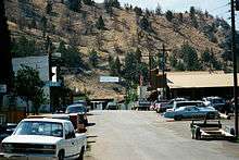
Main Street as seen from Rosenbaum Street | |
 Location in Oregon | |
| Coordinates: 44°34′2″N 120°9′13″W / 44.56722°N 120.15361°WCoordinates: 44°34′2″N 120°9′13″W / 44.56722°N 120.15361°W | |
| Country | United States |
| State | Oregon |
| County | Wheeler |
| Incorporated | 1891 |
| Government | |
| • Mayor | Vernita Jordan |
| Area[1] | |
| • Total | 1.26 sq mi (3.26 km2) |
| • Land | 1.26 sq mi (3.26 km2) |
| • Water | 0 sq mi (0 km2) |
| Elevation | 2,777 ft (846.4 m) |
| Population (2010)[2] | |
| • Total | 130 |
| • Estimate (2012[3]) | 129 |
| • Density | 103.2/sq mi (39.8/km2) |
| Time zone | Pacific (UTC-8) |
| • Summer (DST) | Pacific (UTC-7) |
| ZIP code | 97750 |
| Area code(s) | 541 |
| FIPS code | 41-49150[2] |
| GNIS feature ID | 1146370[4] |

Mitchell is a city in Wheeler County, Oregon, United States. The population was 130 at the 2010 census. It was founded in 1873 and was named after John H. Mitchell, a politician.
The Painted Hills unit of the John Day Fossil Beds National Monument is about 9 miles (14 km) northwest of Mitchell. Mitchell School, a public school with an enrollment of about 70 students, is in Mitchell.[5]
History
At the request of William "Brawdie" Johnson, a blacksmith, a post office was established at Mitchell in 1873.[6] Johnson, the first postmaster, suggested the name Mitchell after John Hipple Mitchell, a U.S. Senator from Oregon. Senator Mitchell held the office in 1873−79, 1885−97, and 1901−05. Platted in 1885, the community was incorporated in 1893.[6]
In 1872 the first school in Wheeler County was established near Mitchell, and in 1874 it was relocated to the town itself.[7] Over the next two decades, Mitchell grew to include a store, assay office, two churches, two hotels, livery stable, three houses of ill-repute (one of which is still standing), five saloons, a flour mill, a livery stable, and an apothecary. There were also two newspapers, The Sentinel and The News. The business district, including the saloons, grew up along Bridge Creek and became known locally as "Tiger Town". The church and most of the city's homes were built at higher elevation on a bench overlooking the creek; this part of town was known locally as "Piety Hill". About half the town was destroyed by fire in 1899, but it was later rebuilt.[7]
Since its founding, Mitchell has experienced three catastrophic flash floods along Bridge Creek, which runs through the center of the city. Flooding caused great damage to the city in 1884 and 1904.[8] The third flood occurred on July 13, 1956, shortly after an intense thunderstorm in the hills to the south. The creek is usually less than 12 inches (30 cm) deep during July.[9] Minutes after the thunderstorm a 50-foot (15 m) wall of water surged into Mitchell destroying or heavily damaging 20 buildings in the city and several bridges over the creek. Eight people were killed including a family of four who were swept away and never recovered. An observer from the United States Geological Survey estimated that about 4 inches (10 cm) of rain had fallen in about 50 minutes at the storm's center.[9] Total damage from the flood, which also caused extensive damage to crops and roads in a nearby valley, was $709,000.[10]
Geography
Mitchell, in southwestern Wheeler County, is on U.S. Route 26 just east of its intersection with Oregon Route 207.[11] By highway, the city is 47 miles (76 km) east of Prineville and 60 miles (97 km) west of John Day.[12] To the city's south lie the Ochoco Mountains, the source of Bridge Creek. It flows through Mitchell and then north through the Painted Hills to the John Day River.[11] Eroded remnants of ancient stratovolcanoes, once the size of Mount Hood are nearby; these include Black Butte and White Butte, visible from town.[13] According to the United States Census Bureau, the city has a total area of 1.26 square miles (3.26 km2), all of it land.[1]
Climate
July and August are the warmest months in Mitchell, with an average high of 86 °F (30 °C) and an average low of 52 °F (11 °C).[14] January is the coldest month, when highs average 42 °F (6 °C) and lows average 24 °F (−4 °C).[14] The highest recorded temperature in Mitchell was 107 °F (42 °C) in 1972, and the lowest was −27 °F (−33 °C) in 1983.[14] Precipitation in the region is limited by the rain shadow effect of the Cascade Range and the Ochoco Mountains to the west.[15] May is generally the wettest month, when precipitation averages 1.65 inches (42 mm).[14] In winter, much of the precipitation arrives as snow.[15]
| Climate data for Mitchell, Oregon | |||||||||||||
|---|---|---|---|---|---|---|---|---|---|---|---|---|---|
| Month | Jan | Feb | Mar | Apr | May | Jun | Jul | Aug | Sep | Oct | Nov | Dec | Year |
| Average high °F (°C) | 42 (6) |
47 (8) |
54 (12) |
60 (16) |
69 (21) |
77 (25) |
86 (30) |
86 (30) |
77 (25) |
65 (18) |
49 (9) |
42 (6) |
62.8 (17.2) |
| Average low °F (°C) | 24 (−4) |
27 (−3) |
31 (−1) |
34 (1) |
40 (4) |
47 (8) |
52 (11) |
52 (11) |
44 (7) |
36 (2) |
30 (−1) |
25 (−4) |
36.8 (2.6) |
| Average precipitation inches (mm) | 0.87 (22.1) |
0.65 (16.5) |
1.00 (25.4) |
1.22 (31) |
1.65 (41.9) |
1.13 (28.7) |
0.61 (15.5) |
0.65 (16.5) |
0.67 (17) |
0.80 (20.3) |
1.12 (28.4) |
0.99 (25.1) |
11.36 (288.4) |
| Source: The Weather Channel[14] | |||||||||||||
Demographics
| Historical population | |||
|---|---|---|---|
| Census | Pop. | %± | |
| 1900 | 135 | — | |
| 1910 | 210 | 55.6% | |
| 1920 | 224 | 6.7% | |
| 1930 | 211 | −5.8% | |
| 1940 | 219 | 3.8% | |
| 1950 | 415 | 89.5% | |
| 1960 | 236 | −43.1% | |
| 1970 | 196 | −16.9% | |
| 1980 | 183 | −6.6% | |
| 1990 | 163 | −10.9% | |
| 2000 | 170 | 4.3% | |
| 2010 | 130 | −23.5% | |
| Est. 2015 | 121 | [16] | −6.9% |

2010 census
As of the census of 2010, there were 130 people, 61 households, and 39 families residing in the city. The population density was 103.2 inhabitants per square mile (39.8/km2). There were 83 housing units at an average density of 65.9 per square mile (25.4/km2). The racial makeup of the city was 92.3% White, 0.8% Native American, and 6.9% from two or more races. Hispanic or Latino of any race were 1.5% of the population.[2]
There were 61 households of which 18.0% had children under the age of 18 living with them, 50.8% were married couples living together, 4.9% had a female householder with no husband present, 8.2% had a male householder with no wife present, and 36.1% were non-families. 26.2% of all households were made up of individuals and 9.8% had someone living alone who was 65 years of age or older. The average household size was 2.13 and the average family size was 2.56.[2]
The median age in the city was 51.7 years. 15.4% of residents were under the age of 18; 4.6% were between the ages of 18 and 24; 16.1% were from 25 to 44; 33.1% were from 45 to 64; and 30.8% were 65 years of age or older. The gender makeup of the city was 46.2% male and 53.8% female.[2]
2000 census
As of the census of 2000, there were 170 people, 75 households, and 42 families residing in the city. The population density was 144.6 people per square mile (55.6/km²). There were 91 housing units at an average density of 77.4 per square mile (29.8/km²). The racial makeup of the city was 90.00% White, 2.35% Native American, 1.18% Asian, 1.18% from other races, and 5.29% from two or more races. Hispanic or Latino of any race were 7.65% of the population.[2]
There were 75 households out of which 25.3% had children under the age of 18 living with them, 46.7% were married couples living together, 9.3% had a female householder with no husband present, and 42.7% were non-families. 38.7% of all households were made up of individuals and 22.7% had someone living alone who was 65 years of age or older. The average household size was 2.27 and the average family size was 2.79.[2]
In the city the population was spread out with 28.8% under the age of 18, 2.9% from 18 to 24, 19.4% from 25 to 44, 28.2% from 45 to 64, and 20.6% who were 65 years of age or older. The median age was 42 years. For every 100 females there were 107.3 males. For every 100 females age 18 and over, there were 89.1 males.[2]
The median income for a household in the city was $20,417, and the median income for a family was $20,833. Males had a median income of $21,250 versus $23,125 for females. The per capita income for the city was $13,906. About 26.9% of families and 28.7% of the population were below the poverty line, including 43.5% of those under the age of 18 and none of those 65 or over.[2]

Tourism
Mitchell holds three festivals each year.
The Painted Hills Festival is held each Labor Day weekend. This includes a half marathon, 5K and 10K, parade, show horses, fire trucks, Red Hat ladies, motorcycle show, games, watermelon eating contests, dunk tank, Karaoke and live entertainment. Craft vendors and food vendors line the street and city park. A Quilt Show in always held at the Community Hall. The day winds down with a street dance to live bands.
Tiger Town Music Festival is held the second weekend of each June and features bands from all over the Pacific Northwest from 9am to 10 pm.
Tiger Town Vintage Trailer Rally is held the second weekend of each July and features award winning vintage travel trailers from as far away as New York State.
In popular culture
In the novel World War Z, by Max Brooks, the population of Mitchell, Oregon is almost entirely infected and turned into zombies. Instead of being cleared, the town is sealed and is turned into the K-9 Urban Warfare school, where military dogs were trained with live zombies.[18]
References
- 1 2 "US Gazetteer files 2010". United States Census Bureau. Retrieved December 21, 2012.
- 1 2 3 4 5 6 7 8 9 "American FactFinder". United States Census Bureau. Retrieved December 21, 2012.
- ↑ "Population Estimates". United States Census Bureau. Retrieved June 2, 2013.
- ↑ "US Board on Geographic Names". United States Geological Survey. October 25, 2007. Retrieved January 31, 2008.
- ↑ "About Mitchell School". Mitchell School. 2011. Retrieved August 15, 2011.
- 1 2 McArthur, Lewis A.; Lewis L. McArthur (2003) [1928]. Oregon Geographic Names (7th ed.). Portland, Oregon: Oregon Historical Society Press. p. 652. ISBN 0-87595-277-1.
- 1 2 Stinchfield, Janet L.; Stinchfield, McLaren E., eds. (1983). The History of Wheeler County, Oregon. Dallas, Texas: Taylor Publishing Company. pp. 8−9. OCLC 10948544.
- ↑ "Oregon Historic Photographs Collection". Salem Public Library. Retrieved September 24, 2008.
- 1 2 "Some of the Area's Rainstorms". National Weather Service Forecast Office, Portland, Oregon. Retrieved September 22, 2008.
- ↑ "Flood of 1955-1956: Columbia River and Tributaries". U.S. Army Corps of Engineers. Retrieved September 22, 2008.
- 1 2 Oregon Atlas & Gazetteer (7th ed.). Yarmouth, Maine: DeLorme. pp. 76−77. ISBN 978-0-89933-347-2.
- ↑ "Directions". City of Mitchell. Retrieved August 15, 2011.
- ↑ Bishop, Ellen Morris (2003). In Search of Ancient Oregon: A Geological and Natural History. Portland, Oregon: Timber Press. pp. 86–92. ISBN 978-0-88192-789-4.
- 1 2 3 4 5 "Monthly Averages for Mitchell, Oregon". The Weather Channel Interactive. Archived from the original on October 24, 2012. Retrieved 2011-07-07.
- 1 2 "John Day Fossil Beds: Nature and Science". National Park Service. September 24, 2006. Retrieved July 7, 2011.
- ↑ "Annual Estimates of the Resident Population for Incorporated Places: April 1, 2010 to July 1, 2015". Retrieved July 2, 2016.
- ↑ "Census of Population and Housing". Census.gov. Retrieved June 4, 2015.
- ↑ Brooks, Max (2006). World War Z. p. 286.
External links
| Wikimedia Commons has media related to Mitchell, Oregon. |
Municipalities and communities of Wheeler County, Oregon, United States | ||
|---|---|---|
| Cities |  | |
| Unincorporated communities | ||
| Ghost towns | ||