Missouri Headwaters State Park
|
Three Forks of the Missouri | |
|
Confluence of Madison and Jefferson | |
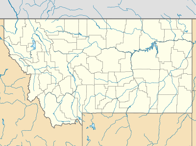  | |
| Location | Gallatin County, Montana |
|---|---|
| Nearest city | Three Forks, Montana |
| Coordinates | 45°55′15″N 111°29′53″W / 45.9207°N 111.4980°WCoordinates: 45°55′15″N 111°29′53″W / 45.9207°N 111.4980°W |
| Built | 1805 |
| NRHP Reference # | 66000433[1] |
| Significant dates | |
| Added to NRHP | October 15, 1966 |
| Designated NHL | October 9, 1960[2] |
Missouri Headwaters State Park is a Montana state park that marks the official start of the Missouri River. It includes the Three Forks of the Missouri National Historic Landmark.
It is located near Three Forks, Montana at an elevation of 4,045 feet (1,233 m).
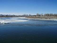
The Missouri starts at the confluence of the Jefferson River and Madison River. It is joined about 0.6 mile down stream (northeast) by the Gallatin River.
Lewis and Clark visited the site on July 28, 1805. Meriwether Lewis in his journal entry wrote:
- Both Capt. C. and myself corresponded in opinon with rispect(sic) to the impropriety of calling either of these [three] streams the Missouri and accordingly agreed to name them after the President of the United States and the Secretaries of the Treasury and State.
The Lewis and Clark decision not to call the Jefferson the Missouri has spurred debate over what is the longest river in North America since the Missouri and Mississippi are nearly identical in length. The Missouri traditionally had been called the longest river in North America. However, 72 miles of it have been trimmed off in re-channeling its streambed—mainly for the many hydroelectric power plants in the region— so that it is now sometimes referred as second to the Mississippi in terms of length. If the Jefferson were included in the Missouri length, it would technically still be considered the longest river by the USGS experts.
The utmost headwaters of the Missouri are subject to debate but both locations ultimately drain into the Jefferson. Lewis on August 12, 1805 said he visited the headwaters on Trail Creek just above Lemhi Pass on the Continental Divide in the Beaverhead Mountains at around 8,600 feet which he described:
- the most distant fountain of the waters of the mighty Missouri in surch(sic) of which we have spent so many toilsome days and wristless(sic) nights.
However in 1888 Jacob V. Brower, who had championed turning the headwaters of the Mississippi River into a Minnesota state park, visited another site which today is believed to be the furthest point on the Missouri—now called Brower's Spring. Brower published his finding in 1896 in "The Missouri: Its Utmost Source."
The site of Brower's Spring is at around 8,800 feet in the Centennial Mountains. The site is commemorated by a rock pile at the source of Hellroaring Creek which flows into Red Rock River and then into Clark Canyon Reservoir where it joins the Beaverhead then the Big Hole River before ultimately hooking up with the Jefferson.[3]
References
- ↑ National Park Service (2007-01-23). "National Register Information System". National Register of Historic Places. National Park Service.
- ↑ "Three Forks of the Missouri". National Historic Landmark summary listing. National Park Service. Retrieved 2007-06-28.
- ↑ The True Utmost Reaches of the Missouri - Montana Outdoors - July-August 2005
External links
| Wikimedia Commons has media related to Missouri River Headwaters State Park. |
| Topics | |
|---|---|
| Lists by states |
|
| Lists by insular areas | |
| Lists by associated states | |
| Other areas | |
| |