Miraj Junior
| Miraj State (ca. 1750 - 1820) Miraj Junior State (1820 - 1948) मिरज / ಮೀರಜ್ ಸಂಸ್ಥಾನ | |||||
| Princely State of British India | |||||
| |||||
|
Flag | |||||
 | |||||
| History | |||||
| • | Established | 1820 | |||
| • | Independence of India | 1948 | |||
| Area | |||||
| • | 1901 | 508 km2 (196 sq mi) | |||
| Population | |||||
| • | 1901 | 35,806 | |||
| Density | 70.5 /km2 (182.6 /sq mi) | ||||
| | |||||

Miraj Junior was one of two Maratha princely states during the British Raj: 'Miraj Senior' and Miraj Junior. The two states separated in 1820.[1] It was under the southern division of the Bombay Presidency, forming part of the southern Mahratta Jagirs, and later the Deccan States Agency.
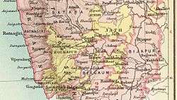
Miraj Junior measured 211 square miles (550 km2) in area. According to the 1901 census, the population was 35,806. In 1901, the state enjoyed revenue estimated at £27,000-, and paid £400 in tribute to the British Raj. The Raja resided in the town of Bhudgaon (population 3,591 in 1901).
History
The State of Miraj, the predecessor state, was founded before 1750 and within its limits was the former capital of the State of Sangli before the British Raj. Raja Govind Rao Patwardhan, 1st Ruler of Miraj, began as a cavalry commander. He distinguished himself in several expeditions against the Nizam of Hyderabad and Hyder Ali of Mysore, established the Maratha ascendancy in southern India and pushed the Maratha conquests to the frontier of Mysore.
In 1820, the state of Miraj was divided between a Senior and Junior branch. The territory of both branches was widely scattered among other native states and also British districts.
Miraj Junior acceded to the Dominion of India on 8 March 1948 and is currently a part of Maharashtra state.
Rulers
The rulers belonged to the Patwardhan dynasty and used the title of Raja.[2] They were of the same clan that ruled nearby Jamkhandi State.
Rajas
- Raja Madhavrao I Patwardhan, 1st Raja of Miraj Junior 1820/1845
- Raja Lakshmanrao I [Anna Saheb] Patwardhan, 2nd Raja of Miraj Junior 1845/1876, born 1807, died 1876.
- Raja Hariharrao [Dada Saheb] Patwardhan, 3rd Raja of Miraj Junior 1876/1877, died 1877.
- Raja Lakshmanrao II [Anna Saheb] Patwardhan, 4th Raja of Miraj Junior 1877/1899, died 7 February 1899.
- Meherban Shrimant Raja Sir Madhavrao II Harihar Babasaheb Patwardhan, 5th Raja of Miraj Junior 1899/1950
- Meherban Shrimant Raja Chintamanrao Madhavrao Balasaheb Patwardhan, 6th Raja of Miraj Junior 1950/1972
- Rajkumari Yamuna Raje Patwardhan - Married to Vasant Ramchandra Naykude
- Yuvaraj Shrimant Agastyanand Patwardhan
- Meherban Shrimant Raja Hariharrao Madhavrao Babasaheb Patwardhan, Raja of Miraj Junior
- Meherban Shrimant Raja Parshuram Hariharrao Patwardhan
See also
References
- ↑ Imperial Gazetteer of India, Oxford: Clarendon Press, 1908
- ↑ Miraj Junior (Princely State)
External links
Coordinates: 16°49′07″N 74°38′29″E / 16.818673°N 74.641405°E