Millstone, New Jersey
| Millstone, New Jersey | |
|---|---|
| Borough | |
| Borough of Millstone | |
|
John Van Doren House | |
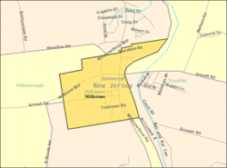
 Map of Millstone in Somerset County. Inset: Location of Somerset County highlighted in the State of New Jersey. | |
 Census Bureau map of Millstone, New Jersey | |
| Coordinates: 40°29′59″N 74°35′45″W / 40.499817°N 74.595876°WCoordinates: 40°29′59″N 74°35′45″W / 40.499817°N 74.595876°W[1][2] | |
| Country |
|
| State |
|
| County | Somerset |
| Incorporated | May 14, 1894 |
| Government[3] | |
| • Type | Borough |
| • Body | Borough Council |
| • Mayor | Raymond Heck (Democratic Party, term ends December 31, 2018)[4][5] |
| • Clerk | Gregory Bonin[6] |
| Area[1] | |
| • Total | 0.760 sq mi (1.969 km2) |
| • Land | 0.738 sq mi (1.911 km2) |
| • Water | 0.022 sq mi (0.058 km2) 2.95% |
| Area rank |
525th of 566 in state 19th of 21 in county[1] |
| Elevation[7] | 56 ft (17 m) |
| Population (2010 Census)[8][9][10] | |
| • Total | 418 |
| • Estimate (2015)[11] | 419 |
| • Rank |
558th of 566 in state 21st of 21 in county[12] |
| • Density | 566.5/sq mi (218.7/km2) |
| • Density rank |
434th of 566 in state 18th of 21 in county[12] |
| Time zone | Eastern (EST) (UTC-5) |
| • Summer (DST) | Eastern (EDT) (UTC-4) |
| ZIP code | 08844[13] |
| Area code(s) | 732 and 908[14] |
| FIPS code | 3403546590[1][15][16] |
| GNIS feature ID | 0885302[1][17] |
| Website |
www |

Millstone is a borough in Somerset County, New Jersey, United States. As of the 2010 United States Census, the borough's population was 418,[8][9][10] reflecting an increase of 8 (+2.0%) from the 410 counted in the 2000 Census, which had in turn declined by 40 (-8.9%) from the 450 counted in the 1990 Census.[18]
Millstone was incorporated as a borough by an act of the New Jersey Legislature on May 14, 1894, from portions of Hillsborough Township, based on the results of a referendum held that day. The borough was reincorporated on March 12, 1928.[19] The borough was named for the Millstone River, whose name derives from an incident in which a millstone was dropped into it.[20][21][22]
Added in 1976, Millstone Borough is listed in the National Register of Historic Places and encompasses 58 buildings. The borough possesses a military significance for 1700–1749, 1750–1799, 1850–1874.[23]
New Jersey Monthly magazine ranked Millstone as its 7th best place to live in its 2008 rankings of the "Best Places To Live" in New Jersey.[24]
History
Millstone, then called Somerset Courthouse, was the county seat of Somerset County from 1738 until the British burned it to the ground in 1779 during the American Revolutionary War.[25] After the victory at Princeton on January 3, 1777, General George Washington headquartered at the Van Doren house, while the army camped nearby that night. The next day, they marched to Pluckemin on the way to their winter encampment at Morristown.[26][27]
Millstone was briefly connected to the Pennsylvania Railroad when the Mercer and Somerset Railway was extended to the town in the 1870s and connected via a bridge across the Millstone River to the Pennsylvania Railroad's Millstone and New Brunswick Railroad, but that arrangement did not last into the 1880s. Remnants of the railroad bridge can still be seen.
Geography
According to the United States Census Bureau, the borough had a total area of 0.760 square miles (1.969 km2), including 0.738 square miles (1.911 km2) of land and 0.022 square miles (0.058 km2) of water (2.95%).[1][2]
The borough borders Franklin Township and Hillsborough Township.[28]
Demographics
| Historical population | |||
|---|---|---|---|
| Census | Pop. | %± | |
| 1900 | 200 | — | |
| 1910 | 157 | −21.5% | |
| 1920 | 178 | 13.4% | |
| 1930 | 187 | 5.1% | |
| 1940 | 252 | 34.8% | |
| 1950 | 289 | 14.7% | |
| 1960 | 409 | 41.5% | |
| 1970 | 630 | 54.0% | |
| 1980 | 530 | −15.9% | |
| 1990 | 450 | −15.1% | |
| 2000 | 410 | −8.9% | |
| 2010 | 418 | 2.0% | |
| Est. 2015 | 419 | [11][29] | 0.2% |
| Population sources: 1900-1920[30] 1900-1910[31] 1910-1930[32] 1930-1990[33] 2000[34][35] 2010[8][9][10] | |||
Census 2010
The 2010 United States Census counted 418 people, 162 households, and 117.9 families residing in the borough. The population density was 566.5 per square mile (218.7/km2). The borough contained 167 housing units at an average density of 226.3 per square mile (87.4/km2). The racial makeup of the borough was 95.69% (400) White, 1.20% (5) Black or African American, 0.00% (0) Native American, 1.67% (7) Asian, 0.00% (0) Pacific Islander, 0.96% (4) from other races, and 0.48% (2) from two or more races. Hispanics or Latinos of any race were 3.59% (15) of the population.[8]
Out of a total of 162 households, 30.9% had children under the age of 18 living with them, 58.0% were married couples living together, 8.6% had a female householder with no husband present, and 27.2% were non-families. 22.2% of all households were made up of individuals, and 11.7% had someone living alone who was 65 years of age or older. The average household size was 2.58 and the average family size was 3.03.[8]
In the borough, 23.7% of the population were under the age of 18, 5.0% from 18 to 24, 25.8% from 25 to 44, 29.4% from 45 to 64, and 16.0% who were 65 years of age or older. The median age was 42.8 years. For every 100 females the census counted 94.4 males, but for 100 females at least 18 years old, it was 86.5 males.[8]
The Census Bureau's 2006-2010 American Community Survey showed that (in 2010 inflation-adjusted dollars) median household income was $97,500 (with a margin of error of +/- $18,039) and the median family income was $102,708 (+/- $20,734). Males had a median income of $73,250 (+/- $8,715) versus $50,625 (+/- $15,872) for females. The per capita income for the borough was $37,678 (+/- $5,017). About 0.0% of families and 0.5% of the population were below the poverty line, including 0.0% of those under age 18 and 3.0% of those age 65 or over.[36]
Census 2000
As of the 2000 United States Census[15] there were 410 people, 169 households, and 126 families residing in the borough. The population density was 547.1 people per square mile (211.1/km2). There were 173 housing units at an average density of 230.9 per square mile (89.1/km2). The racial makeup of the borough was 97.56% White, 0.98% African American, 0.98% Asian, and 0.49% from two or more races. Hispanic or Latino of any race were 3.17% of the population.[34][35]
There were 169 households out of which 25.4% had children under the age of 18 living with them, 59.8% were married couples living together, 9.5% had a female householder with no husband present, and 24.9% were non-families. 18.9% of all households were made up of individuals and 8.9% had someone living alone who was 65 years of age or older. The average household size was 2.43 and the average family size was 2.79.[34][35]
In the borough the population was spread out with 19.3% under the age of 18, 4.1% from 18 to 24, 25.4% from 25 to 44, 34.1% from 45 to 64, and 17.1% who were 65 years of age or older. The median age was 46 years. For every 100 females there were 99.0 males. For every 100 females age 18 and over, there were 91.3 males.[34][35]
The median income for a household in the borough was $76,353, and the median income for a family was $83,118. Males had a median income of $60,156 versus $36,406 for females. The per capita income for the borough was $30,694. About 3.1% of families and 4.6% of the population were below the poverty line, including 6.4% of those under age 18 and 7.3% of those age 65 or over.[34][35]
Government
Local government
Millstone is governed under the Borough form of New Jersey municipal government. The governing body consists of a Mayor and a Borough Council comprising six council members, with all positions elected at-large on a partisan basis as part of the November general election. A Mayor is elected directly by the voters to a four-year term of office. The Borough Council consists of six members elected to serve three-year terms on a staggered basis, with two seats coming up for election each year in a three-year cycle.[3] The Borough form of government used by Millstone, the most common system used in the state, is a "weak mayor / strong council" government in which council members act as the legislative body with the mayor presiding at meetings and voting only in the event of a tie. The mayor can veto ordinances subject to an override by a two-thirds majority vote of the council. The mayor makes committee and liaison assignments for council members, and most appointments are made by the mayor with the advice and consent of the council.[37][38]
As of 2016, the Mayor of Millstone Borough is Democrat Raymond Heck, whose term of office ends December 31, 2018. Members of the Millstone Borough Council are Council President Scott J. Ross (R, 2017), Sal Ciurleo (D, 2016), Merry Emmich (R, 2018), Alan Kidd (R, 2017), Denene Smerdon (R, 2016) and Johnathan Stashek (D, 2018).[4][39][40][41][42][43]
Federal, state and county representation
Millstone is located in the 7th Congressional District[44] and is part of New Jersey's 16th state legislative district.[9][45][46] Prior to the 2010 Census, Millstone had been part of the 4th Congressional District, a change made by the New Jersey Redistricting Commission that took effect in January 2013, based on the results of the November 2012 general elections.[47]
New Jersey's Seventh Congressional District is represented by Leonard Lance (R, Clinton Township).[48] New Jersey is represented in the United States Senate by Cory Booker (D, Newark, term ends 2021)[49] and Bob Menendez (D, Paramus, 2019).[50][51]
For the 2016–2017 session (Senate, General Assembly), the 16th Legislative District of the New Jersey Legislature is represented in the State Senate by Christopher Bateman (R, Branchburg) and in the General Assembly by Jack Ciattarelli (R, Hillsborough Township) and Andrew Zwicker (D, South Brunswick). [52] The Governor of New Jersey is Chris Christie (R, Mendham Township).[53] The Lieutenant Governor of New Jersey is Kim Guadagno (R, Monmouth Beach).[54]
Somerset County is governed by a five-member Board of Chosen Freeholders, whose members are elected at-large to three-year terms of office on a staggered basis, with one or two seats coming up for election each year. At an annual reorganization meeting held in the beginning of January, the board selects a Director and Deputy Director from among its members.[55] As of 2016, Somerset County's Freeholders are Freeholder Director Patricia L. Walsh (R, Green Brook Township, term ends December 31, 2016)[56], Freeholder Deputy Director Peter S. Palmer (R, Bernardsville, 2017),[57] Patrick Scaglione (R, Bridgewater Township, 2018),[58] Mark Caliguire (R, Skillman in Montgomery Township, 2018),[59] and Brian D. Levine (R, Franklin Township, 2017),[60] Constitutional officers elected on a countywide basis are County Clerk Brett A. Radi (R, Somerville, 2017),[61] Sheriff Frank J. Provenzano (R, Raritan, 2016)[62][63] and Surrogate Frank Bruno (R, Branchburg, 2018).[64]
Politics
As of March 23, 2011, there were a total of 309 registered voters in Millstone, of which 107 (34.6% vs. 26.0% countywide) were registered as Democrats, 85 (27.5% vs. 25.7%) were registered as Republicans and 117 (37.9% vs. 48.2%) were registered as Unaffiliated. There were no voters registered to other parties.[65] Among the borough's 2010 Census population, 73.9% (vs. 60.4% in Somerset County) were registered to vote, including 96.9% of those ages 18 and over (vs. 80.4% countywide).[65][66]
In the 2012 presidential election, Republican Mitt Romney received 49.8% of the vote (119 cast), ahead of Democrat Barack Obama with 49.4% (118 votes), and other candidates with 0.8% (2 votes), among the 240 ballots cast by the borough's 325 registered voters (1 ballot was spoiled), for a turnout of 73.8%.[67][68] In the 2008 presidential election, Republican John McCain received 143 votes (57.0% vs. 46.1% countywide), ahead of Democrat Barack Obama with 104 votes (41.4% vs. 52.1%) and other candidates with 2 votes (0.8% vs. 1.1%), among the 251 ballots cast by the borough's 309 registered voters, for a turnout of 81.2% (vs. 78.7% in Somerset County).[69] In the 2004 presidential election, Republican George W. Bush received 130 votes (50.6% vs. 51.5% countywide), ahead of Democrat John Kerry with 123 votes (47.9% vs. 47.2%) and other candidates with 2 votes (0.8% vs. 0.9%), among the 257 ballots cast by the borough's 304 registered voters, for a turnout of 84.5% (vs. 81.7% in the whole county).[70]
In the 2013 gubernatorial election, Republican Chris Christie received 61.0% of the vote (97 cast), ahead of Democrat Barbara Buono with 35.2% (56 votes), and other candidates with 3.8% (6 votes), among the 159 ballots cast by the borough's 320 registered voters for a turnout of 49.7%.[71][72] In the 2009 gubernatorial election, Republican Chris Christie received 100 votes (54.6% vs. 55.8% countywide), ahead of Democrat Jon Corzine with 62 votes (33.9% vs. 34.1%), Independent Chris Daggett with 18 votes (9.8% vs. 8.7%) and other candidates with 1 votes (0.5% vs. 0.7%), among the 183 ballots cast by the borough's 303 registered voters, yielding a 60.4% turnout (vs. 52.5% in the county).[73]
Education
Millstone is a non-operating school district. All public school students from Millstone attend school in the Hillsborough Township School District, in Hillsborough Township as part of a sending/receiving relationship.[74]
Transportation
As of May 2010, the borough had a total of 4.41 miles (7.10 km) of roadways, of which 4.01 miles (6.45 km) were maintained by the municipality so 0.40 miles (0.64 km) by Somerset County[75]
Notable people
People who were born in, residents of, or otherwise closely associated with Millstone include:
- Frederick Theodore Frelinghuysen (1817-1885), United States Senator representing New Jersey and a United States Secretary of State under Chester A. Arthur.[76]
- Ferdinand Schureman Schenck (1790–1860), represented New Jersey in the United States House of Representatives from 1833-1837.[77]
- Charles Titus (1838-1921), Union Army soldier who was awarded a Medal of Honor for his actions in the Civil War.[78]
See also
References
- 1 2 3 4 5 6 2010 Census Gazetteer Files: New Jersey County Subdivisions, United States Census Bureau. Accessed May 21, 2015.
- 1 2 US Gazetteer files: 2010, 2000, and 1990, United States Census Bureau. Accessed September 4, 2014.
- 1 2 2012 New Jersey Legislative District Data Book, Rutgers University Edward J. Bloustein School of Planning and Public Policy, March 2013, p. 77.
- 1 2 Borough Council, Borough of Millstone. Accessed August 1, 2016.
- ↑ 2016 New Jersey Mayors Directory, New Jersey Department of Community Affairs. Accessed June 14, 2016.
- ↑ Borough Staff, Millstone Borough. Accessed August 1, 2016.
- ↑ U.S. Geological Survey Geographic Names Information System: Borough of Millstone, Geographic Names Information System. Accessed March 8, 2013.
- 1 2 3 4 5 6 DP-1 - Profile of General Population and Housing Characteristics: 2010 for Millstone borough, Somerset County, New Jersey, United States Census Bureau. Accessed February 13, 2013.
- 1 2 3 4 Municipalities Grouped by 2011-2020 Legislative Districts, New Jersey Department of State, p. 8. Accessed January 6, 2013.
- 1 2 3 Profile of General Demographic Characteristics: 2010 for Millstone borough, New Jersey Department of Labor and Workforce Development. Accessed February 13, 2013.
- 1 2 PEPANNRES - Annual Estimates of the Resident Population: April 1, 2010 to July 1, 2014 - 2014 Population Estimates for New Jersey municipalities, United States Census Bureau. Accessed May 21, 2015.
- 1 2 GCT-PH1 Population, Housing Units, Area, and Density: 2010 - State -- County Subdivision from the 2010 Census Summary File 1 for New Jersey, United States Census Bureau. Accessed February 13, 2013.
- ↑ Look Up a ZIP Code for Millstone, NJ, United States Postal Service. Accessed August 28, 2013. Both 08510 and 08535 are listed in the search, which are ZIP Codes assigned to Millstone Township.
- ↑ Area Code Lookup - NPA NXX for Millstone, NJ, Area-Codes.com. Accessed August 28, 2013.
- 1 2 American FactFinder, United States Census Bureau. Accessed September 4, 2014.
- ↑ A Cure for the Common Codes: New Jersey, Missouri Census Data Center. Accessed October 29, 2012.
- ↑ US Board on Geographic Names, United States Geological Survey. Accessed September 4, 2014.
- ↑ Table 7. Population for the Counties and Municipalities in New Jersey: 1990, 2000 and 2010, New Jersey Department of Labor and Workforce Development, February 2011. Accessed February 13, 2013.
- ↑ Snyder, John P. The Story of New Jersey's Civil Boundaries: 1606-1968, Bureau of Geology and Topography; Trenton, New Jersey; 1969. p. 223. Accessed March 12, 2012.
- ↑ The History of Township of Millstone, New Jersey, Township of Millstone. Accessed September 7, 2015. "Our town is named after the Millstone River that originates in the Township. The river was first named by the Lenape Indians as the Mattawong and later renamed by early settlers as Millstone River."
- ↑ Hutchinson, Viola L. The Origin of New Jersey Place Names, New Jersey Public Library Commission, May 1945. Accessed September 7, 2015.
- ↑ Gannett, Henry. The Origin of Certain Place Names in the United States, p. 209. United States Government Printing Office, 1905. Accessed September 7, 2015.
- ↑ New Jersey - Somerset County, National Register of Historic Places. Accessed February 13, 2013.
- ↑ "Best Places To Live - The Complete Top Towns List 1-100", New Jersey Monthly, February 21, 2008. Accessed February 24, 2008.
- ↑ A Brief History of Millstone, also known as Somerset Courthouse; Early History, Millstone Borough. Accessed February 2, 2015.
- ↑ Honeyman, A. Van Doren. "The Second Somerset Courthouse - At Millstone", pp. 50–58. in Somerset County Historical Quarterly, 1912. Accessed February 2, 2015.
- ↑ Fischer, David Hackett. Washington's Crossing, p. 342. Oxford University Press, 2006 (New York). ISBN 0-19-517034-2.
- ↑ Areas touching Millstone, MapIt. Accessed February 2, 2015.
- ↑ Census Estimates for New Jersey April 1, 2010 to July 1, 2014, United States Census Bureau. Accessed May 21, 2015.
- ↑ Compendium of censuses 1726-1905: together with the tabulated returns of 1905, New Jersey Department of State, 1906. Accessed October 21, 2013.
- ↑ Thirteenth Census of the United States, 1910: Population by Counties and Minor Civil Divisions, 1910, 1900, 1890, United States Census Bureau, p. 338. Accessed February 11, 2013.
- ↑ Fifteenth Census of the United States : 1930 - Population Volume I, United States Census Bureau, p. 718. Accessed February 11, 2013.
- ↑ Table 6. New Jersey Resident Population by Municipality: 1930 - 1990, New Jersey Department of Labor and Workforce Development. Accessed June 28, 2015.
- 1 2 3 4 5 Census 2000 Profiles of Demographic / Social / Economic / Housing Characteristics for Millstone borough, New Jersey, United States Census Bureau. Accessed February 13, 2013.
- 1 2 3 4 5 DP-1: Profile of General Demographic Characteristics: 2000 - Census 2000 Summary File 1 (SF 1) 100-Percent Data for Millstone borough, Somerset County, New Jersey, United States Census Bureau. Accessed February 13, 2013.
- ↑ DP03: Selected Economic Characteristics from the 2006-2010 American Community Survey 5-Year Estimates for Millstone borough, Somerset County, New Jersey, United States Census Bureau. Accessed February 13, 2013.
- ↑ Cerra, Michael F. "Forms of Government: Everything You've Always Wanted to Know, But Were Afraid to Ask", New Jersey State League of Municipalities. Accessed November 30, 2014.
- ↑ "Forms of Municipal Government in New Jersey", p. 6. Rutgers University Center for Government Studies. Accessed June 3, 2015.
- ↑ 2016 User Friendly Budget for Millstone Borough, New Jersey Department of Community Affairs. Accessed August 1, 2016.
- ↑ Somerset County Directory 2016, Somerset County, New Jersey. Accessed July 31, 2016.
- ↑ Somerset County - General Election November 3, 2015 Winning Candidates, Somerset County, New Jersey. Accessed July 31, 2016.
- ↑ Somerset County - General Election November 4, 2014 Winning Candidates, Somerset County, New Jersey. Accessed July 31, 2016.
- ↑ Somerset County - General Election November 5, 2013 Winning Candidates, Somerset County, New Jersey. Accessed July 31, 2016.
- ↑ Plan Components Report, New Jersey Redistricting Commission, December 23, 2011. Accessed January 6, 2013.
- ↑ 2016 New Jersey Citizen's Guide to Government, p. 61, New Jersey League of Women Voters. Accessed July 20, 2016.
- ↑ Districts by Number for 2011-2020, New Jersey Legislature. Accessed January 6, 2013.
- ↑ 2011 New Jersey Citizen's Guide to Government, p. 61, New Jersey League of Women Voters. Accessed May 22, 2015.
- ↑ Directory of Representatives: New Jersey, United States House of Representatives. Accessed January 5, 2012.
- ↑ About Cory Booker, United States Senate. Accessed January 26, 2015. "He now owns a home and lives in Newark's Central Ward community."
- ↑ Biography of Bob Menendez, United States Senate, January 26, 2015. "He currently lives in Paramus and has two children, Alicia and Robert."
- ↑ Senators of the 114th Congress from New Jersey. United States Senate. Accessed January 26, 2015. "Booker, Cory A. - (D - NJ) Class II; Menendez, Robert - (D - NJ) Class I"
- ↑ Legislative Roster 2016-2017 Session, New Jersey Legislature. Accessed January 17, 2016.
- ↑ "About the Governor". State of New Jersey. Retrieved 2010-01-21.
- ↑ "About the Lieutenant Governor". State of New Jersey. Retrieved 2010-01-21.
- ↑ Somerset County Government: At Your Service, Somerset County, New Jersey. Accessed August 5, 2014.
- ↑ Patricia Walsh, Somerset County, New Jersey. Accessed January 18, 2016.
- ↑ Peter S. Palmer, Somerset County, New Jersey. Accessed January 18, 2016.
- ↑ Patrick Scaglione, Somerset County, New Jersey. Accessed January 18, 2016. A term-end year of 2015 is listed as of date accessed.
- ↑ Mark Caliguire, Somerset County, New Jersey. Accessed January 18, 2016. A term-end year of 2015 is listed as of date accessed.
- ↑ Brian Levine, Somerset County, New Jersey. Accessed January 18, 2016.
- ↑ Biography: Somerset County Clerk Brett A. Radi, Somerset County, New Jersey. Accessed August 5, 2014.
- ↑ Sheriff Frank J. Provenzano, Somerset County Sheriff's Office. Accessed August 5, 2014.
- ↑ Sheriff, Somerset County, New Jersey. Accessed August 5, 2014.
- ↑ Somerset County Surrogate, Somerset County, New Jersey. Accessed January 18, 2016. A term-end year of 2015 is listed as of date accessed.
- 1 2 Voter Registration Summary - Somerset, New Jersey Department of State Division of Elections, March 23, 2011. Accessed February 13, 2013.
- ↑ GCT-P7: Selected Age Groups: 2010 - State -- County Subdivision; 2010 Census Summary File 1 for New Jersey, United States Census Bureau. Accessed February 13, 2013.
- ↑ "Presidential General Election Results - November 6, 2012 - Somerset County" (PDF). New Jersey Department of Elections. March 15, 2013. Retrieved December 24, 2014.
- ↑ "Number of Registered Voters and Ballots Cast - November 6, 2012 - General Election Results - Somerset County" (PDF). New Jersey Department of Elections. March 15, 2013. Retrieved December 24, 2014.
- ↑ 2008 Presidential General Election Results: Somerset County, New Jersey Department of State Division of Elections, December 23, 2008. Accessed February 13, 2013.
- ↑ 2004 Presidential Election: Somerset County, New Jersey Department of State Division of Elections, December 13, 2004. Accessed February 13, 2013.
- ↑ "Governor - Somerset County" (PDF). New Jersey Department of Elections. January 29, 2014. Retrieved December 24, 2014.
- ↑ "Number of Registered Voters and Ballots Cast - November 5, 2013 - General Election Results - Somerset County" (PDF). New Jersey Department of Elections. January 29, 2014. Retrieved December 24, 2014.
- ↑ 2009 Governor: Somerset County, New Jersey Department of State Division of Elections, December 31, 2009. Accessed February 13, 2013.
- ↑ Somerset County School Districts-Sending/Receiving/Regional, Somerset County Superintendent of Schools. Accessed February 13, 2013. "MILLSTONE / NON-OPERATING / K-12 Sent to HILLSBOROUGH"
- ↑ Somerset County Mileage by Municipality and Jurisdiction, New Jersey Department of Transportation, May 2010. Accessed July 18, 2014.
- ↑ Frederick Theodore Frelinghuysen, United States Department of State Office of the Historian. Accessed February 13, 2013.
- ↑ Ferdinand Schureman Schenck, Biographical Directory of the United States Congress. Accessed October 22, 2007.
- ↑ Charles Titus, Congressional Medal of Honor Society of the United States of America. Accessed July 9, 2013.
External links
- Millstone Borough website
- Hillsborough Township School District
- Hillsborough Township School District's 2014–15 School Report Card from the New Jersey Department of Education
- School Data for the Hillsborough Township School District, National Center for Education Statistics
- National Register of Historical Places details for Millstone Historic District
Municipalities and communities of Somerset County, New Jersey, United States | ||
|---|---|---|
| Boroughs | 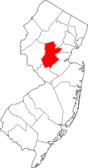 | |
| Townships | ||
| CDPs | ||
| Other unincorporated communities | ||