Midway, New Mexico
| Midway, New Mexico | |
|---|---|
| Census-designated place | |
 Midway | |
| Coordinates: 33°17′40″N 104°27′0″W / 33.29444°N 104.45000°WCoordinates: 33°17′40″N 104°27′0″W / 33.29444°N 104.45000°W | |
| Country | United States |
| State | New Mexico |
| County | Chaves |
| Area | |
| • Total | 2.5 sq mi (6.4 km2) |
| • Land | 2.5 sq mi (6.4 km2) |
| • Water | 0.0 sq mi (0.0 km2) |
| Elevation | 3,573 ft (1,089 m) |
| Population (2010) | |
| • Total | 971 |
| • Density | 391/sq mi (150.8/km2) |
| Time zone | Mountain (MST) (UTC-7) |
| • Summer (DST) | MDT (UTC-6) |
| ZIP code | 88230 |
| Area code(s) | 575 |
| FIPS code | 35-48480 |
| GNIS feature ID | 0923629 |
Midway is an unincorporated community and census-designated place (CDP) in Chaves County, New Mexico, United States. The population was 971 at the 2010 census.[1]
Geography
Midway is located in central Chaves County at 33°17′40″N 104°27′0″W / 33.29444°N 104.45000°W, 9 miles (14 km) southeast of the center of Roswell, the county seat. U.S. Route 285 forms the western edge of the CDP, leading northwest to Roswell and south 33 miles (53 km) to Artesia. New Mexico State Road 2 runs through the center of the community, joining US 285 at the CDP's northwest corner and running southeast 15 miles (24 km) to Hagerman.
According to the United States Census Bureau, the Midway CDP has a total area of 2.5 square miles (6.4 km2), all of it land.[1]
References
- 1 2 "Geographic Identifiers: 2010 Demographic Profile Data (G001): Midway CDP, New Mexico". U.S. Census Bureau, American Factfinder. Retrieved October 17, 2014.
Municipalities and communities of Chaves County, New Mexico, United States | ||
|---|---|---|
| City | 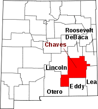 | |
| Towns | ||
| CDP | ||
| Unincorporated community | ||
| Ghost town | ||
This article is issued from Wikipedia - version of the 10/17/2014. The text is available under the Creative Commons Attribution/Share Alike but additional terms may apply for the media files.