Miani, Punjab
| Miani, Punjab | |
|---|---|
| Country |
|
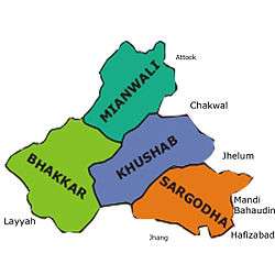
| Province | Punjab |
| District | Sargodha |
Miani is a town in Sargodha District, Bhera Tehsil Punjab province, Pakistan. It is about 70 km from Sargodha city. Centre Point Of Motorway (ISB-LHR) Bhera Interchange Towards Malakwal, Mandi Bahauldin. It is 16 km. from Bhera Motorway Interchange towards Malakwal, Mandi Bahauldin and from Malakwal,It is 10 km. towards Bhera Motorway Interchange. and It is situated on the bank of Jhelum river just few Kilometers from salt range mountains the biggest salt mine at Asia is located in Khewra on the salt mountains, right across and north from Miani and Pind Dadan Khan.
History
The Imperial Gazetteer of India, Vol IX, by W W Hunter, Trubner & Co., London, 1885 contains following details about Miani:
"Miani {Meeanee).— municipality, and centre of salt trade in Bhera tahsil, Shahpur District, Punjab. Lat. 32° 31' 48" n., long. 73° 7' 30" E. Situated on the left bank of the Jehlam (Jhelum) river, opposite Pind Dadan Khan. From time immemorial Miani has been an important mart for salt from mines on the other side of the river. The original town called Shamsabad, having been swept away by a flood, Asaf Khan, father-in-law of Shah Jahan, founded the present one. Plundered by Nur-ud-din, general of Ahmad Shah in 1754; restored in 1787 by Maha Singh, father of Ranjit Singh, who re-opened the salt mart. The town consists of an ill-built collection of narrow lanes and bazars, the upper storeys of the houses almost touching one another. Population (1868) 6857; (1881) 8069, namely, Hindus, 4059; Muhammadans, 3822; Sikhs, 184; Jains, 2; and 'others;' 2. Number of houses, 1270. The town carries on an enormous trade in salt from the Mayo mines, which has been greatly increased of late years owing to the extension of the Northern Punjab State Railway to Miani. Ghi is collected from neighbouring villages, and is also exported in large quantities. The imports consist of gur, refined sugar, and rice. Police station, town hall, school, sarai or rest-house. Municipal revenue in 1883-84, £525, or is. 3S per head of population within municipal limits."
A book entitled "The land of the five rivers and Sindh" BY DAVID ROSS, C.I.E., F.R.G.S.(London 1883) and reproduced by: Sani Hussain Panhwar (Copyright © www.panhwar.com) gives following account of Miani and adjoining sites of importance:
"Station is fifty-three miles from Lala Musa. The town is situated on the left bank of the Jhelum, opposite Pind Dadan Khan; it contains a population of 8,000, of whom 4,000 are Hindus and 4,000 Muhammadans. From time immemorial Miani has been an important mart for the salt from the mines on the opposite side of the river. The original town, called Shamshahabad, was swept away by the river, and a town on the present site was built under the auspices of Asaf Khan, father-in-law of the emperor Shah Jehan, by two Hindus named Madho Das and Shiv Ram. It was plundered and destroyed by Nur-ud-din, general of Ahmad Shah, in A.D. 1574 (actually 1754), and the inhabitants dispersed among the neighbouring villages. In A.D. 1787, Maha Singh, father of Ranjit Singh, induced a number of the descendants of the old residents and others to rebuild the town. He reopened the salt mart; but it appears never to have entirely recovered Nur-ud-din’s visitation, for the descendants of the families which then abandoned the place and took refuge in the adjoining villages are still to be found in the latter.
Miani is an ill-built town of narrow lanes and bazaars, the upper storeys of the houses and shops almost touching each other. The town owes its existence to the salt trade. This, however, is in itself enormous, for almost all the salt of the Mayo mines destined for downcountry markets as far as Delhi passes through its bazaars. Its public buildings are a police station, a town-hall, and a rest-house.
Opposite Miani, on the right bank of the river Jhelum, is Pind Dadan Khan, the headquarters of the Salt Department. It is a large and flourishing town of 16,800 inhabitants, nearly two-thirds of whom are Muhammadans. The range of mountains furnishing salt, although comparatively destitute of vegetation, has a most picturesque appearance. It rises boldly to the north of the river in vertical precipices of 500 to 600 feet in height. The sky-line here and there is cut by numerous gorges or gullies where the hill torrents have worn their way, displaying various strata of dull red sandstone, white limestone, and gray gypsum, which contrast beautifully with bright red and pink soil—the well-known indication of salt. In the valley there are a number of streams, but so impregnated with salt that the water proves more injurious than beneficial to the crops. This range is about 3,500 feet high, and is made up of three spurs; one of which runs for twenty-five miles parallel with the Jhelum. In the third spur is the mountain of Sakeswar, which rises 4,994 feet above sea-level. Between these hills is an elevated and fertile plain, and in its midst the beautiful lake of Kala Kahar. The salt, in the shape of solid rock, lies in great beds on the slopes of the table-land; and these deposits are the largest in the world. The workings are called the Mayo mines, near Pind Dadan Khan. Besides rock salt, coal, though of. an inferior kind, is found here, some of which has been used in the Indus steamers. The Pind Dadan Khan district was apparently at one time densely populated. Ruins of cities, forts, and temples abound, and there still remain the immense walls and stones of the great city of Gurjak, the stronghold of the Darapur Janjuahs. The ancient temple and fort of Baghamwala, belonging to the same race, the beautiful gardens of Sulvie and Choya, and the ancient forts of Kusak and Dulur, crown precipitous rocks. It was in the Kusak fort that Ranjit Singh besieged for six months the last sultan of the Janjuahs, who only then surrendered for want of water. The steep cliffs of Karangal are also covered with bastions and lines of defence. From A.D. 625 to A.D. 939 the salt range formed a portion of the Kashmir kingdom. Sixteen miles from Pind Dadan Khan, on the north side of the mountains, is the sacred fountain of Katas, esteemed next in sanctity to Kuru-Kshetra at Thaneswar or Jawalamukhi at Kangra, and referred to in the Mahabharat as the “Eye of the World.” Here Shiv became so inconsolable for the loss of his wife Sati, the daughter of Daksha, that the flood of tears from his eyes was enough to form the two sacred pools of Pushkara near Ajmir and Katas, or Kataksha, in the Sind Sagar Doab. The surrounding country is covered with ruins belonging to the Buddhist, Kar- kota, and Varmma periods, that is, dating from B.C. 6 to A.D. 939. Katas stands at an elevation of 2,000 feet. An enormous number of devotees frequent the place annually, a pilgrimage thereto being considered equal in virtue to Hardwar or Benares. In the valley beneath are the Sat Ghara, or Seven Temples; but according to General Cunningham there are really twelve. The architecture is the same as in Kashmir, beautiful fluted pillars, trefoil arches, dentils, and pointed roofs. The origin of this singular group of temples is ascribed to the Pandava brethren. Katas is supposed to have been the capital of the Sinhapur kingdom, visited by the Chinese Buddhist pilgrim, Hwen Thsang, in the seventh century. About a mile distant is held the great Musalman mela at the shrine of Saidana Shah. The number of persons present has been frequently estimated at 100,000. At Malot, twelve miles south-east of Katas, there are some fine old temples, with most chaste Ionic or Graeco-Indian fluted columns, at least 2,000 years old, situated on the edge of a stupendous precipice, and commanding a most extensive view of the Chenab, Jhelum, and Ravi valleys. Near Malot is the ancestral fort of the chief of all the Janjuahs. An adjoining eminence is crowned by a fort built by Maha Singh, the father of Maharaja Ranjit Singh. A notable place in the salt range is Jogi Tillah, not only in consequence of its ancient sanctity and of its being resorted to by religious Hindu devotees from all parts of India, but also because of its geological formation. The elevation, and consequent coolness of the climate, have made it a kind of summer resort and sanitarium for the Civil officers of Jhelum and the neighbourhood. Jogi Tillah, as well as many other localities in the salt range, contains antiquities, rock indentations, architectural remains, and relics of past ages of incalculable value and historical interest. The salt range of hills throughout is rich in geological structure and mineral wealth unexplored and undeveloped. Coal has been found, antimony has been picked up on the surface; and although the explorations heretofore conducted have not yielded profitable results, the fact by no means proves that the search has been complete and exhaustive, or that the hills do not contain mineral wealth of inestimable value. On the contrary, there is much greater reason to believe the popular native conviction that such does exist, and will come to light unexpectedly and unsought for some day. A brief allusion to the salt mines may be interesting. Formerly the property of the great Janjuah sultans, they were, on the decline of that family, seized by the Sikhs, who allowed the chiefs a royalty. In a short time, however, this grant was stopped. On the fall of the Sikhs the mines came into British possession. About 50,000 tons of salt are quarried annually, valued at £430,000. The salt is quarried from the thick stratum of red or pink earth, which is hollowed out, forming large arches or recesses of forty feet span. Blasting now is freely resorted to, and this has considerably reduced the cost of production."
Miani had a substantial population of Hindus and Sikhs, especially Khatri Kukhrans, before the partition of India. The Khatris had to leave their ancestral homes and move to India after partition. Sargodha itself was the homeland of Khatris and had a large concentration of the ancient Khatri clans. Khatris are found among both Hindu/Sikh as well as Muslim Punjabis. Some Khatris were converted to Islam after the introduction of Islam into the Punjab. Miani continues to have a population of Muslim Khatris.
Pre-partition, there were also many Hindu Brahmin families living in Miani. There were Gosain Brahmins of six clans, some of which are Balak-nathiye, Dabre, Bhature. The details are available with Purohits at Haridwar, India, a most holy place for Hindus on the banks of holy river Ganges. They were living, before partition, in and around Jhikki Gali of Miani, which was near a 'Roni Khui' or a well. These Gosain families would marry their children into Bagge, Kapooriye Saraswat Brahmins of the region. Other Brahmin families of Miani were Mohyal Brahmins, mainly Dutt. A very large house belonging to a Dutt family still stands tall in Miani with the name 'Krishen Niwas' inscribed in Hindi on the elaborately carved, large wooden doors (for which Miani & Bhera were famous). This door has also engravings of Lord Krishna, lotus etc.The family which earn name name of Miani by their Education are called the Qanugo Sheikhs, the Sheikh are land lords Zamindars,and veru active in politics,sheikh abdul gafoor .sheikh ramzan .sheikh sajjad header gandhi,shahzad saleem sheikh,was head of municipal commatiy of miani city, The famous place of Miani is Mohallah Sheikhanwallan.
The family which established business in the area belonged to SUMLANWALA. They are called AMEERKE. Their forefather delt in Leather, Salt, Raw Sugar and other Raw materials.
Miawas nicknamed Namak-Miani or Lun-Miani (Salt Miani) because it was the main marketplace for salt that was mined from the mountains around Khewra. It had quite a historic significance (more than now) and there are two doors of 18th century to the village on display in Lahore Fort in Lahore.