McCoole, Maryland
| McCoole, Maryland | |
|---|---|
| Census-designated place | |
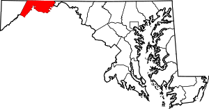
 McCoole  McCoole Location within the state of Maryland | |
| Coordinates: 39°26′47″N 78°58′20″W / 39.44639°N 78.97222°WCoordinates: 39°26′47″N 78°58′20″W / 39.44639°N 78.97222°W | |
| Country | United States |
| State | Maryland |
| County | Allegany |
| Area | |
| • Total | 1.4 sq mi (3.6 km2) |
| • Land | 1.4 sq mi (3.6 km2) |
| • Water | 0 sq mi (0 km2) |
| Elevation | 830 ft (250 m) |
| Population (2010) | |
| • Total | 511 |
| • Density | 364/sq mi (140.5/km2) |
| Time zone | Eastern (EST) (UTC-5) |
| • Summer (DST) | EDT (UTC-4) |
| ZIP codes | 21562 |
| FIPS code | 24-49325 |
| GNIS feature ID | 2583651 |
McCoole is an unincorporated community and census-designated place (CDP) in Allegany County, Maryland, United States. As of the 2010 census it had a population of 511.[1]
McCoole is located at the intersection of U.S. Route 220 and the east end of Maryland Route 135. It lies directly across the North Branch Potomac River from Keyser, West Virginia. McCoole had its own post office in operation from 1903 to 1910.
References
- ↑ "Geographic Identifiers: 2010 Demographic Profile Data (G001): McCoole CDP, Maryland". U.S. Census Bureau, American Factfinder. Retrieved May 28, 2013.
This article is issued from Wikipedia - version of the 10/29/2016. The text is available under the Creative Commons Attribution/Share Alike but additional terms may apply for the media files.