McCleary, Washington
| McCleary, Washington | |
|---|---|
| City | |
|
Location of McCleary, Washington | |
| Coordinates: 47°3′19″N 123°16′8″W / 47.05528°N 123.26889°WCoordinates: 47°3′19″N 123°16′8″W / 47.05528°N 123.26889°W | |
| Country | United States |
| State | Washington |
| County | Grays Harbor |
| Area[1] | |
| • Total | 2.07 sq mi (5.36 km2) |
| • Land | 2.05 sq mi (5.31 km2) |
| • Water | 0.02 sq mi (0.05 km2) |
| Elevation | 276 ft (84 m) |
| Population (2010)[2] | |
| • Total | 1,653 |
| • Estimate (2015)[3] | 1,618 |
| • Density | 806.3/sq mi (311.3/km2) |
| Time zone | Pacific (PST) (UTC-8) |
| • Summer (DST) | PDT (UTC-7) |
| ZIP code | 98557 |
| Area code(s) | 360 |
| FIPS code | 53-41225 |
| GNIS feature ID | 1506537[4] |
| Website | www.cityofmccleary.com |
McCleary (/mᵊkˈklæriː/) is a city in Grays Harbor County, Washington, United States. The population was 1,653 at the 2010 census.
History
Henry McCleary came to the land in 1897, building two sawmills and a door manufacturing company. He sold the land and the companies to Simpson Logging Company, December 31, 1941. On January 9, 1943 the land became an incorporated city named after its founder.[5] Henry McCleary's house is still standing today in Olympia, Washington.
In 1959, McCleary started its famous Bear Festival. It was an idea that bears that were in surplus came and ate the bark from the evergreen trees and killing the trees after hibernation. People from all over have come to taste its bear stew. Although the bear stew is the big attraction to the festival, there is also a kiddies parade, grand parade, royal court ceremony, bands, dances, slow-pitch baseball, and many other events in all three days.[6]
Geography
McCleary is located at 47°3′19″N 123°16′8″W / 47.05528°N 123.26889°W (47.055359, -123.268859).[7]
According to the United States Census Bureau, the city has a total area of 2.07 square miles (5.36 km2), of which, 2.05 square miles (5.31 km2) is land and 0.02 square miles (0.05 km2) is water.[1]
Demographics
| Historical population | |||
|---|---|---|---|
| Census | Pop. | %± | |
| 1950 | 1,175 | — | |
| 1960 | 1,115 | −5.1% | |
| 1970 | 1,265 | 13.5% | |
| 1980 | 1,419 | 12.2% | |
| 1990 | 1,235 | −13.0% | |
| 2000 | 1,454 | 17.7% | |
| 2010 | 1,653 | 13.7% | |
| Est. 2015 | 1,618 | [8] | −2.1% |
| U.S. Decennial Census[9] 2015 Estimate[3] | |||
2010 census
As of the census[2] of 2010, there were 1,653 people, 699 households, and 427 families residing in the city. The population density was 806.3 inhabitants per square mile (311.3/km2). There were 759 housing units at an average density of 370.2 per square mile (142.9/km2). The racial makeup of the city was 93.5% White, 0.8% African American, 1.0% Native American, 0.7% Asian, 0.1% Pacific Islander, 0.4% from other races, and 3.4% from two or more races. Hispanic or Latino of any race were 2.4% of the population.
There were 699 households of which 29.6% had children under the age of 18 living with them, 43.5% were married couples living together, 13.2% had a female householder with no husband present, 4.4% had a male householder with no wife present, and 38.9% were non-families. 31.9% of all households were made up of individuals and 19.1% had someone living alone who was 65 years of age or older. The average household size was 2.36 and the average family size was 2.95.
The median age in the city was 37.4 years. 24.6% of residents were under the age of 18; 7.7% were between the ages of 18 and 24; 28.8% were from 25 to 44; 21.7% were from 45 to 64; and 17.1% were 65 years of age or older. The gender makeup of the city was 47.7% male and 52.3% female.
2000 census
As of the census of 2000, there were 1,454 people, 555 households, and 376 families residing in the city. The population density was 800.2 people per square mile (308.5/km²). There were 583 housing units at an average density of 320.9 per square mile (123.7/km²). The racial makeup of the city was 94.36% White, 0.21% African American, 0.89% Native American, 0.28% Asian, 0.76% from other races, and 3.51% from two or more races. Hispanic or Latino of any race were 2.20% of the population.
There were 555 households out of which 32.1% had children under the age of 18 living with them, 50.3% were married couples living together, 13.7% had a female householder with no husband present, and 32.1% were non-families. 27.2% of all households were made up of individuals and 13.2% had someone living alone who was 65 years of age or older. The average household size was 2.48 and the average family size was 3.00.
In the city the population was spread out with 25.0% under the age of 18, 7.7% from 18 to 24, 27.0% from 25 to 44, 21.5% from 45 to 64, and 18.8% who were 65 years of age or older. The median age was 38 years. For every 100 females there were 91.1 males. For every 100 females age 18 and over, there were 87.0 males.
The median income for a household in the city was $30,769, and the median income for a family was $36,534. Males had a median income of $33,421 versus $25,417 for females. The per capita income for the city was $14,249. About 12.2% of families and 17.8% of the population were below the poverty line, including 22.9% of those under age 18 and 24.5% of those age 65 or over.
School District
In 1901, there was a one-room class serving 60 students. In 1909, the district was official and a school was built on the current location. McCleary has since then had four remodels. It currently serves 50 preschoolers and 270 K-8th graders. In 1988, McCleary school district began a scholarship program for its students. When a student who completed their 8th grade class in McCleary Elementary School graduates high school, they are awarded a scholarship equal to the sum of $55 per year that they attended McCleary, including kindergarten. This scholarship may be used for college or any type of skilled training or trade school. Most high school students travel to Elma or Capital High School.
Notable people
- Angelo Pellegrini, author
- Clarence Chesterfield Howerton, circus performer
City government
The City of McCleary is governed by a mayor, as well as five councilmembers representing 5 different districts. The McCleary City Council currently meets on the 2nd and 4th Wednesdays of each month at the McCleary City Hall, beginning at 6:30 pm.
Mayor: Brent Schiller Councilmember, pos 1 & Mayor Pro Tem: Brenda Orffer Councilmember, pos 2: Dustin Richey Councilmember, pos 3: Larry Peterson Councilmember, pos 4: Ben Blankenship Councilmember, pos 5: Pam Ator
References
- 1 2 "US Gazetteer files 2010". United States Census Bureau. Archived from the original on January 24, 2012. Retrieved 2012-12-19.
- 1 2 "American FactFinder". United States Census Bureau. Retrieved 2012-12-19.
- 1 2 "Population Estimates". United States Census Bureau. Retrieved July 12, 2016.
- ↑ "McCleary". Geographic Names Information System. United States Geological Survey.
- ↑ McClary, Daryl C. (2006-12-31). "HistoryLink: McCleary -- Thumbnail History". HistoryLink.org.
- ↑ http://www.mcclearybearfestival.org/
- ↑ "US Gazetteer files: 2010, 2000, and 1990". United States Census Bureau. 2011-02-12. Retrieved 2011-04-23.
- ↑ "Annual Estimates of the Resident Population for Incorporated Places: April 1, 2010 to July 1, 2015". Retrieved July 2, 2016.
- ↑ "U.S. Decennial Census". Census.gov. Archived from the original on May 11, 2015. Retrieved June 6, 2013.
Municipalities and communities of Grays Harbor County, Washington, United States | ||
|---|---|---|
| Cities | 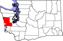 | |
| CDPs | ||
| Other unincorporated communities | ||
| Indian reservations | ||
| Footnotes | ‡This populated place also has portions in an adjacent county or counties | |