Maynard, Minnesota
| Maynard, Minnesota | |
|---|---|
| City | |
 Location of Maynard, Minnesota | |
| Coordinates: 44°54′23″N 95°28′7″W / 44.90639°N 95.46861°W | |
| Country | United States |
| State | Minnesota |
| County | Chippewa |
| Area[1] | |
| • Total | 0.65 sq mi (1.68 km2) |
| • Land | 0.65 sq mi (1.68 km2) |
| • Water | 0 sq mi (0 km2) |
| Elevation | 1,030 ft (314 m) |
| Population (2010)[2] | |
| • Total | 366 |
| • Estimate (2012[3]) | 354 |
| • Density | 563.1/sq mi (217.4/km2) |
| Time zone | Central (CST) (UTC-6) |
| • Summer (DST) | CDT (UTC-5) |
| ZIP code | 56260 |
| Area code(s) | 320 |
| FIPS code | 27-41210[4] |
| GNIS feature ID | 0647635[5] |
Maynard is a city in Chippewa County, Minnesota, United States. The population was 366 at the 2010 census.[6]
History
Maynard was platted in 1887.[7] It was named for the brother-in-law of a railroad official.[7] A post office has been in operation in Maynard since 1889.[8]
Geography
According to the United States Census Bureau, the city has a total area of 0.65 square miles (1.68 km2), all of it land.[1]
Minnesota State Highway 23 serves as a main route in the community.
Demographics
| Historical population | |||
|---|---|---|---|
| Census | Pop. | %± | |
| 1900 | 245 | — | |
| 1910 | 386 | 57.6% | |
| 1920 | 536 | 38.9% | |
| 1930 | 504 | −6.0% | |
| 1940 | 580 | 15.1% | |
| 1950 | 507 | −12.6% | |
| 1960 | 429 | −15.4% | |
| 1970 | 455 | 6.1% | |
| 1980 | 428 | −5.9% | |
| 1990 | 419 | −2.1% | |
| 2000 | 388 | −7.4% | |
| 2010 | 366 | −5.7% | |
| Est. 2015 | 351 | [9] | −4.1% |
2010 census
As of the census[2] of 2010, there were 366 people, 158 households, and 99 families residing in the city. The population density was 563.1 inhabitants per square mile (217.4/km2). There were 175 housing units at an average density of 269.2 per square mile (103.9/km2). The racial makeup of the city was 92.6% White, 1.1% African American, 0.3% Native American, 1.1% Asian, and 4.9% from other races. Hispanic or Latino of any race were 5.5% of the population.
There were 158 households of which 27.2% had children under the age of 18 living with them, 51.9% were married couples living together, 6.3% had a female householder with no husband present, 4.4% had a male householder with no wife present, and 37.3% were non-families. 32.9% of all households were made up of individuals and 19% had someone living alone who was 65 years of age or older. The average household size was 2.32 and the average family size was 2.95.
The median age in the city was 43.3 years. 23.5% of residents were under the age of 18; 8.2% were between the ages of 18 and 24; 20.5% were from 25 to 44; 31.8% were from 45 to 64; and 16.1% were 65 years of age or older. The gender makeup of the city was 47.5% male and 52.5% female.
2000 census
As of the census[4] of 2000, there were 388 people, 163 households, and 110 families residing in the city. The population density was 597.6 people per square mile (230.5/km²). There were 181 housing units at an average density of 278.8 per square mile (107.5/km²). The racial makeup of the city was 97.68% White, 0.52% Asian, 1.80% from other races. Hispanic or Latino of any race were 1.80% of the population.
There were 163 households out of which 32.5% had children under the age of 18 living with them, 58.3% were married couples living together, 6.7% had a female householder with no husband present, and 32.5% were non-families. 30.1% of all households were made up of individuals and 14.1% had someone living alone who was 65 years of age or older. The average household size was 2.38 and the average family size was 2.98.
In the city the population was spread out with 26.3% under the age of 18, 6.7% from 18 to 24, 25.8% from 25 to 44, 22.9% from 45 to 64, and 18.3% who were 65 years of age or older. The median age was 40 years. For every 100 females there were 95.0 males. For every 100 females age 18 and over, there were 97.2 males.
The median income for a household in the city was $28,571, and the median income for a family was $39,583. Males had a median income of $26,250 versus $21,071 for females. The per capita income for the city was $14,285. About 6.4% of families and 7.8% of the population were below the poverty line, including 2.3% of those under age 18 and 8.2% of those age 65 or over.
References
- 1 2 "US Gazetteer files 2010". United States Census Bureau. Archived from the original on January 24, 2012. Retrieved 2012-11-13.
- 1 2 "American FactFinder". United States Census Bureau. Retrieved 2012-11-13.
- ↑ "Population Estimates". United States Census Bureau. Archived from the original on June 17, 2013. Retrieved 2013-05-28.
- 1 2 "American FactFinder". United States Census Bureau. Archived from the original on September 11, 2013. Retrieved 2008-01-31.
- ↑ "US Board on Geographic Names". United States Geological Survey. 2007-10-25. Retrieved 2008-01-31.
- ↑ "2010 Census Redistricting Data (Public Law 94-171) Summary File". American FactFinder. United States Census Bureau. Archived from the original on July 21, 2011. Retrieved 27 April 2011.
- 1 2 Upham, Warren (1920). Minnesota Geographic Names: Their Origin and Historic Significance. Minnesota Historical Society. p. 104.
- ↑ "Chippewa County". Jim Forte Postal History. Retrieved 19 April 2015.
- ↑ "Annual Estimates of the Resident Population for Incorporated Places: April 1, 2010 to July 1, 2015". Retrieved July 2, 2016.
- ↑ "Census of Population and Housing". Census.gov. Archived from the original on May 11, 2015. Retrieved June 4, 2015.
Municipalities and communities of Chippewa County, Minnesota, United States | ||
|---|---|---|
| Cities | 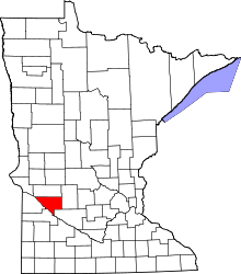 | |
| Townships | ||
| Unincorporated communities | ||
| Footnotes | ‡This populated place also has portions in an adjacent county or counties | |
Coordinates: 44°54′25″N 95°28′08″W / 44.90694°N 95.46889°W