Matchi-Manitou, Quebec
| Matchi-Manitou | |
|---|---|
| Unorganized territory | |
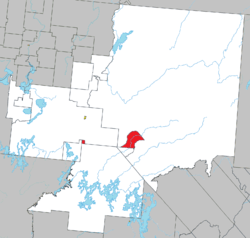 Location within La Vallée-de-l'Or RCM | |
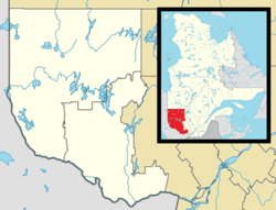 Matchi-Manitou Location in western Quebec | |
| Coordinates: 48°01′N 77°03′W / 48.017°N 77.050°WCoordinates: 48°01′N 77°03′W / 48.017°N 77.050°W[1] | |
| Country |
|
| Province |
|
| Region | Abitibi-Témiscamingue |
| RCM | La Vallée-de-l'Or |
| Constituted | January 1, 1986 |
| Government[2] | |
| • Federal riding |
Abitibi—Baie-James— Nunavik—Eeyou |
| • Prov. riding | Abitibi-Est |
| Area[3][2] | |
| • Total | 163.50 km2 (63.13 sq mi) |
| • Land | 164.62 km2 (63.56 sq mi) |
|
There is an apparent contradiction between two authoritative sources | |
| Population (2011)[3] | |
| • Total | 0 |
| • Density | 0.0/km2 (0/sq mi) |
| • Pop 2006-2011 |
|
| • Dwellings | 0 |
| Time zone | EST (UTC−5) |
| • Summer (DST) | EDT (UTC−4) |
| Highways | No major routes |
Matchi-Manitou is an unorganized territory in the Abitibi-Témiscamingue region of Quebec, Canada. It is one of five unorganized territories in La Vallée-de-l'Or Regional County Municipality.
Until July 6, 1996, Matchi-Manitou was a vast unorganized territory encompassing 16,760 square kilometres (6,470 sq mi). On that day, most of it was added to the City of Senneterre and a smaller portion to the City of Val-d'Or. It retained only two small non-contiguous areas, of which its eastern part is a section of land straddling both banks of the Chochocouane River and mostly part of the La Vérendrye Wildlife Reserve.
It is named after Matchi-Manitou Lake (48°01′N 77°03′W / 48.017°N 77.050°W), which used to be within its limits, but since 1996 is part of Senneterre and Val-d'Or.
Demographics
Population:[4]
- Population in 2011: 0
- Population in 2006: 0
- Population in 2001: 0
- Population in 1996: 241 (prior to reorganization)
- Population in 1991: 240
References
- ↑ Reference number 149855 of the Commission de toponymie du Québec (French)
- 1 2 Total area: Ministère des Affaires municipales, des Régions et de l'Occupation du territoire
Land area: Statistics Canada - 1 2 "(Code 2489902) Census Profile". 2011 census. Statistics Canada. 2012.
- ↑ Statistics Canada: 1996, 2001, 2006, 2011 census
 |
Val-d'Or | | ||
| Lac-Granet | |
Val-d'Or | ||
| ||||
| | ||||
| Réservoir-Dozois |
| |
Senneterre (city) | | ||
| Senneterre (city) | |
Senneterre (city) | ||
| ||||
| | ||||
| Lac-Metei |
| Cities | |
|---|---|
| Municipalities | |
| Parishes | |
| Unorganized territories | |
| |