Mastodon Township, Michigan
| Mastodon Township, Michigan | |
|---|---|
| Township | |
 Mastodon Township, Michigan Location within the state of Michigan | |
| Coordinates: 46°2′2″N 88°19′4″W / 46.03389°N 88.31778°WCoordinates: 46°2′2″N 88°19′4″W / 46.03389°N 88.31778°W | |
| Country | United States |
| State | Michigan |
| County | Iron |
| Area | |
| • Total | 135.3 sq mi (350.5 km2) |
| • Land | 126.6 sq mi (327.9 km2) |
| • Water | 8.7 sq mi (22.7 km2) |
| Elevation | 1,365 ft (416 m) |
| Population (2000) | |
| • Total | 668 |
| • Density | 5.3/sq mi (2.0/km2) |
| Time zone | Central (CST) (UTC-6) |
| • Summer (DST) | CDT (UTC-5) |
| FIPS code | 26-52300[1] |
| GNIS feature ID | 1626708[2] |
Mastodon Township is a civil township of Iron County in the U.S. state of Michigan. As of the 2000 census, the township population was 668.
Mastodon was so named from the fact mastodon bones were discovered when sinking a mine shaft.[3]
Communities
- The village of Alpha is within the township.
Geography
The Brule River forms the southern boundary of the township, with the Town of Florence in Florence County, Wisconsin on the other side of the river.
According to the United States Census Bureau, the township has a total area of 135.3 square miles (350 km2), of which 126.6 square miles (328 km2) is land and 8.8 square miles (23 km2) (6.47%) is water.
Demographics
As of the census[1] of 2000, there were 668 people, 314 households, and 205 families residing in the township. The population density was 5.3 per square mile (2.0/km²). There were 689 housing units at an average density of 5.4 per square mile (2.1/km²). The racial makeup of the township was 99.40% White, 0.30% from other races, and 0.30% from two or more races. Hispanic or Latino of any race were 0.60% of the population. 21.3% were of Polish, 20.8% German, 14.7% Finnish, 6.9% Swedish, 5.9% English, 5.9% Italian and 5.1% Irish ancestry according to Census 2000.
There were 314 households out of which 18.5% had children under the age of 18 living with them, 56.7% were married couples living together, 3.5% had a female householder with no husband present, and 34.7% were non-families. 30.9% of all households were made up of individuals and 17.5% had someone living alone who was 65 years of age or older. The average household size was 2.13 and the average family size was 2.60.
In the township the population was spread out with 17.4% under the age of 18, 4.9% from 18 to 24, 19.8% from 25 to 44, 31.9% from 45 to 64, and 26.0% who were 65 years of age or older. The median age was 50 years. For every 100 females there were 108.8 males. For every 100 females age 18 and over, there were 106.7 males.
The median income for a household in the township was $27,917, and the median income for a family was $39,231. Males had a median income of $26,667 versus $23,125 for females. The per capita income for the township was $16,823. About 6.3% of families and 13.2% of the population were below the poverty line, including 22.5% of those under age 18 and 6.3% of those age 65 or over.
References
- 1 2 "American FactFinder". United States Census Bureau. Retrieved 2008-01-31.
- ↑ U.S. Geological Survey Geographic Names Information System: Mastodon Township, Michigan
- ↑ Chicago and North Western Railway Company (1908). A History of the Origin of the Place Names Connected with the Chicago & North Western and Chicago, St. Paul, Minneapolis & Omaha Railways. p. 100.
Municipalities and communities of Iron County, Michigan, United States | ||
|---|---|---|
| Cities | 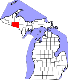 | |
| Village | ||
| Townships | ||
| CDP | ||
| Unincorporated communities | ||