Mantachie, Mississippi
| Mantachie, Mississippi | |
|---|---|
| Town | |
|
Corporate limits on SR 371 | |
 Location of Mantachie, Mississippi | |
 Mantachie, Mississippi Location in the United States | |
| Coordinates: 34°19′51″N 88°29′36″W / 34.33083°N 88.49333°WCoordinates: 34°19′51″N 88°29′36″W / 34.33083°N 88.49333°W | |
| Country | United States |
| State | Mississippi |
| County | Itawamba |
| Area | |
| • Total | 4.0 sq mi (10.2 km2) |
| • Land | 3.9 sq mi (10.2 km2) |
| • Water | 0.0 sq mi (0.0 km2) |
| Elevation | 344 ft (105 m) |
| Population (United States Census, 2010) | |
| • Total | 1,144 |
| • Density | 280/sq mi (108.2/km2) |
| Time zone | Central (CST) (UTC-6) |
| • Summer (DST) | CDT (UTC-5) |
| ZIP code | 38855 |
| Area code(s) | 662 |
| FIPS code | 28-44920 |
| GNIS feature ID | 0673115 |

Mantachie is a town in Itawamba County, Mississippi. The population was 1,144 in the 2010 census. It is located fourteen miles northeast of Tupelo at the intersection of Mississippi Highways 363 and 371 and six miles north of Interstate 22.
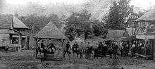
The Town of Mantachie began as a crossroads store, which was owned and operated by Woods Pearce. Near Mantachie on the old Jacinto Road was the largest Chickasaw village in this section of the state. Mantachie was named for one of the Chickasaw chiefs, Man-ta-chee, who was killed in a fight with another Chickasaw. Most of the Chickasaws left the village after the Treaty of Pontotoc Creek was signed in 1832.
Geography
Mantachie is located at 34°19′51″N 88°29′36″W / 34.330819°N 88.493453°W.[1]
According to the United States Census Bureau, the town has a total area of 4.0 square miles (10 km2), all land.
Demographics
| Historical population | |||
|---|---|---|---|
| Census | Pop. | %± | |
| 1910 | 161 | — | |
| 1920 | 195 | 21.1% | |
| 1930 | 188 | −3.6% | |
| 1940 | 238 | 26.6% | |
| 1950 | 178 | −25.2% | |
| 1960 | 246 | 38.2% | |
| 1970 | 534 | 117.1% | |
| 1980 | 732 | 37.1% | |
| 1990 | 651 | −11.1% | |
| 2000 | 1,107 | 70.0% | |
| 2010 | 1,144 | 3.3% | |
| Est. 2015 | 1,138 | [2] | −0.5% |
As of the census[4] of 2010, there were 1,144 people, 511 households, and 319 families residing in the town. The population density was 290 inhabitants per square mile (110/km2). There were 564 housing units at an average density of 120 per square mile (46/km2). The racial makeup of the town was 96.6% White, 2.2% African American, 0.2% Native American, 0.2% Asian, 0.0 from other races, and 0.06% from two or more races. Hispanic or Latino of any race were 0.4% of the population.
There were 321 households out of which 27.2% had children under the age of 18 living with them, 45.4% were married couples living together, 13.1% had a female householder with no husband present, and 37.2% were non-families. 25.9% of all households were made up of individuals which were 31.1% under 18 and 12.7% 65 years of age or older. The average household size was 2.85 and the average family size was 2.98.
In the town the population was spread out with 24.5% under the age of 18, 23.9% from 18 to 24, 28.5% from 25 to 44, 26.6% from 45 to 64, and 18.6% who were 65 years of age or older. The median age was 40.8 years. Male Population: 536 (46.9%) Female Population: 608 (53.1 %)
The median income for a household in the town was $41,994,and the median income for a family was $50,046. about 11.6% of families and 9.2% of the population were below the poverty line
Education
The town of Mantachie is served by the Itawamba County School District. Mantachie Elementary School serves grades K-6, Mantachie Junior High serves grades 7 and 8, and Mantachie High School serves grades 9-12. The Mantachie Schools are rated as "B" schools by the Mississippi Department of Education.
The Mantachie Schools' nickname is the mustang. Its logo is similar to that of the SMU mascot. The school colors are royal blue and gold.
The Mustangs field athletic teams in football, cross country, slow pitch and fast pitch softball, basketball, baseball, track, bowling, and archery (the last which won a state championship in 2014).
Business
- Owl Bee Boutique
- Tab Boren Pottery
- BancorpSouth
- Delmars Grill
- Dollar General
- Freds
- Gifts Galore & Flowers By Dan
- Jerry Pitts Auto Parts
- Mantachie Foods
- WOCO aka "The Chicken Store"
- Los Cabos Mexican Restaurant
- Centerville Fish & Steak
- Betty's Catalog Store
- Becky's Restaurant
- Riley Tire & Auto
- Thompson Auto Garage
- Farmers & Merchants Bank
- Banana Box Discount Grocery
- Tombigbee Tool & Die
- A Cut Above Beauty Shop
- The Family Hair Shop Beauty and Barber Shop
- Walmart Neighborhood Market
- Countrywood Manor Assisted Living, Inc.
- Lakeview Place, A Licensed Alzheimer's Facility. (Located at Countrywood Manor ALF).
References
- ↑ "US Gazetteer files: 2010, 2000, and 1990". United States Census Bureau. 2011-02-12. Retrieved 2011-04-23.
- ↑ "Annual Estimates of the Resident Population for Incorporated Places: April 1, 2010 to July 1, 2015". Retrieved July 2, 2016.
- ↑ "Census of Population and Housing". Census.gov. Retrieved June 4, 2015.
- ↑ "American FactFinder". United States Census Bureau. Retrieved 2008-01-31.
Municipalities and communities of Itawamba County, Mississippi, United States | ||
|---|---|---|
| City | 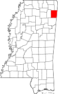 | |
| Towns | ||
| Unincorporated communities |
| |
| Ghost towns | ||