Mallory, West Virginia
| Mallory, West Virginia | |
|---|---|
| CDP | |
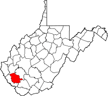
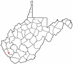 Location of Mallory, West Virginia | |
| Coordinates: 37°43′49″N 81°50′9″W / 37.73028°N 81.83583°WCoordinates: 37°43′49″N 81°50′9″W / 37.73028°N 81.83583°W | |
| Country | United States |
| State | West Virginia |
| County | Logan |
| Area[1] | |
| • Total | 13.0 sq mi (33.8 km2) |
| • Land | 13.0 sq mi (33.6 km2) |
| • Water | 0.0 sq mi (0.1 km2) |
| Elevation | 787 ft (240 m) |
| Population (2010)[2] | |
| • Total | 1,654 |
| • Density | 130/sq mi (49/km2) |
| Time zone | Eastern (EST) (UTC-5) |
| • Summer (DST) | EDT (UTC-4) |
| ZIP code | 25634 |
| Area code(s) | 304 |
| FIPS code | 54-50860[3] |
| GNIS feature ID | 1555032[4] |
Mallory is a census-designated place (CDP) in Logan County, West Virginia, United States. The population was 1,654 at the 2010 census.[2]
The community was named after the local Mallory Coal Company.[5]
Geography
Mallory is located at 37°43′49″N 81°50′9″W / 37.73028°N 81.83583°W (37.730315, -81.835857),[1] along Huff Creek and West Virginia Route 10.[6]
According to the United States Census Bureau, the CDP has a total area of 13.0 square miles (33.8 km²); 13.0 square miles (33.6 km²) of this is land, and 0.05 square miles (0.1 km²) is water.
Demographics
As of the census[3] of 2000, there were 1,143 people, 437 households, and 343 families residing in the CDP. The population density was 99.2 people per square mile (38.3/km²). There were 491 housing units at an average density of 42.6/sq mi (16.4/km²). The racial makeup of the CDP was 96.94% White, 2.27% African American, 0.09% Asian, and 0.70% from two or more races.
There were 437 households out of which 30.0% had children under the age of 18 living with them, 61.1% were married couples living together, 14.6% had a female householder with no husband present, and 21.5% were non-families. 19.0% of all households were made up of individuals and 8.9% had someone living alone who was 65 years of age or older. The average household size was 2.62 and the average family size was 2.97.
In the CDP the population was spread out with 22.6% under the age of 18, 8.6% from 18 to 24, 27.2% from 25 to 44, 27.6% from 45 to 64, and 14.0% who were 65 years of age or older. The median age was 39 years. For every 100 females there were 92.7 males. For every 100 females age 18 and over, there were 93.2 males.
The median income for a household in the CDP was $24,458, and the median income for a family was $27,813. Males had a median income of $27,625 versus $14,750 for females. The per capita income for the CDP was $11,654. About 21.8% of families and 25.9% of the population were below the poverty line, including 45.7% of those under age 18 and 4.8% of those age 65 or over.
References
- 1 2 "US Gazetteer files: 2010, 2000, and 1990". United States Census Bureau. 2011-02-12. Retrieved 2011-04-23.
- 1 2 "American FactFinder". United States Census Bureau. Retrieved 2011-05-14.
- 1 2 "American FactFinder". United States Census Bureau. Retrieved 2008-01-31.
- ↑ "US Board on Geographic Names". United States Geological Survey. 2007-10-25. Retrieved 2008-01-31.
- ↑ Kenny, Hamill (1945). West Virginia Place Names: Their Origin and Meaning, Including the Nomenclature of the Streams and Mountains. Piedmont, WV: The Place Name Press. pp. 399–400.
- ↑ West Virginia Atlas & Gazetteer. Yarmouth, Me.: DeLorme. 1997. p. 57. ISBN 0-89933-246-3.