M23 motorway
| |
|---|---|
_map.svg.png) | |
| Route information | |
| Length: | 15.9 mi (25.6 km) |
| Existed: | 1974 – present |
| History: | Constructed 1974–75 |
| Major junctions | |
| From: | Marling Glen, Surrey |
|
J8 → M25 motorway | |
| To: | Crawley, West Sussex |
| Location | |
| Primary destinations: | Croydon, Reigate, Gatwick Airport, Crawley |
| Road network | |

The M23 is a motorway in the United Kingdom. The motorway runs from south of Hooley in Surrey, where it splits from the A23, to Pease Pottage, south of Crawley in West Sussex where it rejoins the A23. The northern end of the motorway starts at junction 7 on what is effectively a 2-mile (3.2 km) spur north from junction 7 of the M25 motorway (junction 8 on the M23). From Hooley it runs for 17 miles (27 km) past Redhill, Gatwick Airport and Crawley. A spur runs from junction 9 to Gatwick Airport.
History
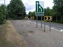
The motorway was constructed between 1972 and 1975, at the same time as the southern section of the M25 from Godstone to Reigate (M25 junctions 6 to 8).[1] The current northern terminus at junction 7 uses the original sliproads to meet the A23 and a flyover above the junction built for the onward northern continuation remains unused.[2]

The cancellation of the unbuilt northern section from the M25 in towards Central London has resulted in the A23 carrying the majority of traffic through South London to the motorway. This is largely a single carriageway route, with many level junctions, traffic lights and awkward interchanges. It travels largely through residential areas and is inadequte for the level of traffic it carries.
A new junction (J10A) was opened in 1997, between J10 and J11, for access to the new Crawley neighbourhood of Maidenbower.[3] It was financed as part of the development of Maidenbower by the construction consortium. It gives only off-access southbound and on-access northbound.
Unbuilt sections

The M23 was planned to relieve congestion on the A23 through Streatham, Thornton Heath, Purley and Coulsdon in south London and was originally intended to terminate in Streatham Vale at a junction with the controversial London Ringways Plan's Ringway 2 (the intended replacement of the South Circular Road (A205)).[4]
In an earlier version of the Ringways Plan it would have continued into central London where it would have met the Balham Loop spur from Ringway 1 (the London Motorway Box) at Tooting. This was dropped in 1967 when the northern terminus was changed to Ringway 2. While a definite route had not been chosen at that time for the northern section, approval was met for the route south of the Greater London boundary at Hooley.[5]
By 1972 the southern section of Ringway 2 had been dropped from the plan,[6] with an alternative proposal that the M23 continue further into London to end on Ringway 1. This was immediately countered in the same year by the GLC, who announced they would not be building that Ringway,[5] which meant that had the M23 continued north into inner London it would not have had the motorway required at its northern end to distribute traffic to the east and west. The M23 plan was gradually scaled back further to omit the section across Mitcham Common and end the motorway at an unsuitable location on Croydon Road (A232)[5] before the plan was postponed indefinitely. By the late 1970s, the area along the proposed line of the motorway had become affected by blight,[7] and while the proposals were finally dropped in the mid-1980s, much of the land reserved for the route was not released by the Department for Transport until the mid-1990s.
The missing section of motorway and the missing six junctions north of Hooley were not constructed due to the refusal of the GLC to finance the project, having encountered large scale opposition to the construction of Ringways elsewhere in London.[5] However, the scale of the four-tier junction between the M23 and the M25, one of only three stack interchanges in the UK, is indicative of the importance attached to the M23 at that time.
Junctions
Data from driver location signs are used to provide distance and carriageway identifier information.[8] Where a junction spans several hundred metres and start and end points are available, both are cited.
| M23 motorway junctions | |||||
| miles | km | Northbound exits (B carriageway) | Junction | Southbound exits (A carriageway) | |
|---|---|---|---|---|---|
| 17.0 | 27.4 | Road continues as A23 to Croydon Croydon A23 |
J7 | Crawley, Gatwick A23 Non-motorway traffic Start of motorway | |
| 17.5 | 28.2 | ||||
| 19.0 | 30.5 | Reigate, Heathrow Airport, Oxford, Sevenoaks, Maidstone, Stansted Airport, (M3, M4, M40, M1, M20, M11), M25 |
J8 | Heathrow Airport (M4), Stansted Airport (M11) Maidstone (M20) (M3, M40, M26) M25 | |
| 19.3 | 31.0 | ||||
| 26.5 | 42.7 | Gatwick Airport, Redhill A23 | J9 | Gatwick Airport, Redhill A23 | |
| 26.8 | 43.1 | ||||
| 28.5 | 45.8 | Crawley A2011 East Grinstead A264 |
J10 | Crawley A2011 East Grinstead A264 | |
| 28.6 | 46.1 | ||||
| 30.3 | 48.8 | No exit | J10a | Crawley B2036 | |
| 30.6 | 49.2 | ||||
| 33.1 | 53.3 | Start of motorway Crawley A23 Non-motorway traffic Pease Pottage services |
J11 Services |
Brighton, Crawley A23 Horsham A264 Pease Pottage services Road continues as A23 to Brighton | |
| 33.4 | 53.8 | ||||
Notes
| |||||
| 1.000 mi = 1.609 km; 1.000 km = 0.621 mi | |||||
See also
References
- ↑ "Construction Contracts". 8 July 1975. Retrieved 18 December 2012.
- ↑ "1:50 000 Landranger map". Ordnance Survey. Retrieved 18 December 2012.
- ↑ "M23, Crawley". 23 February 1987. Retrieved 18 December 2012.
- ↑ Fred Mulley (9 December 1969). "M23 Northern terminals Inquiry". Retrieved 18 December 2012.
- 1 2 3 4 William Shelton (12 November 1974). "M23 (London)". Retrieved 18 December 2012.
- ↑ Geoffrey Ripon (19 February 1973). "Greater London Development Plan". Retrieved 18 December 2012.
- ↑ William Shelton (26 July 1978). "Motorway (London)". Retrieved 18 December 2012.
- ↑ Traffic England Live Traffic Condition Map Highways Agency – Locations extracted from Traffic Camera Popup identifier text
External links
| Great Britain | .svg.png) | |||||||
|---|---|---|---|---|---|---|---|---|
| Northern Ireland | ||||||||
| Former | ||||||||
| Unbuilt | ||||||||
| Proposed | ||||||||
| Related articles | ||||||||
| ||||||||