A3 road
| |
|---|---|
 | |
| Major junctions | |
| North-east end: |
City of London 51°30′39″N 0°05′12″W / 51.5108°N 0.0866°W |
|
[[Image:Motorway Left.svg|[ |x30px|link=]] [[Image:Motorway Left.svg|[ |x22px|link=]] [[Image:Motorway Left.svg|[ |x30px|link=]] [[Image:Motorway Left.svg|[ |x30px|link=]] | |
| South-west end: |
Portsmouth Harbour 50°47′30″N 1°06′31″W / 50.7918°N 1.1086°W |
| Location | |
| Primary destinations: |
Kingston upon Thames Guildford Petersfield |
| Road network | |
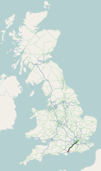
The A3, known as the Portsmouth Road or London Road in sections, is a major road connecting London and Portsmouth passing close to Kingston upon Thames, Guildford, Haslemere and Petersfield. For much of its 67-mile (108 km) length, it is classified as a trunk road and therefore managed by Highways England. Almost all of the road has been built to dual carriageway standards or wider. Apart from bypass sections in London the road travels in a southwest direction and, after Liss, south southwest.
Close to its southerly end, traffic is routed via the A3(M) then either the east-west A27 or the Portsmouth-only M275 which has multiple lanes leading off the westbound A27 — the A3 alongside the A3M re-assumes a single carriageway in each direction through Waterlooville and adjoining small towns, being corollary. The other section of such restriction is through Battersea, Clapham and Stockwell towards the northern end reflecting its urban setting and also accommodating bus lanes and parking meter bays.
History
The historic Portsmouth Road by the 17th century bore great strategic significance as the road link between the capital city and what became the settled main port of the Royal Navy as well as a non-military port as well as nearby Chichester — a petition was passed by Her Majesty for the expansion of the bench of justices of the town of Guildford along its route in consideration of the importance of the Portsmouth Road in 1603.[1] Many of the other towns and villages that the road passed through gained income and in the case of towns a market advantage as a result — principally in the history of Kingston upon Thames, Godalming and Petersfield. The modern A3 follows the general route of the Portsmouth Road, but bypasses many of the towns and villages along the way, leaving the various stretches of the old route for local traffic — for instance, the A307, its original course through Kingston-upon-Thames and Esher retains its name, Portsmouth Road.
A programme of road improvements starting in the 1920s transformed the road so that is now predominantly a two or three lane carriageway, bypassing the town centres; south of the South Downs National Park it includes a section of motorway, the A3(M), just before the road reaches the A27 at Havant. The construction of the Kingston and Guildford bypasses in the 1920s and 1930s made use of temporary narrow gauge railways to move the construction materials. The Esher bypass, between Hook from the first mentioned bypass to the M25, is three lanes with a motorway-standard hard shoulder; from here to Guildford the road has three lanes.
Lord Montagu of Beaulieu stressed the urgency of building a Kingston By-pass in 1911 however before the onset of World War I public funds were not secured and were not available in the aftermath.[2] By the early 1920s, traffic in Kingston town centre had increased by over 160% in 10 years in the coaching town and the decision was taken to revive the plans in 1923, with the contract worth £503,000 (equivalent to £25,900,000 in 2015).[3] Work started in 1924. It was opened by the Prime Minister, the Rt Hon Stanley Baldwin MP, on 28 October 1927. It ran for 8.5 miles (13.7 km) from the Robin Hood Gate of Richmond Park to the near outskirts of Esher. The opening ceremony concluded with refreshments for 800 guests in marquees near to the northern start/end. Its construction immediately attracted developments of housing where access was easiest. The Restriction of Ribbon Development Act 1935 came too late to prevent this private housing, which is apparent where the A3 winds through Tolworth and New Malden where the architecture includes concrete to art nouveau apartments[n 1], Mock-Tudor gabled houses and gabled Arts and Crafts movement-inspired houses.
The road was once the haunt of highwaymen such as Jerry Abershawe who terrorised the area around Kingston and led a gang based at the Bald Faced Stag Inn on the Portsmouth Road. Another particularly dangerous location was in the vicinity of the wooded crest skirting the Devil's Punch Bowl, Hindhead, about 8 miles (13 km) south-west of Guildford.
In 2011 the Hindhead Tunnel became the centre of the Hindhead Bypass around the winding road of the small town, which provided the only urban set of traffic lights outside London and so a bottleneck. Until 2011 the road through Hindhead was the last single carriageway section of the route, outside London and Portsmouth.
Route
The road follows a similar route to the Portsmouth Direct Line railway, which goes through rather than past all of the towns which the road serves, with Havant and Woking 2 miles (3.2 km) and 3 miles (4.8 km) off the road, respectively.
Greater London
The A3 starts at King William Street at its junction with Gracechurch Street in the City of London, crosses London Bridge while entering the London Borough of Southwark and goes south-west along Borough High Street and Newington Causeway to the Elephant and Castle roundabout. It continues along Newington Butts, and bounds then enters the London Borough of Lambeth on Kennington Park Road which becomes Clapham Road and Clapham High Street. The A3 then turns west (leaving as its straight continuation the A24) as Clapham Common North Side. Along this road it enters the London Borough of Wandsworth after which it runs concurrently with the A205 'South Circular' and goes through Wandsworth, then the A205 carries on west towards Richmond. On West Hill, just east of the Tibbets Corner junction with the A219 near Putney Heath, the road increases from 1 lane each way to a 3 lanes each way dual-carriageway and the speed limit increases from 30 mph (48 km/h) to 40 mph (64 km/h). The A3 then continues south-west between Richmond Park and Wimbledon Common before beginning to bypass Kingston upon Thames while going through Roehampton Vale. The A3 enters The Royal Borough of Kingston Upon Thames just before Kingston Vale where there is a junction with the A308 for Kingston upon Thames and Richmond Park. The speed limit then increases to 50 mph (80 km/h) before going under the Coombe Flyover. The A3 then goes on a flyover by Shannon Corner in Raynes Park, before having junctions for New Malden, Tolworth and Hook along the Kingston By-pass.
Brief features of a section of road contribute to a traffic pinch-point during peak hours around the Hook underpass. The road reduces from three lanes to two in the underpass. The speed limit at this point reduces from 70 miles per hour (110 km/h) to 50 miles per hour (80 km/h), with the first of a handful of GATSO speed enforcement cameras. If returning to London traffic from the A309 also joins just before the underpass.[n 2]
Surrey
The A3's Kingston By-pass now ends sooner leaving a spur junction the A309 to the Scilly Isles junction near Sandown Park, Esher, its route instead becoming the Esher By-pass on the border of Hook, London and Long Ditton, Surrey.
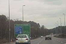
After passing Claygate the motorway-standard section has junctions with the A244 between Esher and Oxshott, then the A245 between Cobham and Hersham.[n 3] The road's Wisley Interchange with the M25 enables a flyover still with a 70 mph (112 km/h) speed limit.[n 4] It bypasses Wisley, Ockham, Ripley (and Burpham which is a suburb of Guildford) before cutting through the major town itself as a dual carriageway and changing to a 50 mph (80 km/h) speed limit.[4] It returns to 70 mph (112 km/h) at the A31 and A246 junction before bypassing Godalming and Milford. It continues through a tunnel at Hindhead (constructed in 2011 to improve capacity and bypass the Devil's Punch Bowl) before leaving Surrey.
Hampshire
The A3 enters Hampshire just after exiting the Hindhead Tunnel, passes Liphook and Bramshott, turns SSW past Liss then passes Petersfield. The A3's original route between Hindhead and Petersfield, passing through several villages, became the B2070. At Liss there remains an at-grade roundabout; the only such junction on the route. Over the South Downs it passes Clanfield and Horndean. From just north of Horndean (still heading towards Portsmouth) the A3 separates from the A3(M) (below) and continues as London Road as far as Hilsea, south of which it is Northern Parade[n 5]. It runs along the west side of Portsea Island which forms Portsmouth proper, roughly parallel with the M275, into the nearly waterfront centre of the city where, after passing the Catholic cathedral, it meets with the A2030. Here it reaches Old Portsmouth passing the Anglican cathedral and the 15th century harbour where it comes to an end at Portsmouth Point.
Hindhead tunnel
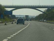
The Hindhead Tunnel is a 1,830-metre (1.14 mi) twin bore tunnel,[5] which cost £371 million to construct, and is the longest non-estuarial road tunnel in the UK. Transport Secretary Philip Hammond conducted the opening ceremony on 27 July 2011, though the northbound tunnel opened to traffic two days later than the southbound one, on 29 July.[6][7][8]
The new dual carriageway diverges from the original route where the old A3 began climbing sharply as it headed towards the scenic Devil's Punch Bowl. The old road now turns right and continues into Highfield Lane. From here, the remainder of the original route to Punch Bowl Common, a short distance north-east of the Hindhead traffic lights, has been completely ripped up and returned to nature. From the South, the short largely built-up southern stretch of old A3 (now bypassed) runs up from the Grayshott exit into Hindhead and remains in use, but has been renumbered from A3 to A333.
Proposed developments
Ham Barn roundabout, Liss
Since the 2013 opening of the Hindhead Tunnel the modern route (or its associated motorway section in the case of the southernmost section) is at least dual-carriageway, at Liss is the sole at-grade roundabout. Widely considered the main traffic pinch-point and an accident hotspot (due to its unusual egg-shape and camber angle causing lorries at excess speed to tip over), there have been wide calls for its removal,[9] the projected increase in traffic with the completion of the tunnel supporting the proposal. In November 2010, the Highways Agency announced it would discuss three options for the roundabout's future, but in December announced none of which would be commenced before 2015.:[10][11]
- full-time signalling,
- removing the roundabout entirely (and thereby removing the A3/B3006 connection completely),
- keeping the existing system.
Cathedral exit, Guildford
The slip road exiting the A3 leading to the Royal Surrey County Hospital and the Surrey Research Park regularly creates congestion on the main A3 during peak times when the traffic queue reaches onto the main carriageway. In May 2011 it was announced that this to be resolved with new improvements to the traffic system directly adjacent to the A3 with work funded jointly by the University of Surrey and Surrey County Council.[12]
Related urban proposals and developments
Various schemes to manage urban traffic exist and economise land use, which include running park and ride services. The main such scheme along the route is in Guildford. In February 2015 the Mayor of London announced plans to buildover a short section at Tolworth after visiting a similar site in Boston, Massachusetts, Mayor Boris Johnson said "rebuilding some of our complex and ageing road network underneath our city would not only provide additional capacity for traffic, but it would also unlock surface space and reduce the impact of noise and pollution." Similar plans have been proposed for other areas of London but proven cost-prohibitive.[13]
A3(M)
| |
|---|---|
| Route information | |
| Length: | 5 mi (8 km) |
| Existed: | 1979 – present |
| Major junctions | |
| North end: | Horndean |
| South end: | Bedhampton |
| Location | |
| Primary destinations: | (London), (Portsmouth), (Chichester), (Petersfield), Waterlooville |
| Road network | |
.svg.png)
_M27_interchange%2C_Farlington.jpg)
This section of the road was opened in 1979[14] and acts as a bypass of the A3 road in this part of Hampshire.
Junctions
| A3(M) motorway | ||
| Northbound exits | Junction | Southbound exits |
| Road continues as the A3 to Petersfield and London | A3 Terminus (J1) |
Horndean, Clanfield A3 Portsmouth, Hayling Island A3(M) |
| No exit | Start of motorway | |
| Horndean, Cowplain B2149 | J2 | Emsworth, Rowlands Castle B2149, Cowplain |
| Waterlooville B2150 | J3 | Waterlooville, Purbrook, Leigh Park B2150 |
| Purbrook, Leigh Park | J4 | No exit |
| Start of motorway | J5 Terminus A27 |
Bedhampton, Farlington, Drayton |
| Petersfield, London, Waterlooville, Leigh Park (A3(M)) Bedhampton B2177 |
Brighton, Chichester, Havant, Hayling Island A27(E) Portsmouth, Southampton (M27) A27(W) | |
Cycle and footpaths
There are shared pedestrian and cycle paths by or on the A3.
Dedicated paths
One cycle path links Liss with larger Petersfield on the Portsmouth-bound (south) side.
From the former, a cycle path runs alongside between adjoining villages Greatham and West Liss. The path is on the London-bound side, linking to a minor road bridge over the A3 to West Liss which is close to the centre of Liss.
Using the above routes together, cyclists and pedestrians from Petersfield and Liss (and points further south) can pass over the A3 at Liss and safely pass the Ham Barn roundabout to access various roads from Greatham: towards London from this village is an eastward path (alongside the A3) to Liphook via the northern perimeter of Longmoor Camp and Griggs Green, Liphook. From here a single carriageway that is not a trunk road runs to Guildford. From the Burpham junction a track facilitates access to Woking which has good access to the RideLondon–Surrey Classic route.
Nearer Portsmouth there is a cycle path between Clanfield and the Queen Elizabeth Country Park, a large forest and downsland in the South Downs National Park. There is, however, no cycle path between Petersfield and the Queen Elizabeth Country Park. Instead there are footpaths for pedestrians only from the nearest village, Buriton.
On-road lanes
Between Thursley and Milford in Surrey cycle crossings of the slip roads exist for the few cyclists travelling along the cycle lanes.
In Portsmouth, nearby where bypassed by the A3(M) and in London the speed limit of the road is lower and lanes fewer than three, facilitating cycling.
See also
- Great Britain road numbering scheme
- List of motorways in the United Kingdom
- British industrial narrow gauge railways
Notes and references
- Notes
- ↑ Main examples are Shelley Court and Byfield Court as to art nouveau by this stretch.
- ↑ This section except on bank holidays is busy weekdays from about 7:50am to 8:30am and from 5:15pm to 5:50pm.
- ↑ Along this road are Painshill Park, Brooklands, West Byfleet and western Woking
- ↑ Hard shoulders, and outer barriers of the section thereafter are 'dual carriageway standard'.
- ↑ London Road continues as the A2047
- References
- ↑ 'The borough of Guildford: Borough, manors, churches and charities' in A History of the County of Surrey: Volume 3, ed. H E Malden (London, 1911), pp. 560-570. British History Online, University of Portsmouth, the History of Parliament Trust and others accessed 20 November 2016.]
- ↑ "The Road Board". Parliamentary Debates (Hansard). House of Lords. November 22, 1911. col. 282–282.
- ↑ "Arterial Roads - reply of the Parlimentary Secretary, Minister of Transport". Parliamentary Debates (Hansard). House of Commons. March 21, 1923. col. 2541–2541.
- ↑ "Signs to remind drivers to stick to the 50 mile an hour speed limit" Archived 11 April 2010 at the Wayback Machine.. Surrey Herald and Surrey Advertiser (getsurrey.co.uk) 6 April 2010. Retrieved 6 January 2013.
- ↑ "A3 Hindhead Improvement – The Tunnel". Highways agency. Retrieved 18 February 2010.
- ↑ "A3 Hindhead Improvement". Highways Agency.
- ↑ "£371 million A3 improvements will go ahead". Government News Network. 26 October 2006. Archived from the original on 10 March 2007.
- ↑ "A3 Hindhead Tunnel". Mott MacDonald.
- ↑ Selborne Civil Parish Council - campaign to replace or alter roundabout Archived 1 April 2010 at the Wayback Machine.
- ↑ "No changes for A3 roundabout". Petersfield Post. 29 December 2010. Retrieved 14 March 2013.
- ↑ 'Ham Barn Options Outlined' 10 Nov 2010, Haslemre Messenger
- ↑ Caulfield, Chris (13 May 2011). "End in sight for Guildford traffic hotspot - News". Surrey Advertiser. getsurrey. Retrieved 14 March 2013.
- ↑ Sharman, Jon (9 February 2015). "Going underground? A3 at Tolworth could become a tunnel, says Boris Johnson". Kingston Guardian. Retrieved 15 February 2015.
- ↑ "The Motorway Archive – M27 Dates Page". Iht.org. Retrieved 14 March 2013.
- ↑ Information above gathered from Advanced Direction Signs April/May 2012
External links
![]() Media related to A3 road (England) at Wikimedia Commons
Media related to A3 road (England) at Wikimedia Commons
- CBRD Motorway Database – A3 and A3(M)
- A3 Hindhead Improvement – Highways Agency page
- Society for All British Road Enthusiasts entry for the A3
A roads in Zone 3 of the Great Britain road numbering scheme | ||
|---|---|---|
| Great Britain | .svg.png) | |||||||
|---|---|---|---|---|---|---|---|---|
| Northern Ireland | ||||||||
| Former | ||||||||
| Unbuilt | ||||||||
| Proposed | ||||||||
| Related articles | ||||||||
| ||||||||