Lydart
| Lydart | |
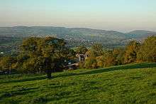 View over Lydart House towards Monmouth |
|
 Lydart |
|
| OS grid reference | SO500092 |
|---|---|
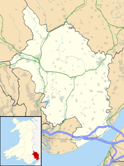
| Principal area | Monmouthshire |
| Ceremonial county | Gwent |
| Country | Wales |
| Sovereign state | United Kingdom |
| Post town | MONMOUTH |
| Postcode district | NP25 |
| Dialling code | 01600 |
| Police | Gwent |
| Fire | South Wales |
| Ambulance | Welsh |
| EU Parliament | Wales |
| UK Parliament | Monmouth |
|
|
Coordinates: 51°46′46″N 2°43′37″W / 51.779510°N 2.726970°W
Lydart is a dispersed hamlet within the community of Mitchel Troy, Monmouthshire, Wales. It is located about 3 miles (4.8 km) south-west of Monmouth, 3 miles (4.8 km) north of Trellech, and 1 mile (1.6 km) south-east of Mitchel Troy village, on the top of an escarpment which slopes steeply down to the valley of the River Trothy and which commands spectacular views. The B4293 road passes through the area.[1]
Lydart House and Estate
Lydart House is described as a "handsomely proportioned"[2] eighteenth-century house, of six bays and two storeys. The nearby Lydart Manor and estate, ancestral seat of the Price family, is a fortified manor house largely constructed in the late fifteenth or early sixteenth century, though parts of the house date to the twelfth century.[2][3][4] The Manor underwent further expansion in the late eighteenth century, after the Lydart estate saw a significant influx of wealth from the wars with France.[5] The Manor's chapel is designated as a site of historical interest by CADW due to its rare fleur-de-lys decorative plasterwork and hidden staircase, which may indicate early ecclesiastical use.[6] Both are Grade II listed buildings.[7]

Caer Llan
Caer Llan, 1 mile (1.6 km) to the south of Lydart House, is a former country house, thought to have been built about 1800 but much extended in various stages since that time. After being used briefly as a boarding school, it began to be used as a field studies centre in 1971. It is now also used as a conference centre and events venue, and provides some accommodation.[8] Ancient woodland to the south east of the centre is a Site of Special Scientific Interest (SSSI).[9]
Ty Mawr
Ty Mawr is a convent run by the Society of the Sacred Cross in a secluded location at Lydart. The community was established at Ty Mawr in 1923, and today consists of about ten professed sisters, with several oblates and associates.[10]
Other buildings and structures
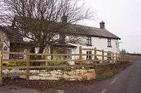
The Gockett Inn was a public house located on the B4293 road. It is known to have operated since at least the 17th century and to have been used by drovers, but closed down around 2003 and is now a private house.
A boundary stone at Five Trees marks the point at which the boundaries of the ancient parishes of Cwmcarvan, Mitchel Troy, Penallt and Trellech meet. Four trees were planted to mark the junction before 1800, and a fifth was placed in the middle as the central point. The site was restored in 1982/83, with the assistance of young persons employed under the Youth Training Scheme.[11]
High Glanau, a house and garden built in 1922/23 for the architectural writer and garden designer Henry Avray Tipping, is located just south of Lydart, within the community of Cwmcarvan.[12]
References
- ↑ Ordnance Survey: Explorer map sheet OL14 Wye Valley & Forest of Dean ISBN 9780319240953
- 1 2 Newman, John (2000). The Buildings of Wales: Gwent/Monmouthshire. Penguin Books. p. 392. ISBN 0-14-071053-1.
- ↑ https://www.houseofnames.com/price-family-crest
- ↑ http://www.wyedeantourism.co.uk/system-images/files/3_Lydart_Loop.pdf
- ↑ http://www.wyedeantourism.co.uk/system-images/files/3_Lydart_Loop.pdf
- ↑ http://www.britishlistedbuildings.co.uk/wa-25754-lydart-farmhouse-mitchel-troy#.WEDdcVf3rzI
- ↑ British Listed Buildings: Mitchel Troy. Accessed 22 April 2012
- ↑ "About Caer Llan: History, heritage and environmental vision". The Caer Llan Partnership. Retrieved 15 March 2012.
- ↑ "Caer Llan Wood" (pdf). Countryside Council for Wales. Retrieved 12 March 2012.
- ↑ Church In Wales: The Society of the Sacred Cross. Accessed 21 April 2012
- ↑ Five Trees boundary stone at geograph.org. Accessed 23 April 2012
- ↑ Newman, The Buildings of Wales: Gwent/Monmouthshire, p.208