Cliffe, Selby

Coordinates: 53°46′57″N 0°59′42″W / 53.782500°N 0.995000°W
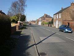
Cliffe is a small village and civil parish in the Selby district of North Yorkshire, England. Until 1974 it was in the East Riding of Yorkshire.
The civil parish includes the villages of Cliffe Common, South Duffield, Lund, and Newhay.
The site of the former Selby Coalfield Whitemoor mine in the north of the parish is now a business park.
Geography
The civil parish of Cliffe is bounded by Barlby with Osgodby to the west, Hemingbrough to the east, and the River Ouse to the south, and North Duffield and Skipwith to the north. The parish includes the village of Cliffe, as well as South Duffield and the hamlets of Cliffe Common, Lund and Newhay. Whitemoor business park is in the northern part of the parish.[1]
The A63 Selby to Hull road and on the Hull-Selby railway line pass roughly east-west through the parish; the A163 Market Weighton road, and the route of the former Selby-Market Weighton-Driffield railway line pass through the northern part of the parish. The parish is predominately agricultural land at around 5 metres (16 ft) above sea level.[1] At the time of the 2001 UK census, Cliffe parish had a population of 1,143,[2] increasing to 1,267 at the 2011 Census.[3]
Cliffe has a public house (the New Inn), a butcher's shop and a mini-mart. The post office closed in 2007, although there is one at Hemingbrough.
Cliffe Voluntary Controlled Primary School received a grade 1 (outstanding) 2009 Ofsted inspection report.[4]
History
Archaeological evidence of humans living in the area dating back to the Iron Age or British Roman age has been found in the area between and around Cliffe and Cliffe Common; the evidence suggested rectangular enclosures thought to be part of a field system, as well as ditched enclosures, and roundhouses.[5] Evidence of permanent human habitation in the medieval period has also been found, suggesting ridge and furrow farming.[6]
Cliffe, Cliffe Common
Cliffe is recorded in the Domesday survey as being part of the manor of Howden.[7] In the Middle Ages the village was in the Ouse and Derwent wapentake of the East Riding of Yorkshire. With the hamlet of Lund it formed the township of Cliffe cum Lund in the large ancient parish of Hemingbrough. Until the later Middle Ages Cliffe was on the banks of the River Ouse, but the river changed course when a meander was broken through.
In the medieval period much of the land was in the possession of the Bishops of Durham, passing to the Bishopric of Ripon in 1836. The remainder of the land passed through various hands, with part becoming of the manor of Turnham Hall.[8]

A school was established in 1708 with the bequeathal of £200 by Mary Waud. A school house was subsequently built, and, after further endowments, it was enlarged in 1835.[8]
Non-conformist chapels were established in 1825 (Wesleyan, with Sunday school, closed 1968) and 1842 (Primitive Methodist, deregistered 1942).[8]
A seed milling and crushing business was established at Cliffe in around 1840, the business ceased after the 1870s. By the 1890s maltings had been established at Cliffe and at Cliffe Common, near to the railway lines, both remained in business into the second half of the 20th century.[8]
During the First World War a 3" anti-aircraft battery was installed at cliffe.[9]
From 1960 senior education was carried out at the secondary school in Barlby; the Cliffe school was still educating pupils in 1973, with 65 students.[8]
The township of Cliffe cum Lund became a separate civil parish in 1866. In 1883 the hamlet of Newhay, which in medieval times had been on the south bank of the Ouse in the West Riding, was transferred from the parish of Drax. In 1935 the civil parish of Cliffe cum Lund was abolished and merged with the parish of South Duffield to form the new parish of Cliffe.[10]
Railways
The Hull and Selby Railway arrived in Cliffe in 1848, and a station was opened in the village as Cliff Common Gate later renamed Cliff Common. The station closed in 1954 the line closed in 1965.[11] The Derwent Valley Light Railway opened in 1913 from a branch at Cliff Common; it closed to passengers in 1926;[12] the section from Wheldrake station and Cliff Common closed completely in 1965.[13]
South Duffield

South Duffield was also a township in the ancient parish of Hemingbrough. There was a manor at South Duffield, now evidenced by an earthwork.[14] The present South Duffield Hall dates from the late 1700s.[15]
At South Duffield remains of previous activity included a former brick tower mill used for grain dating from c.1800.[16]
The Selby-Market Weighton railway line arrived in 1848, passing north of the village - a station (Duffield Gate railway station) was opened north of the village, which closed in 1884.[17]
A school was built in 1881. From 1960 secondary students were educated at Barlby, and the school closed in 1962.[17]
South Duffield became a separate civil parish in 1866. The civil parish was abolished in 1935.
Turnham Hall
There was a manor house at Turnham Hall (also Turneham or Thurnham.[18]) west of Cliffe on the banks of the Ouse as early as 1327. The house was moated at one time.[19] A licence to crenellate was received by John Pylkyngton in 1477.[20]
The current farm at Turnham Hall dates from the late 1700s to 1820.[21] [22][23]
Whitemoor mine
Whitemoor Mine was developed in the 1970s as part of the Selby coalfield, after closure in the 21st century the above ground site was redeveloped as Whitemoor Business Park.
References
- 1 2 Ordnance Survey. 1:25000. 2006
- ↑ "2001 Census: Key Statistics: Parish Headcounts: Area: Cliffe CP (Parish)". Neighbourhood Statistics. Office for National Statistics. Retrieved 26 June 2008.
- ↑ "Parish population 2011". Neighbourhood Statistics. Office for National Statistics. Retrieved 15 August 2015.
- ↑ "Cliffe Voluntary Controlled Primary School", Ofsted Report 2009, (pdf download required). Retrieved 21 November 2011
- ↑ Sources:
- Historic England. "A possible Iron Age or Roman rectilinear enclosure .. (1074936)". PastScape. Retrieved 18 June 2014.
- Historic England. "Iron Age or Roman ditched enclosures .. (1074942)". PastScape. Retrieved 18 June 2014.
- Historic England. "Iron Age or Roman rectilinear enclosures (1074943)". PastScape. Retrieved 18 June 2014.
- Historic England. "Possible Iron Age or Roman rectilinear ditched enclosures .. (1306821)". PastScape. Retrieved 18 June 2014.
- Historic England. "Iron Age or Roman rectilinear enclosures .. (1306832)". PastScape. Retrieved 18 June 2014.
- Historic England. "Iron Age or Roman fragmentary, rectilinear ditched enclosures .. (1306881)". PastScape. Retrieved 18 June 2014.
- ↑ Historic England. "Medieval field system of ridge and furrow in the parish of Cliffe .. (1306915)". PastScape. Retrieved 18 June 2014.
- ↑ Cliffe in the Domesday Book
- 1 2 3 4 5 Baggs, Kent & Purdy 1976.
- ↑ Historic England. "Cliffe Heavy Anti Aircraft Battery (1474193)". PastScape. Retrieved 18 June 2014.
- ↑ A P Baggs, G H R Kent and J D Purdy (1976). K J Allison, ed. "Hemingbrough". A History of the County of York East Riding: Volume 3, Ouse and Derwent Wapentake, and Part of Harthill Wapentake. Victoria County History. pp. 37–47. Retrieved 16 May 2015.
- ↑ Historic England. "Cliffe Common Station (500212)". PastScape. Retrieved 18 June 2014.
- ↑ Historic England. "Derwent Valley Light Railway (58102)". PastScape. Retrieved 18 June 2014.
- ↑ Hoole, Ken (1986). A Regional History of the Railways of Great Britain, Volume 4: The North East (3rd ed.). pp. 63–4.
- ↑ Historic England. "Possible manorial earthwork (58045)". PastScape. Retrieved 18 June 2014.
- ↑ Historic England. "South Duffield Hall, Manor House lane (1148487)". National Heritage List for England. Retrieved 18 June 2014.
- ↑ Historic England. "Windmill and Mill House (497530)". PastScape. Retrieved 18 June 2014.
- 1 2 Baggs, Kent & Purdy 1976a.
- ↑ "Turnham Hall". www.gatehouse-gazetteer.info. Retrieved 30 November 2014.
- ↑ Historic England. "Traces of a moat which surrounded an earlier house at Turnham Hall .. (58084)". PastScape. Retrieved 18 June 2014.
- ↑ Calendar of Patent Rolls (1476-85), 1901, p. 71
- ↑ Historic England. "Turnham Hall and attached service wing, Field lane (1072603)". National Heritage List for England. Retrieved 18 June 2014.
- ↑ Historic England. "Warehouse north of Turnham Hall (1072604)". National Heritage List for England. Retrieved 18 June 2014.
- ↑ Historic England. "Coach house and stable to north west of Turnham Hall, Field lane (1072605)". National Heritage List for England. Retrieved 18 June 2014.
Sources
- Baggs, A.P.; Kent, G.H.R.; Purdy, J.D. (1976). "15. Hemingbrough - Cliffe with Lund". In Allison, K.J. A History of the County of York : East Riding. Victoria County Histories. 3. pp. 55–60.
- Baggs, A.P.; Kent, G.H.R.; Purdy, J.D. (1976a). "16. Hemingbrough - South Duffield". In Allison, K.J. A History of the County of York : East Riding. Victoria County Histories. 3. pp. 60–63.
External links
| Wikimedia Commons has media related to Cliffe, Selby. |