Luckett, Cornwall
Coordinates: 50°32′27″N 4°16′29″W / 50.5407°N 4.2746°W
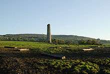
Mining landscape south from Luckett
Luckett is a hamlet in east Cornwall, England. It is situated in a former mining area beside the River Tamar approximately three miles (5 km) north of Callington.[1]
In the 12th century, Luckett became part of a Royal Deer Park called Kerrybullock, until it was disparked by Henry VIII in the 16th century.[2]
South of the hamlet is Greenscoombe Wood, Luckett SSSI (Site of Special Scientific Interest), noted for its biological interest.[3]
References
- ↑ Ordnance Survey: Landranger map sheet 201 Plymouth & Launceston ISBN 978-0-319-23146-3
- ↑ North Cornwall District Council, "Luckett: Conservation Area Character Statement" (PDF), Cornwall.gov.uk, p. 3
- ↑ "Greenscoombe Wood, Luckett" (PDF). Natural England. 1986. Retrieved 1 November 2011.
Cornwall Portal | |
| Unitary authorities | |
| Major settlements |
|
| Rivers | |
| Topics | |
This article is issued from Wikipedia - version of the 11/19/2016. The text is available under the Creative Commons Attribution/Share Alike but additional terms may apply for the media files.