Louann, Arkansas
| Louann, Arkansas | |
|---|---|
| Town | |
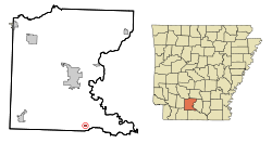 Location in Ouachita County and the state of Arkansas | |
| Coordinates: 33°23′30″N 92°47′34″W / 33.39167°N 92.79278°WCoordinates: 33°23′30″N 92°47′34″W / 33.39167°N 92.79278°W | |
| Country | United States |
| State | Arkansas |
| County | Ouachita |
| Area | |
| • Total | 0.2 sq mi (0.6 km2) |
| • Land | 0.2 sq mi (0.6 km2) |
| • Water | 0 sq mi (0 km2) |
| Elevation | 135 ft (41 m) |
| Population (2010) | |
| • Total | 164 |
| • Density | 975/sq mi (325/km2) |
| Time zone | Central (CST) (UTC-6) |
| • Summer (DST) | CDT (UTC-5) |
| ZIP code | 71751 |
| Area code(s) | 870 |
| FIPS code | 05-41630 |
| GNIS feature ID | 0058090 |
Louann is a town in Ouachita County, Arkansas, United States. The population was 195 at the 2000 census, which fell to 164 in the 2010 census. It is part of the Camden Micropolitan Statistical Area.
Geography
Louann is located at 33°23′30″N 92°47′34″W / 33.39167°N 92.79278°W (33.391712, -92.792909).[1]
According to the United States Census Bureau, the town has a total area of 0.6 km² (0.2 mi²), all land.
Demographics
| Historical population | |||
|---|---|---|---|
| Census | Pop. | %± | |
| 1930 | 910 | — | |
| 1940 | 492 | −45.9% | |
| 1950 | 291 | −40.9% | |
| 1960 | 261 | −10.3% | |
| 1970 | 245 | −6.1% | |
| 1980 | 282 | 15.1% | |
| 1990 | 158 | −44.0% | |
| 2000 | 195 | 23.4% | |
| 2010 | 164 | −15.9% | |
| Est. 2015 | 154 | [2] | −6.1% |
As of the census[4] of 2000, there were 195 people, 71 households, and 57 families residing in the town. The population density was 313.7/km² (822.4/mi²). There were 88 housing units at an average density of 141.6/km² (371.1/mi²). The racial makeup of the town was 62.56% White, 36.41% Black or African American, 0.51% Native American, and 0.51% from two or more races.
There were 71 households out of which 36.6% had children under the age of 18 living with them, 53.5% were married couples living together, 25.4% had a female householder with no husband present, and 19.7% were non-families. 19.7% of all households were made up of individuals and 9.9% had someone living alone who was 65 years of age or older. The average household size was 2.75 and the average family size was 3.05.
In the town the population was spread out with 28.2% under the age of 18, 6.7% from 18 to 24, 27.2% from 25 to 44, 27.7% from 45 to 64, and 10.3% who were 65 years of age or older. The median age was 38 years. For every 100 females there were 99.0 males. For every 100 females age 18 and over, there were 89.2 males.
The median income for a household in the town was $17,273, and the median income for a family was $18,333. Males had a median income of $21,250 versus $18,750 for females. The per capita income for the town was $11,288. About 44.4% of families and 45.0% of the population were below the poverty line, including 66.2% of those under the age of eighteen and 46.2% of those sixty five or over.
Education
Public education for elementary and secondary school students is available from Camden Fairview School District, which leads to graduation from Camden Fairview High School.
References
- ↑ "US Gazetteer files: 2010, 2000, and 1990". United States Census Bureau. 2011-02-12. Retrieved 2011-04-23.
- ↑ "Annual Estimates of the Resident Population for Incorporated Places: April 1, 2010 to July 1, 2015". Retrieved July 2, 2016.
- ↑ "Census of Population and Housing". Census.gov. Retrieved June 4, 2015.
- ↑ "American FactFinder". United States Census Bureau. Retrieved 2008-01-31.
Municipalities and communities of Ouachita County, Arkansas, United States | ||
|---|---|---|
| Cities | 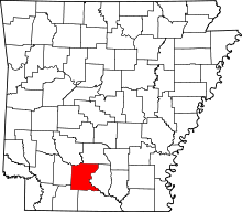 | |
| Town | ||
| CDP | ||
| Unincorporated communities | ||