Loganlea State High School
| Loganlea State High School | |
|---|---|
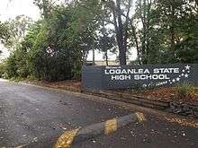 Southern entrance, 2015 To the stars | |
| Location | |
|
Neridah Street, Loganlea, Queensland Australia | |
| Information | |
| Type | Secondary school |
| Established | 1981 |
| Grades | Year 7 to 12 |
| Campus size | 56 ha |
| Website |
loganleashs |
Loganlea State High School (LSHS) is a secondary school in Neridah Street at Loganlea, Logan City, Queensland, Australia, for students between years 7 and 12. The school was established in 1981 between the Logan River and the Beenleigh railway line.
It has an enrollment of 550 students. The school is co-educational with students from a variety of cultural backgrounds. Three year 8 scholarships are offered: an overall year, mathematics and science laptop, and one for dance.

Loganlea State High operates a working property which enables learning opportunities in animal husbandry and farming.[1] In recent years, students partaking in the agribusiness program have been able to spend time on a remote property in Central Queensland in order to gain practical skills as well as a sense of independence.[2]
The school opened Knowledge House in 2006. Its purpose is to establish a more Indigenous-friendly curriculum. Knowledge House is a safe space, an Indigenous cultural experience, achieving results in urban areas for jarjums and community. 'Jarjums' is an Aboriginal word for students.
Students participate in group sporting activities as a member of one of Four houses; Pegasus (PEG), Hydra (HYD), Sagitta (SAG) and Ursa (URS). The School Swimming Carnival includes a teacher versus student relay, which is not seen at many other schools. The Dance Eisteddfod Team competes in the Brisbane performing challenge and the Ipswich Dance Eisteddfod.
Alumni Lists from 1982 can be found at Names Database.
See also
References
- ↑ "Loganlea State High School". Department of Education and Training. Retrieved 22 March 2015.
- ↑ Kathleen Calderwood (24 September 2014). "City students thrown in the deep end to learning about agriculture". ABC Rural. Australian Broadcasting Corporation. Retrieved 22 March 2015.
External links
Coordinates: 27°40′20.05″S 153°8′32.76″E / 27.6722361°S 153.1424333°E