Lillydale, Wyoming County, West Virginia
| Lillydale, West Virginia | |
|---|---|
| Unincorporated community | |
 Lillydale, West Virginia  Lillydale, West Virginia | |
| Coordinates: 37°40′34″N 81°39′47″W / 37.67611°N 81.66306°WCoordinates: 37°40′34″N 81°39′47″W / 37.67611°N 81.66306°W | |
| Country | United States |
| State | West Virginia |
| County | Wyoming |
| Elevation | 1,224 ft (373 m) |
| Time zone | Eastern (EST) (UTC-5) |
| • Summer (DST) | EDT (UTC-4) |
| Area code(s) | 304 & 681 |
| GNIS feature ID | 1541964[1] |
Lillydale is an unincorporated community in Wyoming County, West Virginia, United States. Lillydale is located on West Virginia Route 971 along the Clear Fork,[2] 2.5 miles (4.0 km) southwest of Oceana.
References
- ↑ "US Board on Geographic Names". United States Geological Survey. 2007-10-25. Retrieved 2008-01-31.
- ↑ West Virginia Atlas & Gazetteer. Yarmouth, Me.: DeLorme. 1997. p. 58. ISBN 0-89933-246-3.
Municipalities and communities of Wyoming County, West Virginia, United States | ||
|---|---|---|
| City | 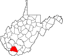 | |
| Towns | ||
| CDPs | ||
| Unincorporated communities |
| |
| Footnotes | ‡This populated place also has portions in an adjacent county or counties | |
This article is issued from Wikipedia - version of the 7/28/2016. The text is available under the Creative Commons Attribution/Share Alike but additional terms may apply for the media files.