Laforce, Quebec
| Laforce | |
|---|---|
| Municipality | |
 Location within Témiscamingue RCM. | |
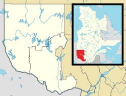 Laforce Location in western Quebec. | |
| Coordinates: 47°32′N 78°44′W / 47.533°N 78.733°WCoordinates: 47°32′N 78°44′W / 47.533°N 78.733°W[1] | |
| Country |
|
| Province |
|
| Region | Abitibi-Témiscamingue |
| RCM | Témiscamingue |
| Settled | 1937 |
| Constituted | January 1, 1979 |
| Government[2] | |
| • Mayor | Gérald Charron |
| • Federal riding | Abitibi—Témiscamingue |
| • Prov. riding | Rouyn-Noranda–Témiscamingue |
| Area[2][3] | |
| • Total | 587.40 km2 (226.80 sq mi) |
| • Land | 440.45 km2 (170.06 sq mi) |
| Population (2011)[3] | |
| • Total | 147 |
| • Density | 0.3/km2 (0.8/sq mi) |
| • Pop (2006–11) |
|
| • Dwellings | 79 |
| Time zone | EST (UTC−5) |
| • Summer (DST) | EDT (UTC−4) |
| Postal code(s) | J0Z 2J0 |
| Area code(s) | 819 |
| Website |
www |
Laforce is a municipality in northwestern Quebec, Canada, in the Témiscamingue Regional County Municipality.
Demographics
Population trend:[4]
- Population in 2011: 147 (2006 to 2011 population change: -15.5 %)
- Population in 2006: 174
- Population in 2001: 303 (or 299 when adjusted for 2006 boundary)
- Population in 1996: 295
- Population in 1991: 225
Private dwellings occupied by usual residents: 61 (total dwellings: 79)
Mother tongue:[5]
- English as first language: 0%
- French as first language: 100%
- English and French as first language: 0%
- Other as first language: 0%
See also
References
- ↑ Reference number 92437 of the Commission de toponymie du Québec (French)
- 1 2 "Laforce". Répertoire des municipalités (in French). Ministère des Affaires municipales, des Régions et de l'Occupation du territoire. Retrieved 2010-12-31.
- 1 2 "Laforce census profile". 2011 Census data. Statistics Canada. Retrieved 2010-12-31.
- ↑ Statistics Canada: 1996, 2001, 2006, 2011 census
- ↑ "Laforce community profile". 2006 Census data. Statistics Canada. Retrieved 2010-12-31.
 |
Rémigny | Rouyn-Noranda | | |
| Moffet | |
Les Lacs-du-Témiscamingue | ||
| ||||
| | ||||
| Belleterre |
| Cities | |
|---|---|
| Municipalities | |
| Townships |
|
| Parishes | |
| Villages | |
| Unorganized territories | |
| |
This article is issued from Wikipedia - version of the 2/23/2014. The text is available under the Creative Commons Attribution/Share Alike but additional terms may apply for the media files.