Lac-Duparquet, Quebec
| Lac-Duparquet | |
|---|---|
| Unorganized territory | |
 Location within Abitibi-Ouest RCM. | |
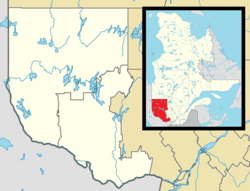 Lac-Duparquet Location in western Quebec. | |
| Coordinates: 48°28′N 79°16′W / 48.467°N 79.267°WCoordinates: 48°28′N 79°16′W / 48.467°N 79.267°W[1] | |
| Country |
|
| Province |
|
| Region | Abitibi-Témiscamingue |
| RCM | Abitibi-Ouest |
| Constituted | unspecified |
| Government[2] | |
| • Federal riding | Abitibi—Témiscamingue |
| • Prov. riding | Abitibi-Ouest |
| Area[2][3] | |
| • Total | 129.70 km2 (50.08 sq mi) |
| • Land | 114.67 km2 (44.27 sq mi) |
| Population (2011)[3] | |
| • Total | 0 |
| • Density | 0.0/km2 (0/sq mi) |
| • Pop 2006-2011 |
|
| • Dwellings | 0 |
| Time zone | EST (UTC−5) |
| • Summer (DST) | EDT (UTC−4) |
| Highways | No major routes |
Lac-Duparquet is an unorganized territory in the Abitibi-Témiscamingue region of Quebec, Canada. It is one of two unorganized territories in the Abitibi-Ouest Regional County Municipality but the only one without a permanent population. It is located between Duparquet Lake and the Quebec/Ontario border.
Demographics
Population:
- Population in 2011: 0
- Population in 2006: 0
- Population in 2001: 0

A view of Lake Hebecourt, from Chemin Lac Hébécourt, south of Route 388
References
 |
Rapide-Danseur | | ||
| Unorganized North Cochrane, Ontario | |
Duparquet | ||
| ||||
| | ||||
| Rouyn-Noranda |
| Towns | |
|---|---|
| Municipalities | |
| Townships | |
| Parishes | |
| Unorganized territories | |
| |
This article is issued from Wikipedia - version of the 1/26/2014. The text is available under the Creative Commons Attribution/Share Alike but additional terms may apply for the media files.