Lac-Croche, Quebec
| Lac-Croche | |
|---|---|
| Unorganized territory | |
 Location within La Jacques-Cartier RCM. | |
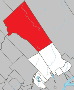
 Lac-Croche Location in central Quebec. | |
| Coordinates: 47°24′N 71°47′W / 47.400°N 71.783°WCoordinates: 47°24′N 71°47′W / 47.400°N 71.783°W[1] | |
| Country |
|
| Province |
|
| Region | Capitale-Nationale |
| RCM | La Jacques-Cartier |
| Constituted | January 1, 1986 |
| Government[2] | |
| • Federal riding | Portneuf—Jacques-Cartier |
| • Prov. riding | Chauveau |
| Area[2][3] | |
| • Total | 1,772.60 km2 (684.40 sq mi) |
| • Land | 1,686.50 km2 (651.16 sq mi) |
| Population (2011)[3] | |
| • Total | 0 |
| • Density | 0.0/km2 (0/sq mi) |
| • Pop 2006-2011 |
|
| • Dwellings | 0 |
| Time zone | EST (UTC−5) |
| • Summer (DST) | EDT (UTC−4) |
| Highways | No major routes |
Lac-Croche is an unorganized territory in the Capitale-Nationale region of Quebec, Canada, in the north of La Jacques-Cartier Regional County Municipality, taking up more than 50% of this regional county. It is unpopulated and undeveloped, almost entirely part of the Laurentides Wildlife Reserve.
It is named after Lake Croche, roughly located in the centre of the territory.
Demographics
Population
| Historical Census Data - Lac-Croche, Quebec[4] | ||||||||||||||||||||||||
|---|---|---|---|---|---|---|---|---|---|---|---|---|---|---|---|---|---|---|---|---|---|---|---|---|
|
|
|
|
| ||||||||||||||||||||
Private dwellings occupied by usual residents: 0 (total dwellings: 0)
See also
References
- ↑ Reference number 149593 of the Commission de toponymie du Québec (French)
- 1 2 Ministère des Affaires municipales, des Régions et de l'Occupation du territoire - Répertoire des municipalités: Lac-Croche
- 1 2 Statistics Canada 2011 Census - Lac-Croche census profile
- ↑ Statistics Canada: 1996, 2001, 2006, 2011 census
 |
La Tuque | | ||
| Lac-Édouard | |
Lac-Jacques-Cartier | ||
| ||||
| | ||||
| Lac-Blanc | Stoneham-et-Tewkesbury |
| Cities & towns | |
|---|---|
| Municipalities | |
| United Townships | |
| Unorganized territories | |
| |
This article is issued from Wikipedia - version of the 3/3/2014. The text is available under the Creative Commons Attribution/Share Alike but additional terms may apply for the media files.