Kynšperk nad Ohří
| Kynšperk nad Ohří | ||
| Town | ||
 | ||
|
||
| Country | Czech Republic | |
|---|---|---|
| Region | Karlovy Vary | |
| District | Sokolov | |
| Commune | Sokolov | |
| Municipality | Kynšperk nad Ohří | |
| River | Ohře | |
| Elevation | 431 m (1,414 ft) | |
| Coordinates | CZ 50°7′8″N 12°31′59″E / 50.11889°N 12.53306°ECoordinates: CZ 50°7′8″N 12°31′59″E / 50.11889°N 12.53306°E | |
| Area | 23.31 km2 (9.00 sq mi) | |
| Population | 5,111 (2006-07-03) | |
| Density | 219/km2 (567/sq mi) | |
| First mentioned | 1232 | |
| Mayor | René Bolvari | |
| Timezone | CET (UTC+1) | |
| - summer (DST) | CEST (UTC+2) | |
| Postal code | 357 51 - 358 01 | |
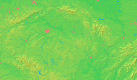  Location in the Czech Republic | ||
 Location in Sokolov District | ||
| Wikimedia Commons: Kynšperk nad Ohří | ||
| Statistics: statnisprava.cz | ||
| Website: www | ||
Kynšperk nad Ohří (Czech pronunciation: [ˈkɪnʃpɛrk ˈnat ʔoɦr̝iː]; German: Königsberg an der Eger) is a town in Sokolov District, Karlovy Vary Region, Czech Republic. It has a population of 5,111 (2006 est.). It lies on the Ohře River.
External links
| Wikimedia Commons has media related to Kynšperk nad Ohří. |
- (Czech) Official website
This article is issued from Wikipedia - version of the 4/4/2016. The text is available under the Creative Commons Attribution/Share Alike but additional terms may apply for the media files.