Kurikoma Quasi-National Park
| Kurikoma Quasi-National Park | |
|---|---|
| 栗駒国定公園 | |
|
IUCN category II (national park) | |
|
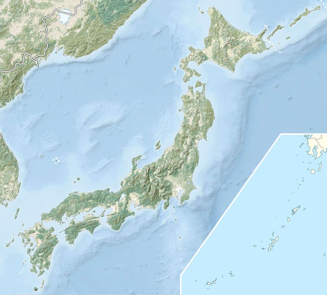
Oyasu-kyō Ravine | |
 Map of Japan | |
| Location | Tōhoku, Japan |
| Coordinates | 38°52′N 140°38′E / 38.86°N 140.64°ECoordinates: 38°52′N 140°38′E / 38.86°N 140.64°E[1] |
| Area | 771.4 km2 (297.8 sq mi) |
| Established | 22 July 1968 |
Kurikoma Quasi-National Park (栗駒国定公園 Kurikoma Kokutei Kōen) is a Quasi-National Park that extends between Akita, Iwate, Miyagi, and Yamagata Prefectures, Japan.[2] Established in 1968, the central feature of the park is Mount Kurikoma (栗駒山) at 1,627 m (5,338 ft).[3][4][5] It is rated a protected landscape (category II) according to the IUCN.[6]
Like all Quasi-National Parks in Japan, the park is managed by the local prefectural governments.[7]
Related municipalities
- Akita: Higashinaruse, Yuzawa[8]
- Iwate: Ichinoseki, Kanegasaki, Kitakami, Nishiwaga, Ōshū[9]
- Miyagi: Kurihara, Ōsaki[10]
- Yamagata: Kaneyama, Mogami, Shinjō[11]
See also
References
- Southerland, Mary and Britton, Dorothy. The National Parks of Japan. Kodansha International (1995). ISBN 4-7700-1971-8
External links
| Wikimedia Commons has media related to Kurikoma Quasi-National Park. |
- ↑ "Kurikoma Quasi National Park". protectedplanet.net.
- ↑ "List of Quasi-national Parks". Official Home Page of the Ministry of the Environment. Ministry of the Environment Government of Japan. 1994-03-31. Retrieved 2009-10-05.
- ↑ "栗駒/南三陸金華山/蔵王/男鹿". National Parks Association of Japan. Retrieved 5 February 2012.
- ↑ "List of Quasi-National Parks" (PDF). Ministry of the Environment. Retrieved 5 February 2012.
- ↑ "Kurikoma Quasi-National Park". Miyagi Prefecture. Retrieved 5 February 2012.
- ↑ "Mount Kurikoma and Tochigamori Forest Ecosystem Reserve". Protected Planet.net.
- ↑ "National Park systems: Definition of National Parks". National Parks of Japan. Ministry of the Environment of the Government of Japan. Retrieved 2008-08-29.
- ↑ "Nature in Akita Prefecture". Akita Prefecture. Retrieved 5 February 2012.
- ↑ "Designation of the Natural Parks of Iwate Prefecture" (PDF). Iwate Prefecture. Retrieved 5 February 2012.
- ↑ "Designation of the Natural Parks of Miyagi Prefecture". Miyagi Prefecture. Retrieved 5 February 2012.
- ↑ "Natural Parks of Yamagata Prefecture" (PDF). Yamagata Prefecture. Retrieved 5 February 2012.
This article is issued from Wikipedia - version of the 11/19/2016. The text is available under the Creative Commons Attribution/Share Alike but additional terms may apply for the media files.