Kryoneri, Attica
| Kryoneri Κρυονέρι | |
|---|---|
 Kryoneri | |
|
Location within the regional unit 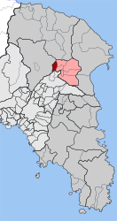 | |
| Coordinates: 38°8′N 23°50′E / 38.133°N 23.833°ECoordinates: 38°8′N 23°50′E / 38.133°N 23.833°E | |
| Country | Greece |
| Administrative region | Attica |
| Regional unit | East Attica |
| Municipality | Dionysos |
| • Municipal unit | 4.531 km2 (1.749 sq mi) |
| Elevation | 380 m (1,250 ft) |
| Population (2011)[1] | |
| • Municipal unit | 5,040 |
| • Municipal unit density | 1,100/km2 (2,900/sq mi) |
| Time zone | EET (UTC+2) |
| • Summer (DST) | EEST (UTC+3) |
| Postal code | 145 65 |
| Area code(s) | 210 |
| Vehicle registration | ZB-ZY |
Kryoneri (Greek: Κρυονέρι, meaning "cold water") is a suburban town of East Attica, Greece. Since the 2011 local government reform it is part of the municipality Dionysos, of which it is a municipal unit.[2] The municipal unit has an area of 4.531 km2.[3]
Geography
Kryoneri is situated in the hills in the northeastern part of the Athens conurbation, at about 380 m elevation. It lies in the eastern foothills of the Parnitha mountains. It is 2 km west of Agios Stefanos and 20 km northeast of Athens city centre. Motorway 1 (Athens - Lamia - Thessaloniki) and the railway from Athens to Thessaloniki pass east of the town.
Historical population
| Year | Population |
|---|---|
| 1981 | 858 |
| 1991 | 1,261 |
| 2001 | 2,721 |
| 2011 | 5,040 |
Notes
- ↑ "Απογραφή Πληθυσμού - Κατοικιών 2011. ΜΟΝΙΜΟΣ Πληθυσμός" (in Greek). Hellenic Statistical Authority.
- ↑ Kallikratis law Greece Ministry of Interior (Greek)
- ↑ "Population & housing census 1991 (incl. area and average elevation)" (in Greek). National Statistical Service of Greece.
External links
- Official website (Greek)
- GTP Travel Pages (Municipality) (in English and Greek)
 |
Acharnes | Agios Stefanos | | |
| Acharnes | |
|||
| ||||
| | ||||
| Nea Erythraia | Anoixi |
This article is issued from Wikipedia - version of the 11/28/2016. The text is available under the Creative Commons Attribution/Share Alike but additional terms may apply for the media files.