Kremenik
| Kremenik | |
|---|---|
 Kremenik Location in Slovenia | |
| Coordinates: 46°5′28.17″N 14°12′6.13″E / 46.0911583°N 14.2017028°ECoordinates: 46°5′28.17″N 14°12′6.13″E / 46.0911583°N 14.2017028°E | |
| Country |
|
| Traditional region | Upper Carniola |
| Statistical region | Upper Carniola |
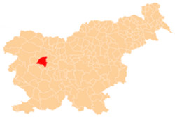
| Municipality | Gorenja Vas–Poljane |
| Area | |
| • Total | 1.59 km2 (0.61 sq mi) |
| Elevation | 713.5 m (2,340.9 ft) |
| Population (2002) | |
| • Total | 26 |
| [1] | |
Kremenik (pronounced [kɾɛˈmeːnik]) is a large dispersed settlement in the plains south of Poljane nad Škofjo Loko in the Municipality of Gorenja Vas–Poljane in the Upper Carniola region of Slovenia.[2]
References
- ↑ Statistical Office of the Republic of Slovenia Archived November 18, 2008, at the Wayback Machine.
- ↑ Gorenja Vas–Poljane municipal site
External links
| Settlements | Administrative centre: Gorenja Vas
|  |
|---|---|---|
| Landmarks |
| |
| Notable people | ||
This article is issued from Wikipedia - version of the 11/15/2016. The text is available under the Creative Commons Attribution/Share Alike but additional terms may apply for the media files.