Konecchlumí
| Konecchlumí | |
| Village | |
 Church of SS Peter and Paul (1728-29) | |
| Name origin: (site at) end of a hill | |
| Country | Czech Republic |
|---|---|
| Region | Hradec Králové |
| District | Jičín |
| Little District | Jičín |
| Parts | Konecchlumí, Kamenice |
| Elevation | 283 m (928 ft) |
| Coordinates | CZ 50°24′10″N 15°29′19″E / 50.40278°N 15.48861°ECoordinates: CZ 50°24′10″N 15°29′19″E / 50.40278°N 15.48861°E |
| Area | 7.19 km2 (2.78 sq mi) |
| Population | 328 (2006-08-28) |
| Density | 46/km2 (119/sq mi) |
| First mentioned | 1226 |
| Mayor | Václav Kunčík |
| Timezone | CET (UTC+1) |
| - summer (DST) | CEST (UTC+2) |
| Postal code | 506 01 - 507 05 |
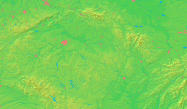  Location in the Czech Republic | |
| Wikimedia Commons: Konecchlumí | |
| Website: www | |
Konecchlumí (Czech pronunciation: [ˈkonɛtsxlumiː]) is a village and municipality in Hradec Králové Region of the Czech Republic located about 10 km (6.2 mi) east-southeast of Jičín.
| Wikimedia Commons has media related to Konecchlumí. |
This article is issued from Wikipedia - version of the 4/7/2016. The text is available under the Creative Commons Attribution/Share Alike but additional terms may apply for the media files.