Knowlton Township, New Jersey
| Knowlton Township, New Jersey | |
|---|---|
| Township | |
| Township of Knowlton | |
|
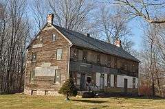
An old barn in Knowlton Township | |
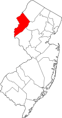
 Map of Knowlton Township in Warren County. Inset: Location of Warren County in New Jersey. | |
 Census Bureau map of Knowlton Township, New Jersey. | |
| Coordinates: 40°55′45″N 75°03′42″W / 40.929261°N 75.061796°WCoordinates: 40°55′45″N 75°03′42″W / 40.929261°N 75.061796°W[1][2] | |
| Country |
|
| State |
|
| County | Warren |
| Royal charter | February 23, 1763 |
| Incorporated | February 21, 1798 |
| Named for | Thomas Knowlton or "knoll town" |
| Government[3] | |
| • Type | Township |
| • Body | Township Committee |
| • Mayor | Adele Starrs (R, term ends December 31, 2016)[4][5] |
| • Clerk | Judy Fisher (acting)[4] |
| Area[1] | |
| • Total | 25.329 sq mi (65.602 km2) |
| • Land | 24.749 sq mi (64.100 km2) |
| • Water | 0.580 sq mi (1.503 km2) 2.29% |
| Area rank |
105th of 566 in state 5th of 22 in county[1] |
| Elevation[6] | 528 ft (161 m) |
| Population (2010 Census)[7][8][9] | |
| • Total | 3,055 |
| • Estimate (2015)[10] | 2,984 |
| • Rank |
449th of 566 in state 14th of 22 in county[11] |
| • Density | 123.4/sq mi (47.6/km2) |
| • Density rank |
533rd of 566 in state 18th of 22 in county[11] |
| Time zone | Eastern (EST) (UTC-5) |
| • Summer (DST) | Eastern (EDT) (UTC-4) |
| ZIP codes |
07825 - Blairstown[12] 07832 - Columbia[13] 07833 - Delaware[14] |
| Area code(s) | 908[15] |
| FIPS code | 3404137320[1][16][17] |
| GNIS feature ID | 0882241[18] |
| Website |
www |

Knowlton Township is a township in Warren County, New Jersey, United States. As of the 2010 United States Census, the township's population was 3,055,[7][8][9] reflecting an increase of 78 (+2.6%) from the 2,977 counted in the 2000 Census, which had in turn increased by 434 (+17.1%) from the 2,543 counted in the 1990 Census.[19]
History
Knowlton Township was created by Royal charter on February 23, 1763, from portions of Oxford Township, while the area was still part of Sussex County, and was incorporated as a township by an act of the New Jersey Legislature on February 21, 1798, and then became part of the newly created Warren County on November 20, 1824. Portions of the township were taken to form Hope Township (April 8, 1839) and Blairstown Township (April 14, 1845).[20]
Knowlton's name is variously attributed to Thomas Knowlton, a Colonel in the Continental Army during the American Revolutionary War who was killed in action at the Battle of Harlem Heights,[21] or to the knolls that characterize the area.[22] The township is served by postal ZIP codes in Columbia (07832) and Delaware (07833), although a small number of Knowlton residents receive postal deliveries via the Blairstown (07825) post office. Within the township are several small hamlets, including Browning, Deckers Ferry, Mount Pleasant, Polkville, Ramseyburg, Warrington and Knowlton itself.[23]
Geography
According to the United States Census Bureau, the township had a total area of 25.329 square miles (65.602 km2), including 24.749 square miles (64.100 km2) of land and 0.580 square miles (1.503 km2) of water (2.29%).[1][2] The township is located in the Kittatinny Valley which is a section of the Great Appalachian Valley that stretches 700 miles (1,100 km) from Canada to Alabama.
Columbia (with a 2010 Census population of 229[24]), Delaware (150[25]) and Hainesburg (91[26]) are unincorporated communities and census-designated places (CDPs) located within the township.[27][28][29]
Other unincorporated communities, localities and place names located partially or completely within the township include Browning, Deckers Ferry, Mount Pleasant, Polkville, Ramseyburg and Warrington.[30]
Demographics
| Historical population | |||
|---|---|---|---|
| Census | Pop. | %± | |
| 1810 | 2,064 | — | |
| 1820 | 2,701 | 30.9% | |
| 1830 | 2,827 | 4.7% | |
| 1840 | 2,310 | * | −18.3% |
| 1850 | 1,356 | * | −41.3% |
| 1860 | 1,557 | 14.8% | |
| 1870 | 1,691 | 8.6% | |
| 1880 | 1,476 | −12.7% | |
| 1890 | 1,411 | −4.4% | |
| 1900 | 1,210 | −14.2% | |
| 1910 | 1,556 | 28.6% | |
| 1920 | 1,073 | −31.0% | |
| 1930 | 1,049 | −2.2% | |
| 1940 | 1,084 | 3.3% | |
| 1950 | 1,260 | 16.2% | |
| 1960 | 1,442 | 14.4% | |
| 1970 | 1,738 | 20.5% | |
| 1980 | 2,074 | 19.3% | |
| 1990 | 2,543 | 22.6% | |
| 2000 | 2,977 | 17.1% | |
| 2010 | 3,055 | 2.6% | |
| Est. 2015 | 2,984 | [10][31] | −2.3% |
| Population sources: 1810-1920[32] 1840[33] 1850-1870[34] 1850[35] 1870[36] 1880-1890[37] 1890-1910[38] 1910-1930[39] 1930-1990[40] 2000[41][42] 2010[7][8][9] * = Lost territory in previous decade[20] | |||
The Township's economic data (as is all of Warren County) is calculated by the US Census Bureau as part of the Allentown-Bethlehem-Easton, PA-NJ Metropolitan Statistical Area.
Census 2010

At the 2010 United States Census, there were 3,055 people, 1,097 households, and 864.4 families residing in the township. The population density was 123.4 per square mile (47.6/km2). There were 1,212 housing units at an average density of 49.0 per square mile (18.9/km2). The racial makeup of the township was 96.07% (2,935) White, 0.92% (28) Black or African American, 0.29% (9) Native American, 0.92% (28) Asian, 0.00% (0) Pacific Islander, 0.75% (23) from other races, and 1.05% (32) from two or more races. Hispanics or Latinos of any race were 3.63% (111) of the population.[7]
There were 1,097 households, of which 33.5% had children under the age of 18 living with them, 66.5% were married couples living together, 8.3% had a female householder with no husband present, and 21.2% were non-families. 16.3% of all households were made up of individuals, and 6.7% had someone living alone who was 65 years of age or older. The average household size was 2.75 and the average family size was 3.10.[7]
In the township, 23.3% of the population were under the age of 18, 7.0% from 18 to 24, 20.2% from 25 to 44, 36.8% from 45 to 64, and 12.7% who were 65 years of age or older. The median age was 44.8 years. For every 100 females there were 101.7 males. For every 100 females age 18 and over, there were 98.1 males.[7]
The Census Bureau's 2006-2010 American Community Survey showed that (in 2010 inflation-adjusted dollars) median household income was $81,346 (with a margin of error of +/- $11,792) and the median family income was $86,708 (+/- $13,339). Males had a median income of $76,733 (+/- $8,158) versus $51,757 (+/- $3,961) for females. The per capita income for the borough was $35,440 (+/- $4,605). About 1.4% of families and 3.3% of the population were below the poverty line, including 3.1% of those under age 18 and 7.7% of those age 65 or over.[43]
Census 2000
As of the 2000 United States Census[16] there were 2,977 people, 1,028 households, and 816 families residing in the township. The population density was 120.1 people per square mile (46.4/km²). There were 1,135 housing units at an average density of 45.8 per square mile (17.7/km²). The racial makeup of the township was 97.45% White, 0.40% African American, 0.07% Native American, 0.64% Asian, 0.47% from other races, and 0.97% from two or more races. Hispanic or Latino of any race were 1.85% of the population.[41][42]
There were 1,028 households out of which 40.0% had children under the age of 18 living with them, 69.1% were married couples living together, 6.6% had a female householder with no husband present, and 20.6% were non-families. 15.0% of all households were made up of individuals and 7.1% had someone living alone who was 65 years of age or older. The average household size was 2.87 and the average family size was 3.21.[41][42]

In the township the population was spread out with 27.6% under the age of 18, 5.7% from 18 to 24, 31.3% from 25 to 44, 24.1% from 45 to 64, and 11.2% who were 65 years of age or older. The median age was 38 years. For every 100 females there were 101.8 males. For every 100 females age 18 and over, there were 98.0 males.[41][42]
The median income for a household in the township was $63,409, and the median income for a family was $72,130. Males had a median income of $46,250 versus $35,326 for females. The per capita income for the township was $24,631. About 1.5% of families and 3.5% of the population were below the poverty line, including 4.2% of those under age 18 and 1.3% of those age 65 or over.[41][42]
Government
Local government

Knowlton Township is governed under the Township form of government. The five-member Township Committee is elected directly by the voters at-large in partisan elections to serve three-year terms of office on a staggered basis, with either one or two seats coming up for election each year as part of the November general election in a three-year cycle.[3][44] At an annual reorganization meeting, the Township Committee selects one of its members to serve as Mayor and another as Deputy Mayor.
As of 2016, the Knowlton Township Committee consists of Mayor M. Adele Starrs (R, term on committee and as mayor ends December 31, 2016), Deputy Mayor Kathy Cuntala (R, term on committee ends 2018; term as deputy mayor ends 2016), Ronald Farber (R, 2017), René Mathez (D, 2016) and Debra L. Shipps (R, 2017).[4][45][46][47][48][49]
Federal, state and county representation

Knowlton Township is located in the 5th Congressional District[50] and is part of New Jersey's 24th state legislative district.[8][51][52] Prior to the 2011 reapportionment following the 2010 Census, Knowlton Township had been in the 23rd state legislative district.[53]
New Jersey's Fifth Congressional District is represented by Scott Garrett (R, Wantage Township).[54] New Jersey is represented in the United States Senate by Cory Booker (D, Newark, term ends 2021)[55] and Bob Menendez (D, Paramus, 2019).[56][57]
For the 2016–2017 session (Senate, General Assembly), the 24th Legislative District of the New Jersey Legislature is represented in the State Senate by Steve Oroho (R, Franklin) and in the General Assembly by Parker Space (R, Wantage Township) and Gail Phoebus (R, Andover Township).[58] The Governor of New Jersey is Chris Christie (R, Mendham Township).[59] The Lieutenant Governor of New Jersey is Kim Guadagno (R, Monmouth Beach).[60]
Warren County is governed by a Board of Chosen Freeholders whose three members are chosen at-large on a staggered basis in partisan elections with one seat coming up for election each year as part of the November general election. At an annual reorganization meeting held in the beginning of January, the board selects one of its members to serve as Freeholder Director and other as Deputy Director. As of 2014, Warren County's Freeholders are Freeholder Director Edward J. Smith (R, Asbury / Franklin Township, 2015), Freeholder Deputy Director Richard D. Gardner (R, Asbury / Franklin Township, 2014) and Freeholder Jason Sarnoski (R, Lopatcong Township, 2016).[61] Constitutional officers elected on a countywide basis are County Clerk Patricia J. Kolb (Blairstown Township),[62] Sheriff David Gallant (Blairstown Township) and Surrogate Kevin O'Neill (Hackettstown).[63][64] The County Administrator, Steve Marvin, is responsible for overseeing the day-to-day operation of the county and its departments.[65]
Politics
As of March 23, 2011, there were a total of 2,008 registered voters in Knowlton Township, of which 418 (20.8% vs. 21.5% countywide) were registered as Democrats, 694 (34.6% vs. 35.3%) were registered as Republicans and 895 (44.6% vs. 43.1%) were registered as Unaffiliated. There as one voter registered to another party.[66] Among the township's 2010 Census population, 65.7% (vs. 62.3% in Warren County) were registered to vote, including 85.7% of those ages 18 and over (vs. 81.5% countywide).[66][67]
In the 2012 presidential election, Republican Mitt Romney received 833 votes (63.1% vs. 56.0% countywide), ahead of Democrat Barack Obama with 441 votes (33.4% vs. 40.8%) and other candidates with 19 votes (1.4% vs. 1.7%), among the 1,320 ballots cast by the township's 2,027 registered voters, for a turnout of 65.1% (vs. 66.7% in Warren County).[68][69] In the 2008 presidential election, Republican John McCain received 918 votes (63.0% vs. 55.2% countywide), ahead of Democrat Barack Obama with 491 votes (33.7% vs. 41.4%) and other candidates with 25 votes (1.7% vs. 1.6%), among the 1,457 ballots cast by the township's 2,045 registered voters, for a turnout of 71.2% (vs. 73.4% in Warren County).[70] In the 2004 presidential election, Republican George W. Bush received 948 votes (65.8% vs. 61.0% countywide), ahead of Democrat John Kerry with 469 votes (32.5% vs. 37.2%) and other candidates with 17 votes (1.2% vs. 1.3%), among the 1,441 ballots cast by the township's 1,899 registered voters, for a turnout of 75.9% (vs. 76.3% in the whole county).[71]
In the 2013 gubernatorial election, Republican Chris Christie received 74.6% of the vote (671 cast), ahead of Democrat Barbara Buono with 22.8% (205 votes), and other candidates with 2.6% (23 votes), among the 915 ballots cast by the township's 2,040 registered voters (16 ballots were spoiled), for a turnout of 44.9%.[72][73] In the 2009 gubernatorial election, Republican Chris Christie received 595 votes (63.8% vs. 61.3% countywide), ahead of Democrat Jon Corzine with 203 votes (21.8% vs. 25.7%), Independent Chris Daggett with 102 votes (10.9% vs. 9.8%) and other candidates with 13 votes (1.4% vs. 1.5%), among the 932 ballots cast by the township's 1,987 registered voters, yielding a 46.9% turnout (vs. 49.6% in the county).[74]
Education
Children in Kindergarten through sixth grade for public school attend Knowlton Township Elementary School as part of the Knowlton Township School District.[75] As of the 2012-13 school year, the district's one school had an enrollment of 244 students and 27.2 classroom teachers (on an FTE basis), for a student–teacher ratio of 8.97:1.[76]
Students in public school for seventh through twelfth grades attend the North Warren Regional High School in Blairstown, a public secondary high school, serving students from the townships of Blairstown, Frelinghuysen, Hardwick and Knowlton.[75][77][78]
Students from the township and from all of Warren County are eligible to attend Ridge and Valley Charter School in Frelinghuysen Township (for grades K-8, with Knowlton students among those given admission preference)[79] or Warren County Technical School in Washington borough (for 9-12),[80] with special education services provided by local districts supplemented throughout the county by the Warren County Special Services School District in Oxford Township (for PreK-12).[75][81]
Recreation
Tunnel Field is the primary recreational site in the township with several baseball and softball diamonds and soccer fields. Tunnel also has a play area (including swings and play area), a basketball court and concession stand. The field is located by Route 94 and is divided by the Lackawanna Cut-Off and is connected through an old tunnel (hence the name).
Transportation


Roads and highways
As of May 2010, the township had a total of 67.96 miles (109.37 km) of roadways, of which 37.33 miles (60.08 km) were maintained by the municipality, 13.67 miles (22.00 km) by Warren County and 16.83 miles (27.09 km) by the New Jersey Department of Transportation and 0.13 miles (0.21 km) by the Delaware River Joint Toll Bridge Commission.[82]
Route 94 passes through the northern portion of the township for 3.92 miles (6.31 km).[83] U.S. Route 46 runs for 5.50 miles (8.85 km) through the township's southern portion.[84] The Portland–Columbia Toll Bridge (part of Route 94), which is owned and operated by the Delaware River Joint Toll Bridge Commission, crosses the Delaware River and connects with Pennsylvania Route 611 in Portland, Pennsylvania.[85][86]
Interstate 80 (Bergen-Passaic Expressway) is the main east-west limited access road, passing through the township for 7.24 miles (11.65 km) with a junction at Routes 94 and 46.[87]
Rail history
Much of Knowlton's development after 1850 can be traced to the presence of the five railroad lines that criss-crossed the township: the Delaware, Lackawanna & Western Railroad's Old Road and, later, the Lackawanna Cut-Off; the New York, Susquehanna and Western Railway; the Lehigh & New England Railroad; and the Blairstown Railway. In subsequent years, all of these rail lines have been abandoned. In their heyday, however, two rail lines and three railroads served the town of Delaware: the New York, Susquehanna and Western (formerly Blairstown) Railway; and the Old Road of the Delaware, Lackawanna and Western Railroad (which also had granted trackage rights to the Pennsylvania Railroad, technically a sixth railroad). The community of Columbia was also served by the NYS&W (Hainesburg also had a station), with the Lehigh and New England Railroad also passing through town.
In more recent years, development within Knowlton has been tied to the presence of U.S. Route 46 and, since the early 1970s, Interstate 80. Many Knowlton residents use Route 80 to commute to their jobs either further east in New Jersey or further west in Pennsylvania. Route 94 crosses through the township. Two bridges cross the Delaware River, connecting the township to Pennsylvania; the Portland–Columbia Toll Bridge, opened in 1953, connects Route 94 to Pennsylvania Route 611 in Portland, Pennsylvania.[88] The two places are also connected by the Portland–Columbia Pedestrian Bridge, which dates back to a structure constructed in 1869 and was dedicated for pedestrian use when the vehicular toll bridge was completed in 1953.[89]
Wineries
Notable people
People who were born in, residents of, or otherwise closely associated with Knowlton Township include:
- Philip Johnson (1818–1867), represented Pennsylvania in the United States House of Representatives from 1861 to 1867.[90]
References
- 1 2 3 4 5 2010 Census Gazetteer Files: New Jersey County Subdivisions, United States Census Bureau. Accessed May 21, 2015.
- 1 2 US Gazetteer files: 2010, 2000, and 1990, United States Census Bureau. Accessed September 4, 2014.
- 1 2 2012 New Jersey Legislative District Data Book, Rutgers University Edward J. Bloustein School of Planning and Public Policy, March 2013, p. 103.
- 1 2 3 Directory, Township of Knowlton. Accessed August 8, 2016.
- ↑ 2016 New Jersey Mayors Directory, New Jersey Department of Community Affairs. Accessed June 14, 2016.
- ↑ U.S. Geological Survey Geographic Names Information System: Township of Knowlton, Geographic Names Information System. Accessed March 7, 2013.
- 1 2 3 4 5 6 DP-1 - Profile of General Population and Housing Characteristics: 2010 for Knowlton township, Warren County, New Jersey, United States Census Bureau. Accessed June 6, 2013.
- 1 2 3 4 Municipalities Grouped by 2011-2020 Legislative Districts, New Jersey Department of State, p. 11. Accessed January 6, 2013.
- 1 2 3 Profile of General Demographic Characteristics: 2010 for Knowlton township, New Jersey Department of Labor and Workforce Development. Accessed June 6, 2013.
- 1 2 PEPANNRES - Annual Estimates of the Resident Population: April 1, 2010 to July 1, 2015 - 2015 Population Estimates for New Jersey municipalities, United States Census Bureau. Accessed May 22, 2016.
- 1 2 GCT-PH1 Population, Housing Units, Area, and Density: 2010 - State -- County Subdivision from the 2010 Census Summary File 1 for New Jersey, United States Census Bureau. Accessed June 6, 2013.
- ↑ Look Up a ZIP Code for Blairstown, NJ, United States Postal Service. Accessed June 6, 2013.
- ↑ Look Up a ZIP Code for Columbia, NJ, United States Postal Service. Accessed June 6, 2013.
- ↑ Look Up a ZIP Code for Delaware, NJ, United States Postal Service. Accessed June 6, 2013.
- ↑ Area Code Lookup - NPA NXX for Blairstown, NJ, Area_Codes.com. Accessed February 4, 2015.
- 1 2 American FactFinder, United States Census Bureau. Accessed September 4, 2014.
- ↑ A Cure for the Common Codes: New Jersey, Missouri Census Data Center. Accessed October 28, 2012.
- ↑ US Board on Geographic Names, United States Geological Survey. Accessed September 4, 2014.
- ↑ Table 7. Population for the Counties and Municipalities in New Jersey: 1990, 2000 and 2010, New Jersey Department of Labor and Workforce Development, February 2011. Accessed June 6, 2013.
- 1 2 Snyder, John P. The Story of New Jersey's Civil Boundaries: 1606-1968, Bureau of Geology and Topography; Trenton, New Jersey; 1969. p. 246. Accessed October 26, 2012.
- ↑ Snell, James P. (1881) History of Sussex and Warren Counties, New Jersey, With Illustrations and Biographical Sketches of its Prominent Men and Pioneers. (Centennial ed., Harmony, NJ: Harmony Press, 1981) pp. 623, 625
- ↑ Home Page, Knowlton Township Historic Commission. Accessed September 2, 2015. "'Knoll town' so called for the prevalent hills and limestone knobs, was sectioned off from Oxford Township in 1768."
- ↑ New Jersey Local Names, State of New Jersey. Accessed January 27, 2014.
- ↑ DP-1 - Profile of General Population and Housing Characteristics: 2010 Demographic Profile Data for Columbia CDP, New Jersey, United States Census Bureau. Accessed June 6, 2013.
- ↑ DP-1 - Profile of General Population and Housing Characteristics: 2010 Demographic Profile Data for Delaware CDP, New Jersey, United States Census Bureau. Accessed June 6, 2013.
- ↑ DP-1 - Profile of General Population and Housing Characteristics: 2010 Demographic Profile Data for Hainesburg CDP, New Jersey, United States Census Bureau. Accessed June 6, 2013.
- ↑ GCT-PH1 - Population, Housing Units, Area, and Density: 2010 - County -- County Subdivision and Place from the 2010 Census Summary File 1 for Warren County, New Jersey, United States Census Bureau. Accessed June 6, 2013.
- ↑ 2006-2010 American Community Survey Geography for New Jersey, United States Census Bureau. Accessed June 6, 2013.
- ↑ New Jersey: 2010 - Population and Housing Unit Counts - 2010 Census of Population and Housing (CPH-2-32), United States Census Bureau, p. III-5, August 2012. Accessed June 6, 2013.
- ↑ Locality Search, State of New Jersey. Accessed April 2, 2015.
- ↑ Census Estimates for New Jersey April 1, 2010 to July 1, 2015, United States Census Bureau. Accessed May 22, 2016.
- ↑ Compendium of censuses 1726-1905: together with the tabulated returns of 1905, New Jersey Department of State, 1906. Accessed June 6, 2013.
- ↑ Bowen, Francis. American Almanac and Repository of Useful Knowledge for the Year 1843, p. 231, David H. Williams, 1842. Accessed June 6, 2013.
- ↑ Raum, John O. The History of New Jersey: From Its Earliest Settlement to the Present Time, Volume 1, p. 272, J. E. Potter and company, 1877. Accessed June 6, 2013. "Knowlton contained in 1850, 1,356 inhabitants; in 1860, 1,557; and in 1870, 1,691."
- ↑ Debow, James Dunwoody Brownson. The Seventh Census of the United States: 1850, p. 141. R. Armstrong, 1853. Accessed June 6, 2013.
- ↑ Staff. A compendium of the ninth census, 1870, p. 260. United States Census Bureau, 1872. Accessed June 6, 2013.
- ↑ Porter, Robert Percival. Preliminary Results as Contained in the Eleventh Census Bulletins: Volume III - 51 to 75, p. 100. United States Census Bureau, 1890. Accessed June 6, 2013.
- ↑ Thirteenth Census of the United States, 1910: Population by Counties and Minor Civil Divisions, 1910, 1900, 1890, United States Census Bureau, p. 339. Accessed June 6, 2013.
- ↑ Fifteenth Census of the United States : 1930 - Population Volume I, United States Census Bureau, p. 719. Accessed June 6, 2013.
- ↑ Table 6. New Jersey Resident Population by Municipality: 1930 - 1990, New Jersey Department of Labor and Workforce Development. Accessed June 28, 2015.
- 1 2 3 4 5 Census 2000 Profiles of Demographic / Social / Economic / Housing Characteristics for Knowlton township, New Jersey, United States Census Bureau. Accessed October 31, 2016.
- 1 2 3 4 5 DP-1: Profile of General Demographic Characteristics: 2000 - Census 2000 Summary File 1 (SF 1) 100-Percent Data for Knowlton township, Warren County, New Jersey, United States Census Bureau. Accessed June 6, 2013.
- ↑ DP03: Selected Economic Characteristics from the 2006-2010 American Community Survey 5-Year Estimates for Knowlton township, Warren County, New Jersey, United States Census Bureau. Accessed June 6, 2013.
- ↑ "Forms of Municipal Government in New Jersey", p. 7. Rutgers University Center for Government Studies. Accessed June 3, 2015.
- ↑ 2016 Municipal Data Sheet, Township of Knowlton. Accessed August 8, 2016.
- ↑ 2015 Official Directory Warren County, New Jersey, Warren County, New Jersey. Accessed August 7, 2016.
- ↑ General Election November 3, 2015 Warren County Official Tally, Warren County, New Jersey, updated November 6, 2015. Accessed August 7, 2016.
- ↑ General Election November 4, 2014 Warren County Official Tally, Warren County, New Jersey, updated November 10, 2014. Accessed August 7, 2016.
- ↑ General Election November 5, 2013 Warren County Official Tally, Warren County, New Jersey, updated November 19, 2013. Accessed August 7, 2016.
- ↑ Plan Components Report, New Jersey Redistricting Commission, December 23, 2011. Accessed January 6, 2013.
- ↑ 2016 New Jersey Citizen's Guide to Government, p. 59, New Jersey League of Women Voters. Accessed July 20, 2016.
- ↑ Districts by Number for 2011-2020, New Jersey Legislature. Accessed January 6, 2013.
- ↑ 2011 New Jersey Citizen's Guide to Government, p. 59, New Jersey League of Women Voters. Accessed May 22, 2015.
- ↑ Directory of Representatives: New Jersey, United States House of Representatives. Accessed January 5, 2012.
- ↑ About Cory Booker, United States Senate. Accessed January 26, 2015. "He now owns a home and lives in Newark's Central Ward community."
- ↑ Biography of Bob Menendez, United States Senate, January 26, 2015. "He currently lives in Paramus and has two children, Alicia and Robert."
- ↑ Senators of the 114th Congress from New Jersey. United States Senate. Accessed January 26, 2015. "Booker, Cory A. - (D - NJ) Class II; Menendez, Robert - (D - NJ) Class I"
- ↑ Legislative Roster 2016-2017 Session, New Jersey Legislature. Accessed January 17, 2016.
- ↑ "About the Governor". State of New Jersey. Retrieved 2010-01-21.
- ↑ "About the Lieutenant Governor". State of New Jersey. Retrieved 2010-01-21.
- ↑ Board of Chosen Freeholders, Warren County, New Jersey. Accessed September 15, 2014.
- ↑ County Clerk's Office, Warren County, New Jersey. Accessed September 15, 2014.
- ↑ Message from Surrogate, Warren County, New Jersey. Accessed September 15, 2014.
- ↑ Constitutional Officers, Warren County, New Jersey. Accessed September 15, 2014.
- ↑ 2013 Official Directory, Warren County, New Jersey. Accessed September 15, 2014.
- 1 2 Voter Registration Summary - Warren, New Jersey Department of State Division of Elections, March 23, 2011. Accessed June 6, 2013.
- ↑ GCT-P7: Selected Age Groups: 2010 - State -- County Subdivision; 2010 Census Summary File 1 for New Jersey, United States Census Bureau. Accessed June 6, 2013.
- ↑ Presidential November 6, 2012 General Election Results - Warren County, New Jersey Department of State Division of Elections, March 15, 2013. Accessed June 6, 2013.
- ↑ Number of Registered Voters and Ballots Cast November 6, 2012 General Election Results - Warren County, New Jersey Department of State Division of Elections, March 15, 2013. Accessed June 6, 2013.
- ↑ 2008 Presidential General Election Results: Warren County, New Jersey Department of State Division of Elections, December 23, 2008. Accessed June 6, 2013.
- ↑ 2004 Presidential Election: Warren County, New Jersey Department of State Division of Elections, December 13, 2004. Accessed June 6, 2013.
- ↑ "Governor - Warren County" (PDF). New Jersey Department of Elections. January 29, 2014. Retrieved December 24, 2014.
- ↑ "Number of Registered Voters and Ballots Cast - November 5, 2013 - General Election Results - Warren County" (PDF). New Jersey Department of Elections. January 29, 2014. Retrieved December 24, 2014.
- ↑ 2009 Governor: Warren County, New Jersey Department of State Division of Elections, December 31, 2009. Accessed June 6, 2013.
- 1 2 3 Municipal Guide to Public School Districts, Warren County, New Jersey. Accessed September 12, 2013.
- ↑ District information for Knowlton Township School District, National Center for Education Statistics. Accessed April 2, 2015.
- ↑ North Warren Regional High School 2014 Report Card Narrative, New Jersey Department of Education. Accessed July 19, 2016. "The North Warren Regional School District is home to approximately 950 students from the communities of Blairstown, Frelinghuysen, Hardwick, and Knowlton."
- ↑ Home Page, North Warren Regional School District. Accessed September 12, 2013. "The North Warren Regional School District is home to just under 1100 students from the communities of Blairstown, Frelinghuysen, Hardwick, and Knowlton. The district stretches almost 97 square miles from the Sussex County border to the Delaware River and the Delaware Water Gap National Recreation Area."
- ↑ Overview, Ridge and Valley Charter School. Accessed September 12, 2013. "Enrollment is open to any child in New Jersey, with preference for students from the districts of Blairstown, Frelinghuysen, Hardwick, Knowlton and North Warren Regional."
- ↑ About Us, Warren County Technical School. Accessed September 12, 2013.
- ↑ About, Warren County Special Services School District. Accessed September 12, 2013.
- ↑ Warren County Mileage by Municipality and Jurisdiction, New Jersey Department of Transportation, May 2010. Accessed July 18, 2014.
- ↑ New Jersey Route 94 Straight Line Diagram, New Jersey Department of Transportation, April 2014. Accessed August 8, 2016.
- ↑ U.S. Route 46 Straight Line Diagram, New Jersey Department of Transportation, July 2014. Accessed August 8, 2016.
- ↑ Portland-Columbia Toll Bridge, Delaware River Joint Toll Bridge Commission. Accessed August 8, 2016.
- ↑ Enlarged View of Interstate 80, U.S. Route 46 and New Jersey Route 94 in Knowlton Township, New Jersey Department of Transportation, June 2009. Accessed August 8, 2016.
- ↑ Interstate 80 Straight Line Diagram, New Jersey Department of Transportation, April 2014. Accessed August 8, 2016.
- ↑ Portland-Columbia Toll Bridge, Delaware River Joint Toll Bridge Commission. Accessed June 6, 2013. "Opened to traffic on December 1, 1953, the main river bridge consists of a ten-span steel girder system with total length of 1,309 feet and a 32-foot curb-to-curb width."
- ↑ Portland-Columbia Toll Supported Pedestrian Bridge, Delaware River Joint Toll Bridge Commission. Accessed June 6, 2013. "The original structure, constructed in 1869 as a vehicular bridge, was a four-span timber bridge reinforced with wooden arches."
- ↑ Philip Johnson, Biographical Directory of the United States Congress. Accessed October 11, 2007.
External links
- Knowlton Township website
- Warren County page for Knowlton Township
- Knowlton Township School District's 2014–15 School Report Card from the New Jersey Department of Education
- School Data for the Knowlton Township School District, National Center for Education Statistics
- North Warren Regional School District
- North Warren Regional High School's 2014–15 School Report Card from the New Jersey Department of Education
- School Data for the North Warren Regional High School, National Center for Education Statistics
 |
Hardwick Township | | ||
| Portland, PA and Upper Mount Bethel Township, PA |
|
Blairstown Township | ||
| ||||
| | ||||
| White Township | Hope Township |