Klaipėda
| Klaipėda | |||
|---|---|---|---|
| City | |||
|
Klaipėda in mid-July 2014 | |||
| |||
| Nickname(s): Uostamiestis (port city) | |||
 Location of Klaipėda | |||
| Coordinates: 55°42′40″N 21°07′50″E / 55.71111°N 21.13056°ECoordinates: 55°42′40″N 21°07′50″E / 55.71111°N 21.13056°E | |||
| Country |
| ||
| Ethnographic region | Lithuania minor | ||
| County | Klaipėda County | ||
| Municipality | Klaipėda city municipality | ||
| Capital of |
Klaipėda County Klaipėda city municipality | ||
| First mentioned | 1252 | ||
| Granted city rights | 1254 | ||
| Elderships | Melnragė and Giruliai | ||
| Area | |||
| • City | 110 km2 (40 sq mi) | ||
| • Metro | 5,209 km2 (2,011 sq mi) | ||
| Elevation | 21 m (69 ft) | ||
| Population (2016-01-20) | |||
| • City | 154,275 | ||
| • Metro | 324,628 | ||
| Time zone | EET (UTC+2) | ||
| • Summer (DST) | EEST (UTC+3) | ||
| Postal code | 91100-96226 | ||
| Area code(s) | (+370) 46 | ||
| GDP (nominal), Klaipėda county[1] | 2015 | ||
| - Total | €4.3 billion | ||
| - Per capita | €13,200 | ||
| Website |
www | ||


Klaipėda (Lithuanian pronunciation: [ˈkɫɐɪˑpʲeːd̪ɐ]) English pronunciation: /klaɪpeɪdə/ (German (formerly official) name: Memel, German pronunciation: [ˈmeːməl]), is a city in Lithuania on the Baltic Sea coast. It is the third largest city in Lithuania and the capital of Klaipėda County.
The city has a complex recorded history, partially due to the combined regional importance of the usually ice-free Port of Klaipėda at the mouth of the Akmena-Danė River. It was controlled by successive German states until the 1919 Treaty of Versailles. As a result of the 1923 Klaipėda Revolt it was added to Lithuania and has remained with Lithuania to this day, except for the period between 1939 and 1945 when it returned to the Third Reich following the 1939 German ultimatum to Lithuania.
The population has shrunk from 207,100 in 1992 to 157,350 in 2014.[2] Popular seaside resorts found close to Klaipėda are Nida to the south on the Curonian Spit, and Palanga to the north.
Names

The Teutonic Knights built a castle in the *Pilsāts Land of the Curonians and named it Memelburg; later the name was shortened to Memel. From 1252–1923 and from 1939–1945, the town and city was officially named Memel. Due to political changes between 1923 and 1939, both names were in official use; since 1945 the Lithuanian name of Klaipėda is used.
The names Memelburg and Memel are found in most written sources from the 13th century onwards, while Klaipėda is found in Lithuania-related sources since the 15th century. The first time the city was mentioned as Caloypede in the letter of Vytautas in 1413,[3] for the second time in the negotiation documents of 1420 as Klawppeda,[4] and for the third time in the Treaty of Melno of 1422 as Cleupeda. According to Samogitian folk etymology, the name Klaipėda refers to the boggy terrain of the town (klaidyti=obstruct and pėda=foot). Most likely the name is of Curonian origin and means "even ground": "klais/klait" (flat, open, free) and "ped" (sole of the foot, ground).
The lower reaches of the Neman River were named either *Mēmele or *Mēmela by Scalovians and local Curonian inhabitants. In the Latvian Curonian language it means mute, silent (memelis, mimelis, mēms). This name was adopted by speakers of German and also chosen for the new city founded further away at the lagoon.
Coat of arms

The coat of arms of Klaipėda is also used as coat of arms of Klaipėda city municipality. The modern version was created by the designer Kęstutis Mickevičius. The modern coat of arms was created by restoring old seals of the Memel city (analogous with those used in the years 1446, 1605 and 1618). It was affirmed on 1 July 1992.
History
Teutonic Knights
A settlement of Baltic tribes in the territory of the present-day city is said to have existed in the region as early as the 7th century.
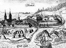
In the 1240s the Pope offered King Håkon IV of Norway the opportunity to conquer the peninsula of Sambia. However, following the personal acceptance of Christianity by Grand Duke Mindaugas of Lithuania, the Teutonic Knights and a group of crusaders from Lübeck moved into Sambia, founding unopposed a fort in 1252 recorded as Memele castrum (or Memelburg, "Memel Castle"). The fort's construction was completed in 1253 and Memel was garrisoned with troops of the Teutonic Order, administered by Deutschmeister Eberhard von Seyne. Documents for its foundation were signed by Eberhard and Bishop Heinrich von Lützelburg of Courland on 29 July 1252 and 1 August 1252.
Master Conrad von Thierberg used the fortress as a base for further campaigns along the Neman River and against Samogitia. Memel was unsuccessfully besieged by Sambians in 1255, and the scattered Sambians submitted by 1259. Memel was colonized by settlers from Holstein, Lübeck and Dortmund, hence Memel also being known at the time as Neu-Dortmund, or "New Dortmund". It became the main town of the Diocese of Curonia, with a cathedral and at least two parochial churches, but the development of the castle became the dominant priority. According to different sources, Memel received Lübeck city rights in 1254[5] or 1258.[6]
In the spring and summer of 1323, a Lithuanian army led by Gediminas came up the Neman and laid siege to the castle of Memel after conquering the town, and devastated Sambia, forcing the Order to sue for a truce in October. During the planning of a campaign against Samogitia, Memel's garrison of the Teutonic Order's Livonian branch was replaced with knights from the Prussian branch in 1328. Threats and attacks by Lithuanians greatly thwarted the town's development; the town and the castle were both sacked by Lithuanian tribes in 1379, while Samogitians attacked 800 workers rebuilding Memel in 1389.
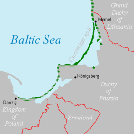
The Treaty of Melno in 1422 stabilized the border between the Teutonic Order and the Grand Duchy of Lithuania for the next 501 years. The rebuilt town received Kulm law city rights in 1475. Memel remained part of what became Prussia and Germany; the border to Lithuania remained unchanged until 1919. It was one of the longest-lasting borders in Europe, and is referred to in the now-unsung first verse of the German national anthem, which describes borders of German-speaking lands: Von der Maas bis an die Memel, referring to the Meuse river in the West and Neman river in the East.
Duchy of Prussia
Against the wishes of its governor and commander, Eric of Brunswick-Wolfenbüttel, Memel adopted Lutheranism after the conversion of Hohenzollern Margrave of Brandenburg Albert of Prussia and the creation of the Duchy of Prussia as a fief of Poland in 1525. It was the onset of a long period of prosperity for the city and port. It served as a port for neighbouring Lithuania, benefiting from its location near the mouth of the Neman, with wheat as a profitable export. The Duchy of Prussia was inherited by a relative, John Sigismund, the Hohenzollern prince-electors of the March of Brandenburg in 1618. Brandenburg-Prussia began active participation in regional policy, which affected the development of Memel. From 1629–1635, the town was occupied by Sweden over several periods during the Polish-Swedish War of 1625–1629 and the Thirty Years' War.
After the Treaty of Königsberg in 1656 during the Northern Wars, Elector Frederick William opened Memel's harbor to Sweden, with whom the harbor's revenue was divided. Prussian independence from Poland and Sweden was affirmed in the Treaty of Oliva in 1660.
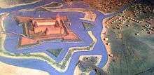
The construction of a defence system around the entire town, initiated in 1627, noticeably changed its status and prospects. In November 1678 a small Swedish army invaded Prussian territory, but was unable to capture the fortress of Memel.
Kingdom of Prussia

By the beginning of the 18th century, Memel was one of the strongest fortresses (Memelfestung) in Prussia, and the town became part of the Kingdom of Prussia in 1701. Despite its fortifications, it was captured by Russian troops during the Seven Years' War in 1757. Consequently, from 1757–1762 the town, along with the rest of eastern Prussia, was dependent on the Russian Empire. After this war ended, the maintenance of the fortress was neglected, but the town's growth continued.
Memel became part of the province of East Prussia within the Kingdom of Prussia in 1773. In the second half of the 18th century Memel's lax customs and Riga's high duties enticed English traders, who established the first industrial sawmills in the town. In 1784, 996 ships arrived in Memel, 500 of which were English. (In 1900 there was still an active English church in Memel, as well as a "British Hotel"). The specialisation in wood manufacturing guaranteed Memel's merchants income and stability for more than a hundred years. During this era it also normalised its trade relations with Königsberg; regional instability had degraded relations since the 16th century.

Memel prospered during the second half of the 18th century by exporting timber to Great Britain for use by the Royal Navy. In 1792, 756 British ships visited the town to transport lumber from the Lithuanian forests near Memel. In 1800 its imports consisted chiefly of salt, iron and herrings; the exports, which greatly exceeded the imports, were corn, hemp, flax, and, particularly, timber. The 1815 Encyclopædia Britannica stated that Memel was "provided with the finest harbour in the Baltic".
During the Napoleonic Wars, Memel became the temporary capital of the Kingdom of Prussia. Between 1807 and 1808, the town was the residence of King Frederick William III, his consort Louise, his court, and the government. On 9 October 1807 the king signed a document in Memel, later called the October Edict, which abolished serfdom in Prussia. It originated the reforms of Karl Freiherr vom und zum Stein and Karl August von Hardenberg. The land around Memel suffered major economic setbacks under Napoleon Bonaparte's Continental System. During Napoleon's retreat from Moscow after the failed invasion of Russia in 1812, General Yorck refused Marshal MacDonald's orders to fortify Memel at Prussia's expense.
German Empire
After the unification of Germany into the German Empire in 1871, Memel had the distinction of being Germany's most northerly city.
The development of the town in the 19th century was influenced by the industrial revolution in Prussia and the attendant processes of urbanisation. Even though the population of Memel increased fourfold during the 19th century, and had risen to 21,470 by 1910, its pace of development lagged in comparison. The reasons for this were mostly political. Memel was the northernmost and easternmost city in Germany, and although the government was engaged in a very costly tree-planting exercise to stabilise the sand-dunes on the Curonian Spit, most of the financial infusions in the province of East Prussia were concentrated in Königsberg, the capital of the province. Some notable instances of the German infrastructure investments in the area included sandbar blasting and a new ship canal between Pillau and Königsberg, which enabled vessels of up to 6.5 m draughts to moor alongside the city, at a cost of 13 million marks.
Owing to the absence of heavy industry in the 1870s and 1880s, the population of Memel stagnated, although wood manufacturing persisted as the main industry. It remained the central point of the Baltic timber-trade. A British Consul was located in the town in 1800; in 1900 a British Vice-Consul was recorded there, as well as a Lloyd's Agent.
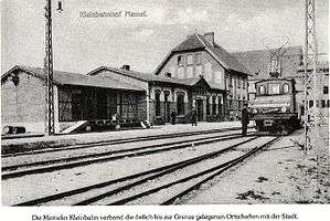
By 1900 steamer services had been established between Memel and Cranz (on the southern end of the Curonian Spit), and also between Memel and Tilsit. A main-line railway was built from Insterburg, the main East Prussian railway junction, to St. Petersburg via Eydtkuhnen, the Prussian frontier station. The Memel line also ran from Insterburg via Tilsit, where a further direct line connected with Königsberg, that crossed the 4 kilometres (2 miles) wide Memel River Valley over three bridges before its arrival in Memel.
During the second half of the 19th century, Memel was a center for the publication of books printed in the Lithuanian language using the Latin alphabet – these publications were prohibited in the nearby Russian Empire of which Lithuania was a province. The books were then smuggled over the Lithuanian border.
The German 1910 census lists the Memel Territory population as 149,766, of whom 67,345 declared Lithuanian to be their first language. The Germans greatly predominated in the town and port of Memel as well as in other nearby villages; the Lithuanian population was predominant in the area's rural districts.[7]
Inter-war years


Under the Treaty of Versailles after World War I, Klaipėda and the surrounding Klaipėda Region (Memel Territory) were detached from Germany and made a protectorate of the Entente States. The French became provisional administrators of the region until a more permanent solution could be worked out. Both Lithuania and Poland campaigned for their rights in the region. However, it seemed that the region would become a free city, similar to the Free City of Danzig. Not waiting for an unfavorable decision, the Lithuanians decided to stage the Klaipėda Revolt, take the region by force, and present the Entente with fait accompli. The revolt was carried out in January 1923 while western Europe was distracted by the occupation of the Ruhr. The Germans tacitly supported the action, while the French offered only limited resistance.[8] The League of Nations protested the revolt, but accepted the transfer in February 1923. The formal Klaipėda Convention was signed in Paris on 8 May 1924, securing extensive autonomy for the region.[9]
The annexation of the city had enormous consequences for the Lithuanian economy and foreign relations. The region subsequently accounted for up to 30% of the Lithuania's entire production. Between 70% and 80% of foreign trade passed through Klaipėda. The region, which represented only about 5% of Lithuania's territory, contained a third of its industry.[10] Weimar Germany, under Foreign Minister Gustav Stresemann, maintained normal relations with Lithuania. However, Nazi Germany desired to reacquire the region and tensions rose. Pro-German parties won clear supermajorities in all elections to the Klaipėda Parliament, which often antagonized with the Lithuanian-appointed Klaipėda Directorate. Lithuanian efforts to "re-Lithuanize" Prussian Lithuanians by promoting Lithuanian language, culture, education were often met with resistance from the locals. In 1932, a conflict between the Parliament and the Directorate had to be resolved by the Permanent Court of International Justice. In 1934–1935, the Lithuanians attempted to combat increasing Nazi influence in the region by arresting and prosecuting over 120 Nazi activists for the alleged plot to organize an anti-Lithuanian rebellion.[11] Despite rather harsh sentences, the defendants in the so-called Neumann–Sass case were soon released under pressure from Nazi Germany. The extensive autonomy guaranteed by the Klaipėda Convention prevented Lithuania from blocking the growing pro-German attitudes in the region.
As tensions in pre-war Europe continued to grow, it was expected that Germany would make a move against Lithuania to reacquire the region. German Foreign Minister Joachim von Ribbentrop delivered an ultimatum to the Lithuanian Foreign Minister on 20 March 1939, demanding the surrender of Klaipėda. Lithuania, unable to secure international support for its cause, submitted to the ultimatum and, in exchange for the right to use the new harbour facilities as a Free Port, ceded the disputed region to Germany in the late evening of 22 March 1939. Adolf Hitler personally visited the harbour and delivered a speech to the city residents. This was Hitler's last territorial acquisition prior to World War II.
1945–present

During World War II, from the end of 1944 into 1945, as Allied victory appeared imminent, the inhabitants fled as the fighting drew nearer. The nearly empty city was captured by the Soviet Red Army on 28 January 1945 with only about 50 remaining people. After the war the Memel Territory was incorporated into the Lithuanian SSR, marking the start of a new epoch in the history of the city.[12]

The Soviets transformed Klaipėda, the foremost ice-free port in the Eastern Baltic, into the largest piscatorial-marine base in the European USSR. A gigantic shipyard, dockyards, and a fishing port were constructed. Subsequently, by the end of 1959, the population of the city had doubled its pre-war population, and by 1989 there were 203,000 inhabitants. In the aftermath of World War II almost all the new residents came to Klaipėda from Lithuania, Russia, Belarus and Ukraine. Initially the Russian-speakers dominated local government in the city, but after the death of Joseph Stalin, more people came to the city from the rest of Lithuania than from other Soviet republics and oblasts; Lithuanians then became its major ethnic group. Among Lithuanian cities with a population greater than 100,000, however, Klaipėda has the highest percentage of people whose native language is Russian.
Until the 1970s, Klaipėda was only important to the USSR for its economy, while cultural and religious activity was minimal and restricted. The developers of a Roman Catholic church (Maria, Queen of Peace, constructed 1957–1962) were arrested. The city began to develop cultural activities in the 1970s and 1980s, such as the introduction of the Sea Festival cultural tradition, where thousands of people come to celebrate from all over the country. Based on the Pedagogical University of Šiauliai and the National Conservatory of Lithuania in Klaipėda, the University of Klaipėda was established in 1991. Klaipėda is now the home of a bilingual German-Lithuanian institution, the Hermann-Sudermann-Schule, as well as an English-language University, LCC International University.
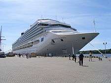
In 2014 Klaipėda was visited 64 times by cruise ships, surpassing the Latvian capital, Riga, for the first time.[13]
Kursenieki
While today the Kursenieki, also known as Kuršininkai are a nearly extinct Baltic ethnic group living along the Curonian Spit, in 1649 Kuršininkai settlement spanned from Memel (Klaipėda) to Danzig (Gdańsk). The Kuršininkai were eventually assimilated by the Germans, except along the Curonian Spit where some still live. The Kuršininkai were considered Latvians until after World War I when Latvia gained independence from the Russian Empire, a consideration based on linguistic arguments. This was the rationale for Latvian claims over the Curonian Spit, Memel, and other territories of East Prussia which would be later dropped.
| Historical populations | [14] | ||
|---|---|---|---|
| Year | Population | ||
| 1722 | 3,400 | ||
| 1782 | 5,500 | ||
| 1790 | 6,300 | ||
| 1813 | 7,230 | ||
| 1823 | 5,300 | ||
| 1837 | 9,000 | ||
| 1855 | 17,000 | ||
| 1861 | 17,500 | ||
| 1875 | 20,000 | ||
| 1890 | 19,282 | ||
| 1897 | 20,100 | ||
| 1905 | 20,700 | ||
| 1924 | 36,187 | ||
| 1938 | 47,189 | ||
| 1950 | 48,500 | ||
| 1959 | 89,500 | ||
| 1970 | 140,342 | ||
| 1979 | 176,648 | ||
| 1992 | 207,100 | ||
| 2001 | 192,954 | ||
| 2011 | 162,690 | ||
| 2014 | 157,350 | ||

Demographics

As of 2007, the population was 185,936. The population by age was: 0–14 14.0%, 15–59 67.1%, 60+ 18.9% There were 85,493 men and 100,443 women in the city. The ethnic composition after population census in 2011 was:[16]
- Lithuanians 73,9%
- Russians 19,6%
- Ukrainians 1,9%
- Belarusians 1.7%
- Poles 0.3%
- Other 2,6%
Of the city's area of 98 square kilometres (38 sq mi), 38% was used for buildings, 1.4% for roads, 8.45% for farming, 14.08% was water, and the remaining 38% was "other uses". Klaipėda contained 17 post offices, a railroad station, a bus station, a harbour, 26 hotels, 4 Catholic chapels,a synagogue, 10 museums, 4 theaters, and 15 sport centers.
City municipality
Klaipėda city municipality council is the governing body of the Klaipėda city municipality. It is responsible for municipal laws. The council is composed of 31 members elected for four-year terms.
The council is the member of the Association of Local Authorities in Lithuania.
Mayors
- 1990–1992 – Povilas Vasiliauskas
- 1992–1994 – Benediktas Petrauskas
- 1994–1995 – Jurgis Aušra
- 1995–1997 – Silverijus Šukys
- 1997–2000 and 2000–2001 – Eugenijus Gentvilas
- 2001–2003, 2003–2007, 2007–2011 – Rimantas Taraškevičius
- 2011–present – Vytautas Grubliauskas
Geography
Climate

Klaipėda's climate is oceanic (Köppen Cfb), but quite close to being humid continental (Köppen Dfb). Winters are cold to mild, and summers are warm. In July and August, the warmest season, high temperatures average 20 °C (68 °F), and low temperatures average 14 °C (57 °F). The highest official temperature ever recorded was 36.6 °C (97.9 °F) in August 2014. In January and February, the coldest season, high temperatures average 0 °C (32 °F) with low temperatures averaging −5 °C (23 °F). The coldest temperature ever recorded in Klaipėda is −33.4 °C (−28.1 °F) in February 1956. The wettest month is November with a mean total precipitation 90 mm (3.5 inches). Not only November, but also August, September and October are wet months because of the warmth of the Baltic sea in relation to the continent and the westerly winds. The driest month is February averaging 31 mm (1.2 in) of total precipitation. Spring is not particularly wet.
Klaipėda is a windy city with many stormy days per year. In autumn and winter, gales are not unusual. Sea breezes are common from April to September. Snow can fall from October to April and a phenomenon resembling lake-effect snow is frequent. Severe snowstorms can paralyze the city in winter.
Klaipėda has unsettled weather all year round. One winter can be cold and snowy, similar to that in Moscow, while another one can be mild, windy, and rainy, similar to the weather in Scotland. August 2005 was very rainy, while August 2002 barely had any precipitation at all.
| Climate data for Klaipėda | |||||||||||||
|---|---|---|---|---|---|---|---|---|---|---|---|---|---|
| Month | Jan | Feb | Mar | Apr | May | Jun | Jul | Aug | Sep | Oct | Nov | Dec | Year |
| Record high °C (°F) | 8.7 (47.7) |
15.4 (59.7) |
17.1 (62.8) |
27.0 (80.6) |
30.0 (86) |
34.0 (93.2) |
34.0 (93.2) |
36.6 (97.9) |
30.4 (86.7) |
22.2 (72) |
15.4 (59.7) |
10.3 (50.5) |
36.6 (97.9) |
| Average high °C (°F) | −0.4 (31.3) |
−0.4 (31.3) |
3.2 (37.8) |
8.9 (48) |
15.0 (59) |
18.3 (64.9) |
19.9 (67.8) |
20.1 (68.2) |
16.4 (61.5) |
11.5 (52.7) |
6.2 (43.2) |
2.3 (36.1) |
10.1 (50.2) |
| Daily mean °C (°F) | −2.8 (27) |
−2.6 (27.3) |
0.3 (32.5) |
5.0 (41) |
10.6 (51.1) |
14.3 (57.7) |
16.6 (61.9) |
16.8 (62.2) |
13.3 (55.9) |
9.0 (48.2) |
3.9 (39) |
−0.1 (31.8) |
7.0 (44.6) |
| Average low °C (°F) | −5.2 (22.6) |
−5.1 (22.8) |
−2.2 (28) |
2.0 (35.6) |
6.9 (44.4) |
10.9 (51.6) |
13.6 (56.5) |
13.6 (56.5) |
10.2 (50.4) |
6.4 (43.5) |
1.7 (35.1) |
−2.5 (27.5) |
4.2 (39.6) |
| Record low °C (°F) | −32.0 (−25.6) |
−33.4 (−28.1) |
−20.8 (−5.4) |
−12.8 (9) |
−4.0 (24.8) |
−0.7 (30.7) |
4.9 (40.8) |
2.9 (37.2) |
−2.1 (28.2) |
−9.1 (15.6) |
−14.4 (6.1) |
−24.2 (−11.6) |
−33.4 (−28.1) |
| Average precipitation mm (inches) | 50 (1.97) |
31 (1.22) |
39 (1.54) |
36 (1.42) |
39 (1.54) |
56 (2.2) |
74 (2.91) |
83 (3.27) |
89 (3.5) |
80 (3.15) |
90 (3.54) |
68 (2.68) |
735 (28.94) |
| Average precipitation days | 19 | 15 | 15 | 12 | 12 | 12 | 13 | 14 | 16 | 16 | 19 | 20 | 183 |
| Mean monthly sunshine hours | 34 | 65 | 122 | 180 | 264 | 285 | 274 | 252 | 167 | 100 | 40 | 28 | 1,811 |
| Source #1: World Meteorological Organization (UN) [17] | |||||||||||||
| Source #2: NOAA [18] | |||||||||||||

.jpg)
Parks and forests
Parks:
|
|
|
Forests:
- Klaipeda Forest
- Giruliai Forest
- Smiltyne Forest
Port of Klaipėda

The Port of Klaipėda is the principal ice-free port on the eastern coast of the Baltic Sea. It is the most important Lithuanian transportation hub, connecting sea, land and railway routes from East to West. Klaipėda is a multipurpose, universal, deep-water port. Nineteen big stevedoring companies, ship-repair and shipbuilding yards operate within the port and all marine business and cargo handling services are rendered.
The annual port cargo handling capacity is up to 40 Mt. The port operates 24 hours a day, seven days a week, all year round.
Infrastructure
Notable buildings

The tallest building in Klaipėda is 34-storey Pilsotas.
| Name | Stories | Height | Built | Purpose | Status |
|---|---|---|---|---|---|
| Pilsotas | 34 | 111.9 m. | 2007 | Residential | Built |
| BIG 2 Complex | 25 | 72–82 m. | 2009 | Mixed use | Built |
| K Tower | 20 | 71.9 m. | 2006 | Office | Built |
| D Tower | 20 | 71.9 m. | 2006 | Residential | Built |
| Klaipėdos burė | 22 | 66 m. | 2009 | Residential | Built |
| Aukštoji Smeltė | 20 | 66 m. | 2009 | Residential | Under construction |
| Minijos Banga | 20 | 62.2 m. | 2007 | Residential | Built |
| Neapolis Business Centre | 16 | 56.7 m. | 2007 | Office | Built |
| Baltijos Avenue Tower | 15 | 50 m. | 2002 | Residential | Built |
| Vėtrungė | 13 | 42 m. | – | Retail | Built |
Transportation


Klaipėda's public transport is very logical and comfortable for travelling because of its geographical peculiarity the city has expanded along the coast, from north to south. In the beginning of year 2007 a new electronic monthly ticket system was introduced. It is possible to buy an electronic card in shops and newspaper stands and top it up with an appropriate amount of money. Public transport organizing, supervising and coordinating body is a Public Enterprise Klaipėda city passenger transport.
The principal public transport routes in Klaipėda are:
- 3 – From Žvejybos uostas to Klaipėda north;
- 6 – From south city microdistrict to Melnragė;
- 8 – From south city microdistrict to Klaipėda's Bus Station and Railway Stations;
- The special routes 1, 1A, 12, and 19 carry workers to the biggest harbour enterprises.
Klaipėda is serviced by Klaipėda Airport. Domestic and international commercial scheduled airline services are provided by Palanga International Airport.
Old town
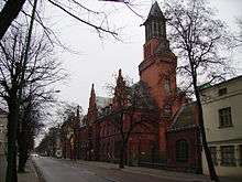
Klaipėda's Old Town is notable among other towns in Lithuania for its abundance of German and Scandinavian architecture. Klaipėda's Old Town is unique with its fachwerk architectural style and the planned street structure, which is uncharacteristic to any other old town in Lithuania. Its streets are geometrically configured very correctly, and the angle of intersection is always straight.
One of most popular places in Klaipėda‘s old town is The Theatre Square. hosts a variety of concerts, the Sea Festival, the International Jazz Festival and other events. An important focus of the Theatre Square is the Tarawa Anike sculpture depicting a youthful barefoot girl. The sculpture was erected in the memory of the poet Simonas Dachas and perpetuates one of the poet’s described heroes.[19]
Culture and contemporary life


.jpg)
.jpg)

Historical
Klaipėda's main attractions are the historic buildings in the city's centre, dating from the 13th to 18th centuries. Some of its older buildings have picturesque half-timbered construction, similar to that found in Germany, France, England, Denmark and southern Sweden. Other places of interest include:
- The remnants of the Klaipėda Castle, built in the 13th century by the Teutonic Order. It had a massive bulk and a quadrangular tower, surrounded by the ramparts and brick bastions. It lost importance after the Russian occupation from 1756 to 1762, and thenceforth started to decay.
- The Žardė ancient settlement, situated on the right bank of the Smiltelė River. It is dated to the late Iron Age (10th century), and was inhabited until the 16th century.
- The remnants of the so-called "Dutch" defence system around the entire town from the 17th–18th centuries.
- The maritime museum in Fort Wilhelm, built at the end of the 19th century at the spike of the Curonian Spit.
Cinemas
- Forum cinemas
- Cinamon cinemas
Theatres
- Klaipėda Musical theatre
- Klaipėda Drama theatre
- Klaipėda Puppet theatre
Museums
- Castle museum
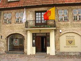
- Lithuania Minor Historical museum
- Blacksmiths museum
- Maritime museum and Dolphinarium
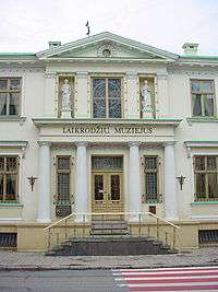
- Clocks museum
Maritime Museum
The museum with 6 different exhibitions is set in a former nineteenth century fortification of the Spit. In the Maritime Museum there is a huge aquarium, the exhibitions of marine fauna, mammals and seabirds. The aquarium is populated with invertebrates, and freshwater fish of Lithuania – many species, not only from the Baltic Sea, but also from various tropical seas. The museum’s courtyard has a pool filled with seals, sea lions and penguins. The marine fauna exhibition has diverse exhibits: mollusc shells, various fossils, algae and other special exhibits, surviving the prehistorical dinosaur times.[20]
Festivals
Annual events include Klaipėda Music Spring, the Klaipėda Castle Jazz Festival, Museum Nights, the International Festival of Street Theatres, the International Short Film Festival, and the Klaipėda Sea Festival, among others.[21]
Sports
| Club | Sport | League | Venue |
|---|---|---|---|
| Neptūnas | Basketball | Lithuanian Basketball League (LKL), Eurocup (Eurocup) | Švyturio Arena |
| Nafta-Uni-Laivitė | Basketball | National Basketball League (NKL) | Žalgirio sporto rūmai |
| Tekoda | Basketball | Regional Basketball League (RKL) | Žalgirio sporto rūmai |
| LCC TU | Basketball | Regional Basketball League (RKL) | Michaelsen Centre |
| Lemminkainen | Basketball | Lithuanian Women Basketball League (LMKL) | Žalgirio Sporto Rūmai |
| Dragūnas | Handball | Lithuanian Handball League (LRL) | Neptūnas Hall |
| Kuršiai | Rugby | Lithuanian Rugby Union I Group | Žalgiris Stadium |
| Atlantas | Football | Lithuanian Football Federation A League (A Lyga) | Žalgiris Stadium |
| FK Klaipedos Granitas | Football | Lithuanian Football Federation A League (A Lyga) | Žalgiris Stadium |
| FK Sendvaris | Football | Sunday football league SFL League (SFL Lyga) | Football school stadium |
| Sadvita | Hockey | Lithuania Hockey League (NVLRL) | Klaipedos Akropolis Ice Arena |
| Skatas - 95 | Hockey | Lithuania Hockey League (NVLRL) | Klaipedos Akropolis Ice Arena |
| Kirai | Hockey | Lithuania Hockey League (NVLRL) | Klaipedos Akropolis Ice Arena |
| Toras | Hockey | Lithuania Hockey League (NVLRL) | Klaipedos Akropolis Ice Arena |
| Marių Meškos | Ultimate | Lithuanian Ultimate Frisbee federation I group | Smiltynė beach, Indoor halls |
| Scala dream | Rock climbing | Inhouse climbing club with top Lithuanian climbers | Indoor climbing facility |
Media
Radio
- Radijas 9 91.4 FM
- Laluna 94.9 FM
- Vox maris 99 FM
- Kelyje 99.8 FM
- Vakarų FM 100.4 FM
- Raduga 100.8 FM
- European Hit Radio 96.2 FM
- Power Hit Radio 96.7 FM
- Zip FM 92.5 FM
Television
Newspapers
- Vakarų ekspresas
- Klaipėda
- 15 Minučių
Notable residents


- Simon Dach (1605–1659), poet and writer of the Ännchen von Tharau song
- Matthäus Prätorius (1635–1704), Protestant pastor, historian, ethnographer
- Michael Wohlfahrt (1687–1741), religious leader in Pennsylvania
- Friedrich Wilhelm Argelander (1799–1875), astronomer
- Yisrael Salanter (1810–1883), founder of Musar movement within Judaism
- Isaac Rülf (1831–1902), editor-in-chief of Memeler Dampfboot, philosopher, activist
- David Wolffsohn (1856–1914), second president of World Zionist Organization
- Julius Kröhl (1820–1867), German-American submarine pioneer
- George Adomeit (1879–1967), painter
- Charlotte Susa (1898–1976), actress
- Werner Wolff (SS officer) (1922-1945)
- Arno Esch (1928–1951) liberal politician in (SBZ) (Soviet Occupied Zone)
- Tomas Venclova (born 1937), poet and author
- Lena Valaitis (born 1943), pop singer
- Hans Henning Atrott (born 1944), philosopher and pro-euthanasia activist
- Leonidas Donskis (1962–2016), philosopher and critic
- Mindaugas Piecaitis (born 1969), conductor and composer of Catcerto for Nora the Piano Cat
- Tomas Danilevičius (born 1978), Lithuanian football (soccer) player
- Eurelijus Žukauskas (born 1973), European basketball champion
- Saulius Štombergas (born 1973), European basketball champion
- Violeta "Sati" Jurkonienė (born 1976), Lithuanian singer
- Arvydas Macijauskas (born 1980), European basketball champion
- Tomas Delininkaitis (born 1982), basketball player
- Tomas Vaitkus (born 1982), cycling champion
- Valdas Vasylius (born 1983), basketball player
- Gintaras Januševičius, (born 1985), pianist
- Heinrich Drews, born 1841, musician. Died in San Salvador, El Salvador in 1916. Known as Don Enrique Drews, he orchestrated the National Anthem of El Salvador and he was also the director of the band of the Supreme Powers of El Salvador
- Gerhard Spiegler (born in Klaipėda), former President of Elizabethtown College
International relations

Twin towns – sister cities
Klaipėda is twinned with:
|
|
See also
References
- Baedeker, Karl. Northern Germany. London, 1904, p. 178.
- Christiansen, Eric. The Northern Crusades. Penguin Books. London, 1997. pp. 107, 160, 248. ISBN 0-14-026653-4
- The Columbia Electronic Encyclopedia (2006).[27]
- Gathorne-Hardy, Geoffrey Malcolm. A Short History of International Affairs, 1920 to 1934. Oxford University Press, 3rd impression, May 1936, p. 89/91.
- Encyclopædia Britannica 1938 Year Book.
- Hagen, Ludwig: Die Seehäfen in den Provinzen Pommern und Preußen. Berlin 1885 (2 Bände, Band 2: Memel)
- Kirby, David. The Baltic World, 1772–1993: Europe's Northern Periphery in an Age of Change. Longman. London, 1999. p. 42, 133. ISBN 0-582-00408-X
- Kirby, David. Northern Europe in the Early Modern Period: The Baltic World, 1492–1772. Longman. London, 1990. p. 366 ISBN 0-582-00410-1
- Koch, Hannsjoachim Wolfgang. A History of Prussia. Barnes & Noble Books. New York, 1993. pp. 35, 54, 194. ISBN 0-88029-158-3
- Urban, William. The Teutonic Knights: A Military History. Greenhill Books. London, 2003, pp. 65, 121. ISBN 1-85367-535-0
- Woodward, E.L., Butler, Rohan, (editors). Documents on British Foreign Policy 1919–1939 (1939), Third Series, volume IV. HMSO, London, 1951.
Notes
- ↑ "Regioninis BVP, to meto kainomis, Regioninis BVP, to meto kainomis". Retrieved 10 November 2016.
- ↑ http://db1.stat.gov.lt/statbank/selectvarval/saveselections.asp?MainTable=M3010211&PLanguage=1&TableStyle=&Buttons=&PXSId=3767&IQY=&TC=&ST=ST&rvar0=&rvar1=&rvar2=&rvar3=&rvar4=&rvar5=&rvar6=&rvar7=&rvar8=&rvar9=&rvar10=&rvar11=&rvar12=&rvar13=&rvar14=
- ↑ "1413 – pirmąkart paminėtas vardas Klaipėda (Caloypede)"
- ↑ "www.klaipedainfo.lt". Retrieved 31 May 2015.
- ↑ Klaipėda city information portal. "History". Retrieved 11 April 2006.
- ↑ Magocsi, Paul Robert. Historical Atlas of Central Europe. University of Washington Press. Seattle, 2002. p. 41. ISBN 0-295-98146-6.
- ↑ EB, 1938 Year Book, see map of languages.
- ↑ Vytautas Kažukauskas. Visa Lietuvių tauta atsiėmė Klaipėdą
- ↑ League of Nations Treaty Series, vol. 29, pp. 86–115.
- ↑ Eidintas, Alfonsas; Vytautas Žalys; Alfred Erich Senn (1999). Ed. Edvardas Tuskenis, ed. Lithuania in European Politics: The Years of the First Republic, 1918–1940 (Paperback ed.). New York: St. Martin's Press. p. 165. ISBN 0-312-22458-3.
- ↑ Mažoji Lietuva.Klaipėdos krašto istorijos vingiuose.
- ↑ Klaipėdos istorija (Lithuanian)
- ↑ Lietuvoje – pirmasis milžinas iš 64-ių (Lithuanian)
- ↑ Tarybų Lietuvos enciklopedija. Vilnius: Vyr. enciklopedijų redakcija, 1986. T.2. P.325.
- ↑ Lithuanian Sea Museum official website (English)
- ↑ http://www.stat.gov.lt/uploads/Lietuvos_gyventojai_2011.pdf
- ↑ "World Weather Information Service – Klaipėda". World Meteorological Organization. Retrieved February 2, 2013.
- ↑ "Klaipeda Climate Normals 1961–1990". National Oceanic and Atmospheric Administration. Retrieved February 2, 2013.
- ↑ "Klaipeda's Old Town – Explore the City". Retrieved 31 May 2015.
- ↑ "Maritime Museum – Located on The Baltic Sea Coast". Retrieved 31 May 2015.
- ↑ "CULTURE EVENTS IN KLAIPĖDA 2010 (PART 1)". Klaipėdos turizmo ir kultūros informacijos centras (Klaipėda Tourism and Culture Information Centre). Retrieved 2010-05-25.
- ↑ "Partner und Freundesstädte". Stadt Mannheim (in German). Retrieved 2013-07-26.
- ↑ "Sister Cities International (SCI)". Sister-cities.org. Retrieved 2013-04-21.
- ↑ P.C., Net. "Gdynia - International Gdynia - International co-operation of Gdynia". www.gdynia.pl.
- ↑ Hassinen, Raino. "Kotka – International co-operation: Twin Cities". City of Kotka. Retrieved 2013-10-22.
- ↑ "Kontakty partnerskie Miasta Szczecin". Urząd Miasta Szczecin (in Polish). Archived from the original on 2012-08-18. Retrieved 2013-07-29.
- ↑ infoplease.com, Retrieved 11 April 2006.
External links
| Wikimedia Commons has media related to Klaipėda. |
- Municipal website, klaipeda.lt
- Klaipėda Tourism and Culture Information Center website, klaipedainfo.lt
- Klaipėda tour overview, nwi.ru
- Klaipėda In Your Pocket City Guide (also a downloadable PDF guide), inyourpocket.com
 Klaipeda travel guide from Wikivoyage
- Klaipėda State Seaport, portofklaipeda.lt
- University of Klaipėda, ku.lt
- LCC International University, lcc.lt
- Klaipėda on Google Maps, maps.google.com
- History of Memel/Klaipėda by Richard Doody, worldatwar.net
- Memel and the Memelland by the Arbeitsgemeinschaft der Memellandkreise e.V. (German), memelland-adm.de
- Klaipėda for tourists, litauen-netz.de
- wiki-de.genealogy.net, Port of Memel
- All information for tourists about Klaipėda and its area, links, photos, storaantis.lt
- Scala dream climbing club, scaladream.com
| Municipalities | 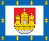 | |
|---|---|---|
| Cities | ||
| Towns | ||
| Villages | ||