Kingston Parish, New Brunswick
| Kingston | |
|---|---|
| Parish | |
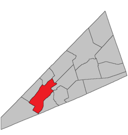 Location within Kings County, New Brunswick. | |
| Country |
|
| Province |
|
| County | Kings County |
| Established | 1786 |
| Area[1] | |
| • Land | 200.63 km2 (77.46 sq mi) |
| Population (2011)[1] | |
| • Total | 2,952 |
| • Density | 14.7/km2 (38/sq mi) |
| • Pop 2006-2011 |
|
| • Dwellings | 1,549 |
| Time zone | AST (UTC-4) |
| • Summer (DST) | ADT (UTC-3) |
Kingston is a Canadian parish in Kings County, New Brunswick.[2]
History
Kingston Parish established in 1786: named for Kingston, Long Island, New York, and to express loyalty to the Crown: included Greenwich Parish, Norton Parish and part of Hampton Parish until 1795, and Kars Parish until 1859.
Delineation
Kingston Parish is defined in the Territorial Division Act[3] as being bounded:
- Northwest by Belleisle Bay and Long Reach; southwest by Westfield Parish; southeast by the Kennebecasis Bay and River until it meets the line dividing lots numbered twelve and thirteen in the Kingston grant; thence northerly along said line and easterly along the rear of the said grant to the line between the lots numbered thirty-three and thirty-four therein; thence northwesterly along the prolongation of said line to the Springfield Parish line; thence southwesterly and northerly along said Springfield Parish line to Belleisle Bay, including Long Island, in the Kennebecasis River.
Governance
The entire parish forms the local service district of the parish of Kingston, established in 1968 to assess for fire protection. Non-fire related rescue was added in 2015. First aid and ambulance services (1976–2015) was formerly included.
Communities
Parish population total does not include incorporated municipalities (in bold).
|
|
|
Bodies of water & Islands
This is a list of rivers, lakes, streams, creeks, marshes and Islands that are at least partially in this parish
- None
Demographics
PopulationPopulation trend[4]
|
LanguageMother tongue language (2006)[5]
|
Access Routes
Highways and numbered routes that run through the parish, including external routes that start or finish at the parish limits:[6]
See also
References
- 1 2 2011 Statistics Canada Census Profile: Kingston Parish, New Brunswick
- ↑ New Brunswick Provincial Archives - Kingston Parish
- ↑ "Territorial Division Act (R.S.N.B. 1973, c. T-3)". Government of New Brunswick website. Retrieved 23 August 2016.
- ↑ Statistics Canada: 2001, 2006 census
- ↑ Profile: Kingston Parish, New Brunswick
- ↑ Atlantic Canada Back Road Atlas ISBN 978-1-55368-618-7
 |
Greenwich Parish | Kars Parish | Springfield Parish | |
| |
Norton Parish | |||
| ||||
| | ||||
| Westfield Parish | Rothesay Parish | Hampton Parish |
| Subdivisions | |
|---|---|
| Cities | |
| Counties | |
| |
Coordinates: 45°30′13″N 65°59′34″W / 45.50358°N 65.992813°W