Kimball, Tennessee
| Kimball, Tennessee | |
|---|---|
| Town | |
|
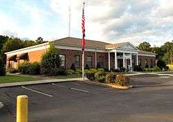
Kimball Town Hall | |
 Location of Kimball, Tennessee | |
| Coordinates: 35°2′49″N 85°40′28″W / 35.04694°N 85.67444°WCoordinates: 35°2′49″N 85°40′28″W / 35.04694°N 85.67444°W | |
| Country | United States |
| State | Tennessee |
| County | Marion |
| Area | |
| • Total | 4.9 sq mi (12.8 km2) |
| • Land | 4.9 sq mi (12.8 km2) |
| • Water | 0.0 sq mi (0.0 km2) |
| Elevation | 679 ft (207 m) |
| Population (2010) | |
| • Total | 1,395 |
| • Density | 265.6/sq mi (102.5/km2) |
| Time zone | Central (CST) (UTC-6) |
| • Summer (DST) | CDT (UTC-5) |
| ZIP code | 37347 |
| Area code(s) | 423 |
| FIPS code | 47-39400[1] |
| GNIS feature ID | 1314134[2] |
Kimball is a town in Marion County, Tennessee, United States. The population was 1,312 at the 2000 census and 1,395 in 2010. It is part of the Chattanooga, TN–GA Metropolitan Statistical Area.
History
Kimball was founded in 1890 as a model industrial city by Hanniball Kimball, with support of the British Anglo-American Company, Limited. The location was chosen to be similar to another planned city, Colorado Springs. It was backed by mountains, with three miles of frontage on the Tennessee River and rail connections on the Nashville, Chattanooga and St. Louis Railway.
The town suffered damage after it was struck by an EF 2 tornado on November 14, 2007. The storm left nine injured, along a damage path of approximately two miles in length.[3]
Geography
Kimball is located at 35°2′49″N 85°40′28″W / 35.04694°N 85.67444°W (35.046956, -85.674476).[4]
According to the United States Census Bureau, the town has a total area of 4.9 square miles (13 km2), all land.
Demographics
| Historical population | |||
|---|---|---|---|
| Census | Pop. | %± | |
| 1970 | 807 | — | |
| 1980 | 1,220 | 51.2% | |
| 1990 | 1,243 | 1.9% | |
| 2000 | 1,312 | 5.6% | |
| 2010 | 1,395 | 6.3% | |
| Est. 2015 | 1,401 | [5] | 0.4% |
| Sources:[6][7] | |||
As of the census[1] of 2000, there were 1,312 people, 563 households, and 389 families residing in the town. The population density was 265.6 people per square mile (102.5/km²). There were 607 housing units at an average density of 122.9 per square mile (47.4/km²). The racial makeup of the town was 97.48% White, 0.99% African American, 0.53% Native American, and 0.99% from two or more races. Hispanic or Latino of any race were 0.08% of the population.
There were 563 households out of which 30.0% had children under the age of 18 living with them, 54.7% were married couples living together, 10.8% had a female householder with no husband present, and 30.9% were non-families. 29.1% of all households were made up of individuals, and 11.4% had someone living alone who was 65 years of age or older. The average household size was 2.33 and the average family size was 2.85.
The town's population was spread out with 22.8% under the age of 18, 7.0% from 18 to 24, 29.0% from 25 to 44, 28.6% from 45 to 64, and 12.6% who were 65 years of age or older. The median age was 40 years. For every 100 females there were 92.1 males. For every 100 females age 18 and over, there were 86.6 males.
The median income for a household in the town was $33,359, and the median income for a family was $41,094. Males had a median income of $31,141 versus $21,382 for females. The per capita income for the town was $17,454. About 7.9% of families and 9.0% of the population were below the poverty line, including 10.0% of those under age 18 and 8.4% of those age 65 or over.
Education
Kimball is home to a satellite campus of Chattanooga State Community College.
References
- 1 2 "American FactFinder". United States Census Bureau. Retrieved 2008-01-31.
- ↑ "US Board on Geographic Names". United States Geological Survey. 2007-10-25. Retrieved 2008-01-31.
- ↑ Documented Tornadoes in Marion County, TN
- ↑ "US Gazetteer files: 2010, 2000, and 1990". United States Census Bureau. 2011-02-12. Retrieved 2011-04-23.
- ↑ "Annual Estimates of the Resident Population for Incorporated Places: April 1, 2010 to July 1, 2015". Retrieved July 2, 2016.
- ↑ "Census of Population and Housing: Decennial Censuses". United States Census Bureau. Retrieved 2012-03-04.
- ↑ "Incorporated Places and Minor Civil Divisions Datasets: Subcounty Resident Population Estimates: April 1, 2010 to July 1, 2012". Population Estimates. U.S. Census Bureau. Retrieved 11 December 2013.
External links
Municipalities and communities of Marion County, Tennessee, United States | ||
|---|---|---|
| Cities | ||
| Towns | ||
| Unincorporated communities | ||
| Footnotes | ‡This populated place also has portions in an adjacent county or counties | |