Kilmersdon Road Quarry
| Site of Special Scientific Interest | |
 | |
 Location within Somerset | |
| Area of Search | Avon |
|---|---|
| Grid reference | ST689542 |
| Coordinates | 51°17′10″N 2°26′50″W / 51.28608°N 2.44733°WCoordinates: 51°17′10″N 2°26′50″W / 51.28608°N 2.44733°W |
| Interest | Geological |
| Area | 0.43 hectares (0.0043 km2; 0.0017 sq mi) |
| Notification | 1954 |
| Natural England website | |
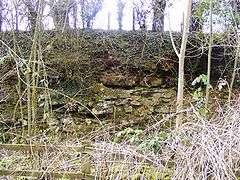
Kilmersdon Road Quarry (grid reference ST689542) is a 0.43 hectare geological Site of Special Scientific Interest between the village of Haydon and the town of Radstock, Bath and North East Somerset, notified in 1954.
This is a key Lias locality spanning much of the Hettangian, Sinemurian and Pliensbachian stages.[1]
References
- ↑ English Nature citation sheet for the site (accessed 13 July 2006)
This article is issued from Wikipedia - version of the 4/10/2014. The text is available under the Creative Commons Attribution/Share Alike but additional terms may apply for the media files.