Kiên Giang Province
| Kiên Giang Province Tỉnh Kiên Giang | |
|---|---|
| Province | |
|
| |
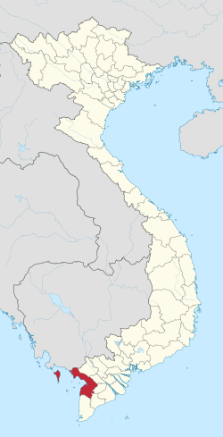 Location of Kiên Giang within Vietnam | |
| Coordinates: 10°0′N 105°10′E / 10.000°N 105.167°ECoordinates: 10°0′N 105°10′E / 10.000°N 105.167°E | |
| Country |
|
| Region | Mekong Delta |
| Capital | Rạch Giá |
| Government | |
| • People's Council Chair | Trương Quốc Tuấn |
| • People's Committee Chair | Bùi Ngọc Sương |
| Area | |
| • Total | 6,299 km2 (2,432 sq mi) |
| Population (2004) | |
| • Total | 1,634,043 |
| • Density | 260/km2 (670/sq mi) |
| Demographics | |
| • Ethnicities | Vietnamese, others |
| Time zone | ICT (UTC+7) |
| Calling code | 773 |
| ISO 3166 code | VN-47 |
| Website | www.kiengiang.gov.vn |

Kiên Giang (![]() listen) is a province of Vietnam, located in the Mekong Delta region of southern Vietnam. It is known for fishing and rice farming. The provincial capital is Rạch Giá, 250 km from the Ho Chi Minh City. Kiên Giang's dimension is about 6,299 km² and its population is about 1,634,043, of which 22 percent live in the urban area.
listen) is a province of Vietnam, located in the Mekong Delta region of southern Vietnam. It is known for fishing and rice farming. The provincial capital is Rạch Giá, 250 km from the Ho Chi Minh City. Kiên Giang's dimension is about 6,299 km² and its population is about 1,634,043, of which 22 percent live in the urban area.
Kiên Giang is bordered with An Giang Province in the northeast, Cần Thơ and Hậu Giang in the east, Bạc Liêu in the southeast and Cà Mau in the south, and Kampot Province of Cambodia (with the 54 km border) in the west, Gulf of Thailand in the southwest (with the 200 km coast).
According to survey results in April 1, 2009, Kiên Giang province's population is 1,683,149 people.
History
In 1774, Lord Nguyen Phuc Dang Khoat divided into 12 in the palace, but still leave the town of Hà Tiên, Mac Thien Tich style as Admiral rule.
By the reign of Minh Mạng, in 1832, Hà Tiên had become one of the six provinces of the South.
In 1876, Southern France divided into four big administrative regions, each region divided into smaller administrative sub-district or county take action (administratif arrondissement), Hà Tiên, the former being divided into two particle parameters are Hà Tiên and Rạch Giá. From January 1, 1900 two-particle parameters of Hà Tiên and Rạch Giá became provinces of Hà Tiên and Rạch Giá.
Since the Republic of Vietnam, Hà Tiên and Rạch Giá merged to Kiên Giang. Kiên Giang were including seven counties at that time: Kiên Lương, Kien An, Kien Binh, Tan Kien Kien Thanh and Phú Quốc. Kiên Giang Province borders Cambodia to the north, Châu Đốc to the northeast, An Giang Province to the east and Phong Dinh Province, Chuong Thien to the southeast, An Xuyen to the south.
Geography
General
- Coordinates: 9°23'50" N to 10°32'30" N, 104°40' E to 105°32'40" E.
- Area: 6,299 km², 4,119.74 km² of agricultural land (66% natural area), private land for rice accounted for 3,170.19 km² (77% of agricultural land). Forest land is 1,200.27 km² (19% natural area). The province also funds unused land near the 500.00 km².
Climate
- Average annual rainfall: 1980mm (for land);
- Average temperature: 27.3 °C;
- Dry seasons occur for approximately 3 months and the rest is mostly wet season;
- Dry season: from 7 to 8 hours/day.
- Rainy Season: from 4 to 6 hours/day.
- Average relative humidity: 80 to 83%.
Administrative divisions
Kiên Giang is subdivided into 15 district-level sub-divisions:
- 13 districts:
They are further subdivided into 12 commune-level towns (or townships), 118 communes, and 15 wards.
External links
- Official website
- Official website (Vietnamese)
 |
Kep Province, |
Kampot Province, |
An Giang Province | |
| Gulf of Thailand | |
Cần Thơ Hậu Giang Province | ||
| ||||
| | ||||
| Gulf of Thailand | Cà Mau Province | Bạc Liêu Province |
Template:Vietnam