Khayelitsha
| Khayelitsha | |
|---|---|
|
View from Khayelitsha Lookout Hill over Ilitha Park | |
 Khayelitsha  Khayelitsha  Khayelitsha
| |
|
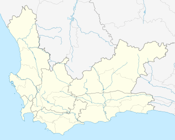
Location within Cape Town 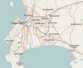 Khayelitsha | |
| Coordinates: 34°02′25″S 18°40′40″E / 34.04028°S 18.67778°ECoordinates: 34°02′25″S 18°40′40″E / 34.04028°S 18.67778°E | |
| Country | South Africa |
| Province | Western Cape |
| Municipality | City of Cape Town |
| Area[1] | |
| • Total | 38.71 km2 (14.95 sq mi) |
| Population (2011)[1] | |
| • Total | 391,749 |
| • Density | 10,000/km2 (26,000/sq mi) |
| Racial makeup (2011)[1] | |
| • Black African | 98.6% |
| • Coloured | 0.6% |
| • Indian/Asian | 0.1% |
| • White | 0.1% |
| • Other | 0.6% |
| First languages (2011)[1] | |
| • Xhosa | 90.5% |
| • English | 3.2% |
| • Sotho | 1.4% |
| • Afrikaans | 1.1% |
| • Other | 3.8% |
| Postal code (street) | 7784 |
| PO box | 7783 |

Khayelitsha /ˌkaɪ.əˈliːtʃə/ is a partially informal township in Western Cape, South Africa, located on the Cape Flats in the City of Cape Town. The name is Xhosa for New Home. It is reputed to be the largest[2] and fastest growing township in South Africa.[3]
History
Cape Town initially opposed implementing the Group Areas Act passed in 1950 and residential areas in the city remained unsegregated until the first Group Areas were declared in the city in 1957.[4] When Cape Town did start implementing the Group Areas Act, it did so more severely than any other major city; by the mid-1980s it became one of the most segregated cities in South Africa.[4]
Plans to build Khayelitsha were first announced by Dr Piet Koornhof in 1983, then Minister of Co-operation and Development. By 1985 the suburb Site C had 30,000 people. Khayelitsha was one of the apartheid regime's final attempts to enforce the Group Areas Act and was seen as the solution to two problems: the rapidly growing number of migrants from the Eastern Cape, and overcrowding in other Cape Town townships.[5]
The discrimination and black population control by the apartheid government did not prevent blacks from settling in the outskirts of Cape Town. After the scrapping of pass laws in 1987 many blacks, mainly Xhosas, moved into areas around Cape Town in search of work. By this time many blacks were already illegally settled in townships like Nyanga and Crossroads. During 1983 and 1984 conditions in squatter camps like Crossroads and KTC worsened, exacerbated by official policing policy in which homes were destroyed[6] and the emergence of the Witdoeke, led by "Mayor" Johnson Ngxobongwana.[7] The Witdoeke were actively supported by the apartheid government in its fight against the ANC-aligned UDF who had actively opposed plans for people to be moved to the new township of Khayelitsha.[8] As the black population grew, the apartheid regime sought to solve the "problem" by establishing new black neighbourhoods. Khayelitsha was established in 1985 and large numbers of people were forcefully relocated there,[9] mostly peacefully,[10] but occasionally accompanied with violence.[11]
The Western Cape was a preference area for the local coloured population and a system called influx control was in place preventing Xhosas from travelling from the Transkei without the required permit. After the historic 1994 elections hundreds of thousands moved to urban areas in search of work, education, or both. Many of them erected shacks made of tin, wood and cardboard.
Demographics
Today Khayelitsha has a population of 391,749(as of 2011) and runs for a number of kilometres along the N2. The ethnic makeup of Khayelitsha is approximately 90.5% Black African, 8.5% Coloured and 0.5% White, with Xhosa being the predominant language of the residents.[12][13] Khayelitsha has a very young population with fewer than 7% of its residents being over 50 years old and over 40% of its residents being under 19 years of age. In 2011 around 62% of residents in Khayelitsha were rural to urban migrants,[14]:6 most coming from the Eastern Cape. In the communities of Enkanini and Endlovini over 85% of the residents were born in the Eastern Cape.[15]
About 75% of residents identify themselves as Christian while about 20% follow traditional beliefs; a small minority of residents identify themselves as Muslim.[16]
Khayelitsha is one of the poorest areas of Cape Town with a median average income per family of R20,000 (US$1,872) a year compared to the City median of R40,000 (US$3,743).[17] Roughly over half of the 118,000 households live in informal dwellings.[15]
- Area: 43.51 square kilometres (16.80 sq mi)
- Population: 391 749: 7,561.99 inhabitants per square kilometre (19,585.5/sq mi)
- Households: 118,809: 1,976.31 per square kilometre (5,118.6/sq mi)
| Gender | Population | % |
|---|---|---|
| Female | 170,908 | 51.95 |
| Male | 158,094 | 48.05 |
| Race | Population | % |
|---|---|---|
| Black | 327,322 | 99.49 |
| White | 87 | 0.03 |
| Coloured | 1,556 | 0.47 |
| Asian | 33 | 0.01 |
| First language | Population | % |
|---|---|---|
| Zulu | 1,176 | 0.36 |
| Xhosa | 318,389 | 96.77 |
| Afrikaans | 2,297 | 0.7 |
| Northern Sotho | 135 | 0.04 |
| Tswana | 427 | 0.13 |
| English | 784 | 0.24 |
| Sotho | 4,753 | 1.44 |
| Tsonga | 61 | 0.02 |
| Swazi | 348 | 0.11 |
| Venda | 117 | 0.04 |
| Southern Ndebele | 155 | 0.05 |
| Other | 361 | 0.11 |
Conditions
Since the ANC came to power in the country in 1994, the ruling party claims that living conditions in the township have improved markedly. There have been many developments such as new brick housing being built, new schools being built, and the creation of a central business district in the Township. However many residents strongly dispute the claim that the quality of life has improved. They claim that crime rates remain very high and that only a small portion of residents see improvements as a result of infrastructure and welfare interventions. The Khayelitsha Commission was established by the provincial government to investigate allegations of inefficient policing in Khayelitsha and a breakdown in the relationship between the police and the community.
Around 70% of residents still live in shacks and one in three people has to walk 200 meters or further to access water.[2] Around 53% of Khayelitsha's total working age population is employed. The five most common forms of employment are domestic work (19.4%), service work (15.2%), skilled manual labour (15.2%), unskilled manual labour (11%), and security services (10.4%).[14]:7 89% of households in Khayelitsha are either moderately or severely food insecure.[14]:13
The 2001 census recorded that two in three residents lived in shacks. By 2011 the number of people living in formal housing had increased to almost half due to the construction of roughly 25,000 new houses being built between 2001-2011.[19]
Geography
Khayelitsha is located on the Cape Flats, between Table Bay and False Bay.
Subdivisions

Khayelitsha has been split into about 22 sub-sections or areas, depending on how one divides them. Khayelitsha is made up of old formal areas and new informal/formal areas. The old formal areas were built originally by the apartheid government and are known as A-J sections(each section with more or less than 500 formal two roomed brick houses) Bongweni, Ikwezi Park, Khulani Park, Khanya Park, Tembani, Washington Square, Graceland, Ekuphumleni and Zolani Park.[20] These areas are mostly made up of bank bond housing and are home to middle-class / upper working class populations.
The newer areas have been built up around the older areas. They include Site B, Site C, Green Point, Litha Park, Mandela Park, Makaza and Harare.[20] With the exception of Litha Park, these areas contain a high number of informal settlements, RDP houses, and informal backyard dwellers.
Notable informal settlements in Khayelitsha include QQ Section, TR Section, RR Section and Enkanini which have gained prominence due to their high-profile conflicts with government including protest actions such as road blockades.[21][22][23][24]
Economy
Khayelitsha has a small but growing middle class with a total of 1,400 households earning more than R25,000 a month in 2011. This is a large increase, as in 2001 there were almost no households earning over R25,000 a month.[19]
The growing number of entrepreneurs in the township are ably supported by organisations such as the Patrice Motsepe Foundation and Caban Investments (through their Qinisanani initiative) and HubSpace.
International funding and partnerships
As Cape Town's largest township, Khayelitsha attracts funding from international aid agencies. A number of partnerships with international companies, governments and NGOs have been set up:
- A successful initiative at Ikhwezi Lesizwe Primary School has brought company support for technology. The UK based Ramesys have donated software and kit to allow for good web communications. Smart Technology from Canada have donated an interactive whiteboard.
- Another such group based in Zion, Illinois, USA is Partners Across the Ocean which has brought Khayelitsha high school learners to the USA and built a computer lab in Khayelitsha.[25]
- The South Africa Community Fund has been active in the neighbourhood of Harare, Khayelitsha, bringing groups of students from Arizona State University and other volunteers for home stays and community immersions.[26]
- German partnerships with the City of Cape Town through an organisation called VPUU (Violence Prevention through Urban Upgrading) is responsible for the building of community centres and gardens, and the sponsorship of soccer clubs.
- Khayelitsha was also the focus of the Community Exchange System when it launched in Cape Town.[27]
- Canadian organisation Golden Future South Africa volunteers in secondary schools in Site B. Within the schools, this organisation facilitates conversation on the topics of health, life orientation and education. Outside the schools, a business group aids local businesses in legitimising their establishments.
- Grassroot Soccer is a South African non-profit organisation that integrates the cross-cultural appeal of soccer with evidence based HIV prevention and life skills programmes that provide youth in Khayelitsha, as well as other parts of Africa, with the knowledge, skills and support to live HIV free. This organisation operates in Khayelitsha from the Football For Hope Centre, a community centre in Khayelitsha.[28]
- AMANDLA EduFootball, a South Africa-based non-profit organisation, established its inaugural Safe-Hub, the Chris Campbell Memorial Field, in partnership with the CTC Ten Foundation[29] in Khayelitsha. The Safe-Hub is a youth friendly space where young people can find physical and emotional safety through support from strong role models and positive young community leaders. The organisation's evidence-based youth violence prevention model identifies hot-spots of chronic youth driven violence and establishes ‘Safe-Hub’ infrastructures at the centre of these crisis points. In 2012, this project won the international Beyond Sport Award for the world-wide best project in the category ‘Sport for Conflict Resolution’.[30]
Education
- Chumisa Primary School
- Eluxolweni Primary School
- Emithini Primary School
- Encotsheni Primary School
- Homba Primary School
- Hopolang Primary School
- Ikhusi Primary School
- Impendulo Public Primary School
- Injongo Primary School
- Intshayelelo Primary School
- Isikhokelo Primary School
- Isiphiwo Primary School
- Kukhanyile Primary School
- Kuyasa Primary School
- Luleka Primary School
- Lwandle Primary School
- Masiphumelele Primary School
- Masithandane Primary School
- Mzamomhle Primary School
- Nkazimlo Primary School
- Nolungile Primary School
- Nomsa Mapongwana Primary School
- Ntwasahlobo Primary School
- Sivile Primary School
- Sivuyiseni Public Primary School
- Skaumlandela Primary School
- Sobambisana Primary School
- Sosebenza Primary School
- Soyisile Primary School
- Ummangaliso Primary School
- Umthawelanga Primary School
- Vuselela Primary School
- Vusumoya Primary School
- Vuzamanzi Public Primary School
- Yomelela Primary School
- Zenzeleni School for Creative Education
- Bulumko Secondary School
- Centre of Science and Technology
- Chris Hani Secondary School
- Esangweni Secondary School
- Harry Gwala Secondary School
- Intlanganiso Secondary School
- Intlangiso Secondary School
- Joe Slovo Secondary School
- Khayelitscha Secondary School
- Kwamfundo Secondary School
- Luhlaza Secondary School
- Manyano High School
- Masiyile Senior Secondary School
- Masiyilie Junior Secondary School
- Matthew Goniwe Memorial High School
- Siphamandla Secondary School
- Sizimisele Secondary School
- Thembelihle High School
- Uxolo High School
- Usasazo Secondary School
- Zola Senior Secondary School
Infrastructure
Transport

Khayelitsha has a good transport infrastructure. Golden Arrow Bus Services, MyCiti bus IRT system, Metrorail trains,[31] and many taxis all have routes to and from the township. Trains are the cheapest and most used form of transport. Khayelitsha has six rail stations: Mandalay, Nolungile, Nonkqubela, Khayelitsha, Kuyasa and Chris Hani. There are also a number of bus stations and taxi ranks, although most taxis still pick up passengers on the main roads. Khayelitsha's busiest roads are Mew Way, Spine Road, Lansdowne Road, Walter Sisulu Road, Bonga Drive and Baden Powell Drive.
Health care
Khayelitsha District Hospital was opened in Khayelitsha in February 2012. It offers district level care including a large 24-hour Emergency Centre, medical wards, surgical wards, obstetric wards, gynaecology wards, paediatric wards and nursery.
There are three provincial government clinics in Khayelitsha. Khayelitsha (Site B) CHC (Community Health Clinic), Michael Maphongwana (Harare) CHC and Nolungile (Site C) CHC and Kuyasa Children's Clinic which was build in 2012 are the other provincial government clinics.
There are also numerous small municipal clinics throughout the township. Services offered at these include child health, family planning, TB treatment, HIV testing, Pap smears and treatment and diagnosis of sexually transmitted infections.
Society and culture
|
|

Beaches and recreation
Khayelitsha has one beach, Monwabisi, located on the coast of False Bay. It is known to be one of the most dangerous beaches in the area. It was recorded that one day, five people drowned at the beach.[32] This is due to a wall that was built to create a calm cove. Instead it has made many dangerous currents.[32] In the past 15 years over 50 people have drowned at the beach.[32] On warm public holidays, Christmas Eve and New Year's Day the beach becomes highly occupied.
Khayelistha also has a swimming pool that was built for the community as whole. It is near the Khayelitsha court.
Social movements
Abahlali baseMjondolo, the [33] the Treatment Action Campaign, the Social Justice Coalition, and the Western Cape Anti-Eviction Campaign all have a strong presence in Khayelitsha.
African National Congress Youth League, led by Sibusiso Zonke and Buyel' embo village, in Mandela Park, is an entertainment place where events are held.[34]
Sport
As part of the 2010 FIFA World Cup preparations, a Football for Hope centre was constructed in Khayelitsha.[35] An Australian rules football development program conducted by the AFL South Africa also operates in the township. Bayanda Sobetwa became the first South African to be signed to an AFL club, when the Greater Western Sydney Giants offered him a SportsReady traineeship in 2010.[36]
Tourism
Recently a tourist centre opened in the township on Look Out Point, or Lookout Hill,[37] one of the highest hills in the area on the corner of Mew Way & Spine Road. Lookout Hill is also one of the 7 Wonders of the world picture frame of Cape Town, part of the World Design Capital projects. Numerous organisations offer "township tours", who support Khayelitsha through social tourism. There are also opportunities for social tourism as volunteers in numerous projects around Khayelitsha.
Community media
Two community newspapers circulate in Khayelitsha, Vukani and City Vision. Radio Zibonele 98.2 is a community radio station situated in the Ilitha Park part of the township.
In popular culture
Films set in Khayelitsha
- U-Carmen eKhayelitsha, a 2005 Xhosa film adaptation of Bizet's Carmen
- The Wooden Camera
- My Mother Built This House,[38] a Bullfrog Film production, part of the City Life series
- Urbanized, a documentary on the effect and affect of urban design theory over the last couple millennia.
Notable people
See also
- District Six
- Partners Across The Ocean
- Mitchell's Plain
References
- 1 2 3 4 "Main Place Khayelitsha". Census 2011.
- 1 2 New, Assertive Women's Voices in Local Election by Erna Curry, 29 January 2011
- ↑ http://www.go2africa.com/south-africa/cape-town/khayelitsha
- 1 2 Saff, Grant (1998). Changing Cape Town: urban dynamics, policy, and planning during the political transition in South Africa. University Press of America. p. 85. ISBN 0-7618-1199-0.
- ↑ Pharie Sefali and GroundUp staff (16 October 2013). "Khayelitsha turns 30". Ground Up. Retrieved 21 October 2013.
- ↑ Ross, Catherine. "Conflict re-emerges at Crossroads". HSRC. Retrieved 18 July 2012.
- ↑ Cleminshaw, Dot. "From Crossroads to Khayelitsha" (PDF). UKZN. Retrieved 18 July 2012.
- ↑ "GOVERNMENT DELIVERY IN CROSSROADS, CAPE TOWN" (PDF). TEN YEAR REVIEW, OFFICE OF THE PRESIDENCY PROJECT 6.7, EIGHT AREA CASE STUDIES OF DEVELOPMENT DELIVERY. Retrieved 18 July 2012.
- ↑ "South Africa". Country reports on human rights practices : report submitted to the Committee on Foreign Affairs, U.S. House of Representatives and Committee on Foreign Relations, U.S. Senate by the Department of State in accordance with sections 116(d) and 502B(b) of the Foreign Assistance Act of 1961, as amended. 1987. United States Senate Committee on Foreign Relations. February 1987. p. 282. Retrieved 25 November 2009.
- ↑ Field, Sean (2001). Lost communities, living memories: remembering forced removals in Cape Town. New Africa Books. p. 23. ISBN 0-86486-499-X.
- ↑ "South Africa". Country reports on human rights practices : report submitted to the Committee on Foreign Affairs, U.S. House of Representatives and Committee on Foreign Relations, U.S. Senate by the Department of State in accordance with sections 116(d) and 502B(b) of the Foreign Assistance Act of 1961, as amended. 1985. United States Senate Committee on Foreign Relations. February 1986. p. 294. Retrieved 25 November 2009.
- ↑ "KHAYELITSHA CELEBRATES R 3.6 MILLION WARD ALLOCATION HANDOVER".
- ↑ "Township History & Information".
- 1 2 3 Battersby, Jane (2011). "THE STATE OF URBAN FOOD INSECURITY IN CAPE TOWN" (PDF). URBAN FOOD SECURITY SERIES NO. 11. Queen's University and AFSUN: Kingston and Cape Town. Retrieved 28 January 2013.
- 1 2 Judge O'Regan and Adv. Pikoli (25 August 2014). "HANDOVER STATEMENT OF THE COMMISSIONERS". Khayelitsha Commission. Retrieved 26 August 2014.
- ↑ "Khayelitsha" (PDF).
- ↑ "Rand to US Dollar exchange rate: 26 August 2014". xe.com. Retrieved 26 August 2014.
- ↑ https://www.capetown.gov.za/en/stats/2011CensusSuburbs/2011_Census_CT_Suburb_Khayelitsha_Profile.pdf
- 1 2 Cronje, Jan (5 April 2014). "Getting Khayelitsha into perspective". Weekend Argus. Retrieved 15 April 2014.
- 1 2 AN EVALUATION OF THE EFFECTS OF POVERTY IN KHAYELITSHA:A CASE STUDY OF SITE C, By Xoliswa Zandile Ndingaye
- ↑ Update on the Call for a Week of Informal Settlement Strike
- ↑ RR SECTION: ALMOST NO TOILETS
- ↑ Atrocious QQ Section Stuns Community
- ↑ A crisis of dignity – 5 humiliating years later
- ↑ http://partnersacrosstheocean.org
- ↑ http://www.southafricacommunityfund.org
- ↑ Schwartz, Judith D. (14 December 2008). "Alternative Currencies Grow in Popularity". Time.
- ↑ Grassroot Soccer
- ↑ http://www.edufootball.org/what-we-do/ccm-field/
- ↑ http://www.beyondsport.org/the-awards/awards2012/entries/winners.php
- ↑ "WESTERN CAPE TIMETABLES". Metrorail. Retrieved 25 November 2009.
- 1 2 3 Raymond, Leanne (12 July 2005). "Monwabisi beach too dangerous, says NSRI". Independent Online. Retrieved 25 November 2009.
- ↑ Mandela Park Backyarders,
- ↑ http://www.buyelembovillage.co.za/
- ↑ Pollack, Martin (29 May 2009). "Football for Hope Centre launched in Khayelitsha". City of Cape Town Metropolitan Municipality. Retrieved 26 November 2009.
- ↑ Team GWS signs its first international player
- ↑
- ↑ My Mother Built This House
- City of Cape Town Department of Health
- South from the Limpopo: Travels Through South Africa by Dervla Murphy ISBN 0-00-655105-X
External links
| Wikimedia Commons has media related to Khayelitsha. |
- Specialists Schools Trust (SSAT)
- BBC Photo Story – Khayelitsha
- Khayelitsha Struggles
- Census 2001 – suburb Khayelitsha
- Audio slideshow on Khayelitsha with Basque subtitles, 2010
.svg.png)