Keota, Oklahoma
| Keota, Oklahoma | |
|---|---|
| Town | |
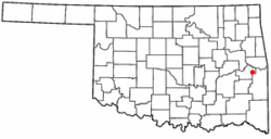 Location of Keota, Oklahoma | |
| Coordinates: 35°15′25″N 94°55′17″W / 35.25694°N 94.92139°WCoordinates: 35°15′25″N 94°55′17″W / 35.25694°N 94.92139°W | |
| Country | United States |
| State | Oklahoma |
| County | Haskell |
| Area | |
| • Total | 0.4 sq mi (1.0 km2) |
| • Land | 0.4 sq mi (1.0 km2) |
| • Water | 0.0 sq mi (0.0 km2) |
| Elevation | 502 ft (153 m) |
| Population (2010) | |
| • Total | 564 |
| • Density | 1,410/sq mi (564/km2) |
| Time zone | Central (CST) (UTC-6) |
| • Summer (DST) | CDT (UTC-5) |
| ZIP code | 74941 |
| Area code(s) | 539/918 |
| FIPS code | 40-39500[1] |
| GNIS feature ID | 1094338[2] |
Keota is a town in northeastern Haskell County, Oklahoma, United States. The population was 564 at the 2010 census, a 9.1 percent increase from 517 at the 2000 census.[3]
The town was first called "KeeOtter", and was later changed to "Keota". The town's name may come from a Choctaw word meaning "the fire gone out", referring to an entire tribe being destroyed by disease.[4] Another account is that Keota was derived from "Jim Keese", a rancher who owned the land where the townsite was located, and "Otter," for Otter Creek, a tributary of the Sans Bois Creek which winds its way through town.[5][6] [lower-alpha 1]
History
Keota was founded in 1904 by the Midland Valley Railroad's land company, and a post office was established in 1905.
By 1911, the town supported several businesses, a hotel, and a lumberyard. The town supported local cotton growers, and was a railroad shipping point for their product.
The Great Depression caused Keota's population to fall from 494 in 1920 to 470 in 1930, though it rebounded to 619 by 1970.[7]
In 1971, the McClellan–Kerr Arkansas River Navigation System was established on the Arkansas River, about 10 miles north of Keota. A dam on the river created the Robert S. Kerr Reservoir, which reaches to Keota. This enabled the Port of Keota to be established. Light industry was beginning to be drawn to the town at the end of the twentieth century, though by 2013, little remained of the port but a boatlaunch The railway had long been abandoned.[5][6]
On December 31, 1974, the nearby Otter Creek Archaeological Site (NR 74001661) was listed on the National Register of Historic Places.
Geography
Keota is located at 35°15′25″N 94°55′17″W / 35.25694°N 94.92139°W (35.256907, -94.921363).[8] It is 38 miles (61 km) west of Fort Smith, Arkansas and 28 miles (45 km) south southwest of Sallisaw, Oklahoma.[7]
According to the United States Census Bureau, the town has a total area of 0.4 square miles (1.0 km2), all of it land.
Demographics
| Historical population | |||
|---|---|---|---|
| Census | Pop. | %± | |
| 1920 | 494 | — | |
| 1930 | 470 | −4.9% | |
| 1940 | 525 | 11.7% | |
| 1950 | 619 | 17.9% | |
| 1960 | 579 | −6.5% | |
| 1970 | 685 | 18.3% | |
| 1980 | 661 | −3.5% | |
| 1990 | 625 | −5.4% | |
| 2000 | 517 | −17.3% | |
| 2010 | 564 | 9.1% | |
| Est. 2015 | 564 | [9] | 0.0% |
As of the census[1] of 2000, there were 517 people, 204 households, and 140 families residing in the town. The population density was 1,388.4 people per square mile (539.5/km²). There were 230 housing units at an average density of 617.6 per square mile (240.0/km²). The racial makeup of the town was 81.43% White, 12.19% Native American, 0.19% Asian, 2.71% from other races, and 3.48% from two or more races. Hispanic or Latino of any race were 4.84% of the population.
There were 204 households out of which 36.8% had children under the age of 18 living with them, 54.9% were married couples living together, 10.3% had a female householder with no husband present, and 30.9% were non-families. 29.9% of all households were made up of individuals and 14.7% had someone living alone who was 65 years of age or older. The average household size was 2.53 and the average family size was 3.15.
In the town the population was spread out with 30.9% under the age of 18, 8.5% from 18 to 24, 24.6% from 25 to 44, 21.7% from 45 to 64, and 14.3% who were 65 years of age or older. The median age was 34 years. For every 100 females there were 82.7 males. For every 100 females age 18 and over, there were 85.9 males.
The median income for a household in the town was $20,000, and the median income for a family was $25,750. Males had a median income of $25,000 versus $13,250 for females. The per capita income for the town was $10,023. About 19.7% of families and 27.0% of the population were below the poverty line, including 26.9% of those under age 18 and 31.9% of those age 65 or over.
Notable people
- Sim Iness - Olympic gold medalist and world record holder for the discus.
- Major General Sidney Marks - distinguished WWII infantry officer and All-American wrestler.
Note
- ↑ As to the origin of Keota...there is a Keota, IA and a Keota, CO. So it stands to reason that how the name evolved is misleading. Also, to say that it is a Choctaw word is misleading.
References
- 1 2 "American FactFinder". United States Census Bureau. Archived from the original on 2013-09-11. Retrieved 2008-01-31.
- ↑ "US Board on Geographic Names". United States Geological Survey. 2007-10-25. Retrieved 2008-01-31.
- ↑ CensusViewer:Population of the City of Keota, Oklahoma
- ↑ "Robert S. Kerr, Lock And Dam 15." L.L. Bean Park Finder. Retrieved January 19, 2015.
- 1 2 "Keota," Hyder, Glenn O.Encyclopedia of Oklahoma History and Culture, Oklahoma Historical Society, 2009. Accessed March 30, 2015.
- 1 2 Template:Cite book'''
- 1 2 Craig, Linda. "Haskell County, Oklahoma History." 2009. Accessed October 17, 2016.
- ↑ "US Gazetteer files: 2010, 2000, and 1990". United States Census Bureau. 2011-02-12. Retrieved 2011-04-23.
- ↑ "Annual Estimates of the Resident Population for Incorporated Places: April 1, 2010 to July 1, 2015". Retrieved July 2, 2016.
- ↑ "Census of Population and Housing". Census.gov. Archived from the original on May 11, 2015. Retrieved June 4, 2015.
External links
- Keota Public School
- Keota, Haskell County Independent News
- Encyclopedia of Oklahoma History and Culture
Municipalities and communities of Haskell County, Oklahoma, United States | ||
|---|---|---|
| City | 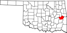 | |
| Towns | ||
| Unincorporated communities | ||